714 résultats pour : world map
- Page
-
- sur
- 8
Connectez-vous pour plus de résultats

HRM26A26_179
Martin Behaim, (1459-1507), German textile merchan...

HRM26A26_197
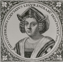
Christopher Columbus, (1451-1506), Navigator, cart...
HRM26A26_196
Christopher Columbus, (1451-1506), Navigator, cart...

HRM26A26_198
Christopher Columbus, (1451-1506), Navigator, cart...

HRM26A26_195
Christopher Columbus, (1451-1506), Navigator, cart...
HRM26A15_483
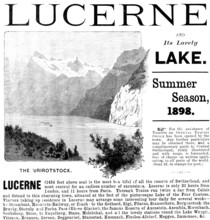
Advertisement for trips to Lake Lucerne, 1898. Cre...
HRM26A14_279
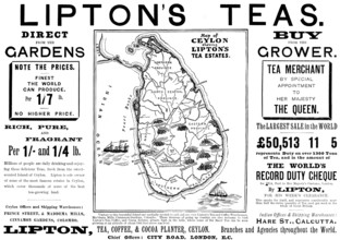
Advertisement for Lipton's Teas, 1898. Creator: Un...

HRM26A15_124
Advertisement for Fry's Pure Concentrated Cocoa, 1...

HRM26A13_311
The Geographer, 1669. Creator: Jan Vermeer.
HRM26A15_229
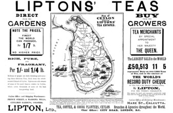
Advertisement for Liptons' Teas, 1898. Creator: Un...
HRM26A06_150
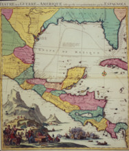
Map of the territory of New Spain, 1771. Creator:...
HRM26A02_436
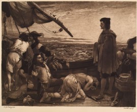
Dawn Revealing the New World to Columbus, (c1852),...
HRM26A07_337
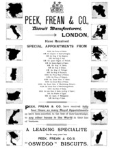
Advertisement for Peek, Frean & Co., biscuit manuf...
HRM25A55_435
Representation of the city of Mexico (Mexico-Tenoc...
HRM25A52_319
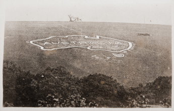
Large map of Australia carved into the chalk downs...
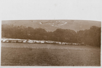
HRM25A52_318
Large map of Australia carved into the chalk downs...
HRM25A46_483
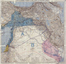
Map showing Eastern Turkey in Asia, Syria and West...
HRM25A47_036
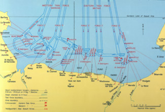
Naval Bombardments on D-Day, Second World War. Cr...

HRM25A46_223
Unity of Strength - Inter-allied posters: 'Liberté...

HRM25A46_139
'And the Navy Goes on', British propaganda poster,...
HRM25A35_470
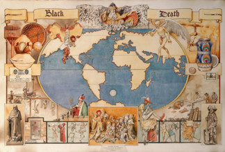
Black Death - pictorial diagram..., late 19th-earl...
HRM25A23_050
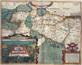
Map of Asia Minor and Africa, 1595. Creator: Unkno...
HRM25A27_187
Royal Air Force No. 2 School of Photography, Palat...
HRM25A28_433
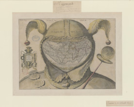
O caput elleboro dignum (Fool's Cap Map of the Wor...
![[Whole map] Desceliers map of the world; with illuminated borders..., 1550. Creator: Pierre Desceliers.](https://lres.photo12.com/th/t-hrm25a23_451.jpg)
HRM25A23_451
[Whole map] Desceliers map of the world; with illu...
HRM25A27_160
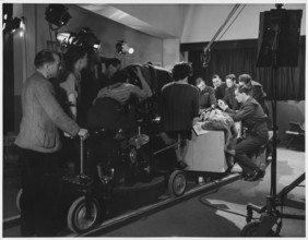
Pinewood Studios, Iver Heath, Iver, Buckinghamshir...
HRM25A23_235
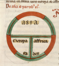
(Detail) Diagrammatic T-O map, early 13th century....
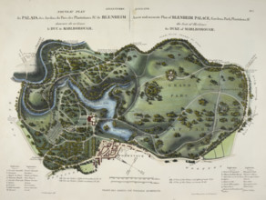
HRM25A23_272
A new and accurate plan of Blenheim Palace, 1835. ...
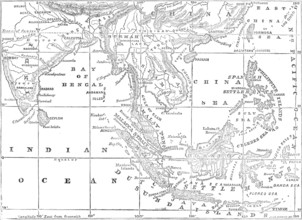
HRM25A32_290
Map of the Strait of Malacca, 1874. Creator: Unkno...
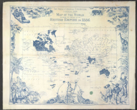
HRM25A23_364
British Empire map, 1886. Creator: Unknown.
HRM25A27_115
Pinewood Studios, Iver Heath, Iver, Buckinghamshir...
HRM25A14_490
World map, 1560. Spanish map showing the 'New Worl...
HRM25A14_499
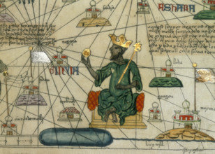
Mansa Musa, King of Mali, 1375. Depiction of Mansa...
HRM25A15_413
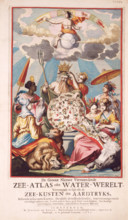
Title page from van Keulen's Chart Atlas, 1682. 'D...
HRM25A14_489
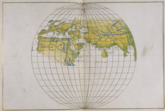
Global map, 1540.
HRM25A15_426
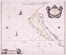
Map of California, 1666. 'Paskaerte Van Nova Grana...
HRM25A14_491
Map of Mexico, 1567. Mexico, conquered by the Span...
HRM25A15_425
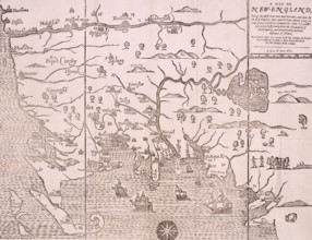
Map of New England, 1677. Self-proclaimed as the f...
HRM25A16_258
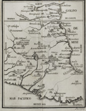
Map showing the Gulf of Mexico and surrounding are...
HRM25A14_475
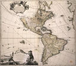
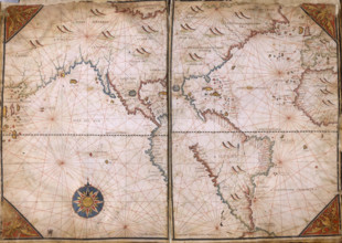
Map of America, (c1700?). This Homann map depicts ...
HRM25A15_419
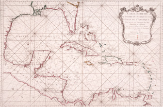
Map of the Gulf of Mexico, 1772. 'Carte Reduite du...
HRM25A16_287
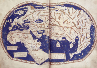
World map, 1490. Labelled and coloured, within a b...
HRM25A14_177
Map of the World, c1701. Nautical table showing ma...
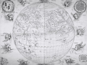
HRM25A14_474
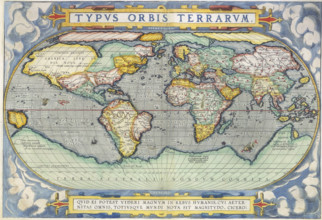
Ortelius World Map, 1570. The map speculates the e...
HRM25A14_483
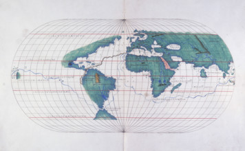
Map plotting Magellan's route, 1536. In 1519, whil...
HRM25A14_496
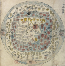
Korean world map, 19th century. Printed and hand-c...
HRM25A14_308
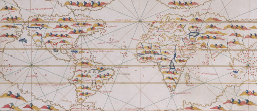
A map of the world, 1515. Depicting Europe, Asia a...
HRM25A14_484
Rome and its roads, from the Peutinger table, 19th...
HRM25A14_274
World Map, 1562. The map suggests that North Ameri...
HRM25A14_283
World Map, 1542. On the left is the 'New World', t...
HRM25A14_498
Map of the World, 1507. The map is accompanied by ...
HRM25A15_333
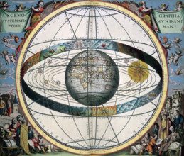
Ptolemaic Solar System, 1660. Scenographia Systema...
HRM25A14_487
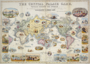
The Crystal Palace Game, 1854. A board game based ...
HRM25A16_286
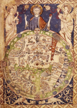
Psalter Map, c1250. A round map of the world, set ...
HRM25A14_488
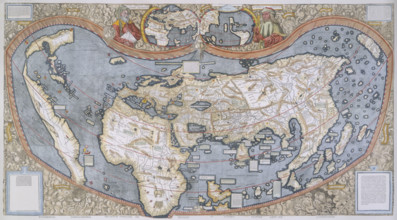
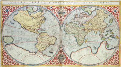
World Map, 1587. 'Orbis terrae compendiosa descrip...
HRM25A15_395
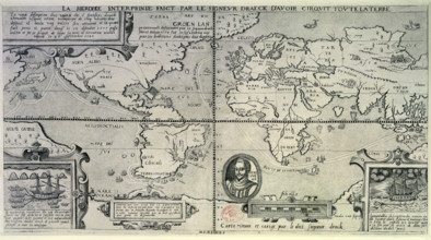
Map showing Francis Drake's Circumnavigation of th...
HRM25A15_417
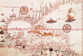
Map of the Caribbean, c1578. Showing 'Niova Spagna...
HRM25A14_143
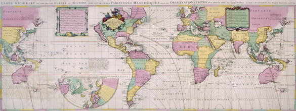
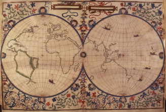
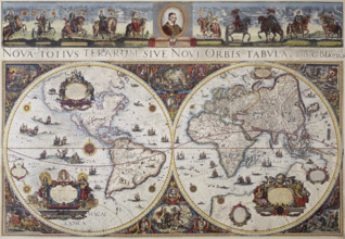
Map of the world, 1680. 'Nova Totius Terrarum Sive...
HRM25A13_141
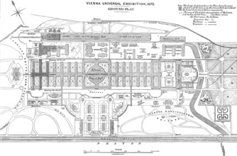
Vienna Universal Exhibition - ground plan, 1873. C...
HRM24A78_086
A Map of the Southern Zones; De Natura Avium; De P...
HRM24A78_088
A Map of the World; De Natura Avium; De Pastoribus...
HRM24A59_023
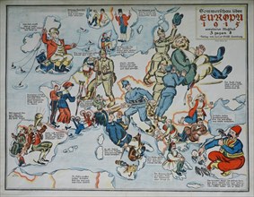
Summer Show over Europe 1915. European satirical m...
HRM24A59_024
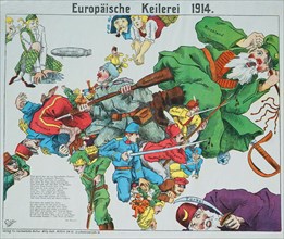
European brawling 1914. European satirical map, 19...
HRM24A59_025
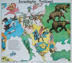
European Beating Hunt. European satirical map, 191...
HRM24A39_423
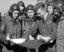
RAF Pilots Planning and Chatting to Each Other, 19...
HRM24A36_197
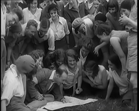
A Large Group of Hikers Setting Off for a Walk in ...
HRM24A39_328
British Pilots Preparing for a Bombing Raid, 1941....
HRM24A39_464
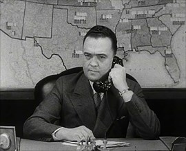
J. Edgar Hoover of the FBI on the Phone, 1942. Cre...
HRM24A38_199
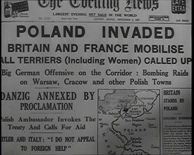
The Front Page of the Evening News on Friday Septe...
HRM24A40_064
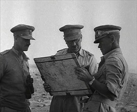
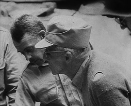
British Officers Planning at El Alamein, 1942. Cre...
HRM24A37_484
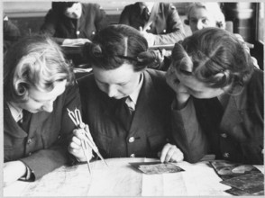
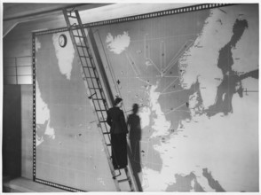
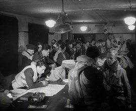
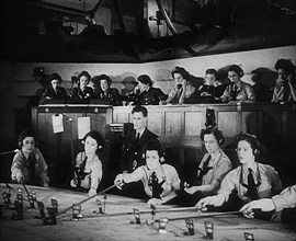
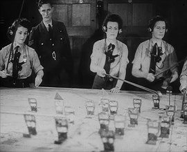
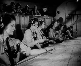
WAAF Plotters Working With Plotting Equipment, 194...
HRM24A39_105
WAAF Plotters Working With Plotting Equipment, 194...
HRM24A39_188
WAAF Plotters Working With Plotting Equipment, 194...
HRM24A40_049
Two Commonwealth Officers, 1943. Creator: British ...
HRM24A40_005
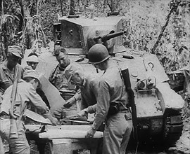
Commonwealth Troops Planning Next to a Tank, 1943....
HRM24A35_013
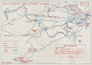
''The 1948 London Olympic Games" - back cover, 194...
HRM24A19_180
Map showing Czechoslovakia's location in Central E...
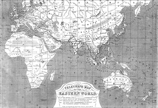
HRM24A26_180
Telegraph map of the Eastern World, 1865. Creator:...

HRM24A13_293
German soldiers in the Aisne District, 26 Dec 1914...
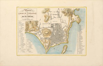
HRM24A16_236
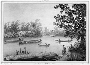
Plan of the city of Rio de Janeiro. From "Voyage p...
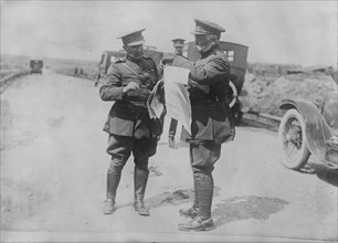
HRM24A13_392
Belgian officers, 1917. Creator: Bain News Service...
HRM24A03_431
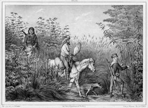
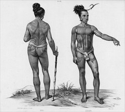
Inhabitants of Kamchatka, 19th century. Creators: ...
HRM24A03_442
View of the entrance to Avacha Bay, taken from Sta...
HRM24A03_453
View taken in the Russian colony of Novo-Arkhangel...
HRM24A04_148
View of Lukunor Island, Lower Caroline Islands, 19...
HRM24A03_432
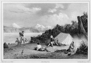
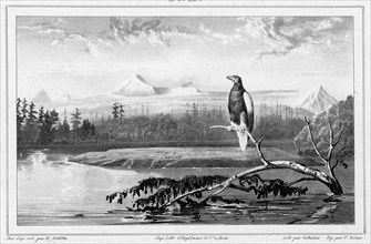
Hunters of Kamchatka, 19th century. Creators: Frie...
HRM24A03_441
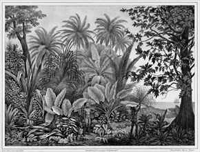
Vegetation of Kamchatka, 19th century. Creators: F...
HRM24A03_454
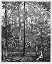
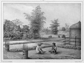
View of the Pasig River in Luzon Island, Philippin...
HRM24A04_147
View Taken in the Woods, Bonin Islands, 19th centu...
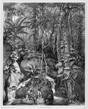
HRM24A03_440
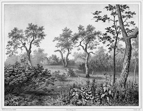
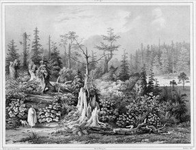
Vegetation in the interior of the Kamchatka penins...

HRM24A04_146
Inhabitants of the lower Caroline Islands, 19th ce...
HRM24A00_104
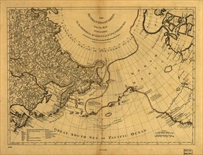
The Russian discoveries from the map published by ...
HRM24A03_430
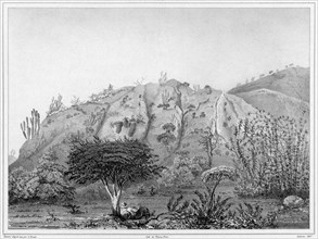
View of the Kamchatka River Kamchatka peninsula, 1...
HRM24A03_439
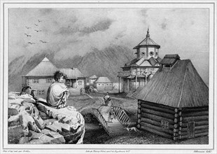
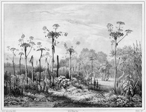
Vegetation around the settlement of Novo-Arkhangel...
HRM24A04_145
Inhabitants of the lower Caroline Islands, 19th ce...

HRM24A09_361
The International Exhibition: plan of the gallerie...
HRM24A03_438
View of the Interior, Luzon Island, Philippines, 1...
HRM24A04_134
View of the Interior of Luzon Island, Philippine I...
HRM24A04_143
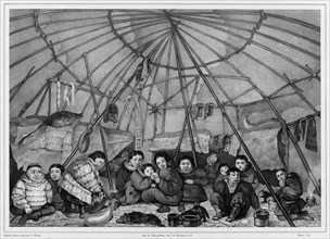
Interior of a Chukchi Hut, Northeast Coast of Asia...
HRM24A04_152
View of the Outskirts of Valparaiso, Chile, 19th c...
- Page
-
- sur
- 8