même sujet
Hrmcartes12
Légende
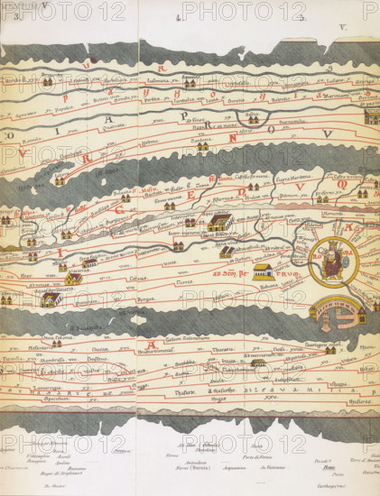
Rome and its roads, from the Peutinger table, 19th-century copy? The Tabula Peutingeriana, a 13th-century copy of an ancient Roman road map, with Rome at centre, is an illustrated itinerarium showing the layout of the cursus publicus, the road network of the Roman Empire. Tabula Peutingeriana - Pannonia Superior, Statio di Surpicano. From "Die weltkarte des Castorius genannt die Peutingersche tafel".
Crédit
Photo12/Heritage Images/Heritage Art
Notre référence
HRM25A14_484
Model release
NA
Property release
NA
Licence
Droits gérés
Format disponible
50.0Mo (5.7Mo) / 31.0cm x 40.4cm / 3660 x 4774 (300dpi)