Légende
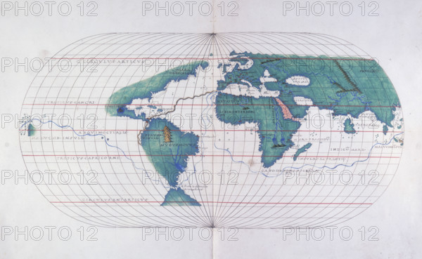
Map plotting Magellan's route, 1536. In 1519, while in the service of Spain, the Portuguese navigator Ferdinand Magellan commanded five ships on a voyage from Spain to attempt to reach the East Indies by the western route. He reached South America later that year, and rounded the southern tip of the continent through the strait which now bears his name, thereby becoming the first European to navigate the Pacific. He reached the Philippines in 1521, but soon afterwards was killed in a skirmish on Cebu. The survivors under the command of Juan Sebastián del Cano, in the only remaining ship, sailed back to Spain around southern Africa, completing the first circumnavigation of the globe.
Date
1536
Crédit
Photo12/Heritage Images/Heritage Art
Notre référence
HRM25A14_483
Model release
NA
Property release
NA
Licence
Droits gérés
Format disponible
49.9Mo (3.4Mo) / 45.0cm x 27.8cm / 5319 x 3280 (300dpi)