1540 results for: travel map
- Page
-
- of
- 16
Please sign in for more results

BRK26C67_115
The logo of the google maps is displayed on a smar...

BRK26C68_173
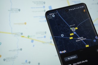
The Google maps go app from Google Playstore is di...
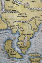
BRK26C62_346
North India, Sumatra, Malaysia, detail, hand-colou...

BRK26D03_440
A lesbian couple is focused and active as they pla...
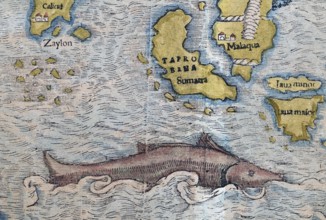
BRK26C56_190
South India, Sumatra, Malaysia, sea monster, detai...

BRK26C77_206
A female tourist stands in front of an ornate wood...
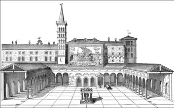
BRK26D02_391
Old St. Peter's Basilica, Vatican, Rome, Italy, 13...
BRK26C85_048
Oberhausen, North Rhine-Westphalia, Germany, Gasom...
BRK26C85_186
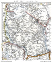
Map of the former German colony of East Africa, 18...

BRK26C63_020
Map of the first voyage and portrait of Vasco da G...

BRK26C16_137
A Hispanic LGBTQIA+ man with vibrant style sits at...
BRK26C42_368
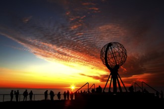
North Cape sunset with iconic globe and people in ...

BRK26C15_384
A Latino transgender man in a hat and sunglasses e...

BRK26C16_123
A Hispanic LGBTQIA+ man plans a holiday. They're u...
BRK26C42_372
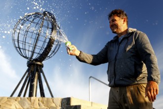
Man spraying globe sculpture at North Cape against...

BRK26C11_102
A Latino transgender man, wearing casual denim and...
BRK26C18_149
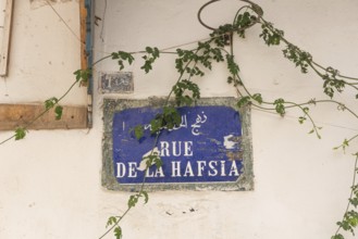
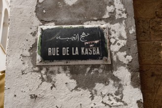
A Tunisian street sign for Rue de la Hafsia writte...
BRK26C19_091
London, United Kingdom. June 28th 2022 Street sign...
BRK26C24_030
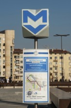
Sofia, Bulgaria. April 1st 2019 Sofia City Metro S...
BRK26C29_041
Sofia, Bulgaria. November 22nd 2025. Sofia city me...
BRK26C33_289
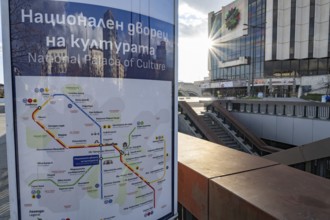
An informative sign on the platform with city and ...
BRK26C34_405
Hand-painted historical map from 1579, Peter Weinh...
BRK26C19_086
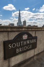
London, United Kingdom. July 9th 2022 Sign for the...
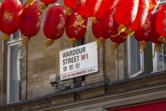
BRK26C19_089
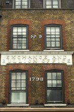
London, United Kingdom, June 28th 2022 9 Wardour S...
BRK26C19_106
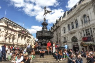
London, United Kingdom, June 28th 2022 Tourists si...
BRK26C19_261
A one-way blue street sign on Rue de la Carriere, ...
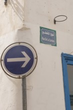
BRK26C32_412
Silver figure explorer traveling by Ekaterina Kova...
BRK26C18_152
Tunis, Tunisia. 13th May 2024 A Tunisian street si...
BRK26C19_109
London, United Kingdom, June 28th 2022 Dott Electr...
BRK26C32_414
Silver figure explorer traveling by Ekaterina Kova...
BRK26C19_181
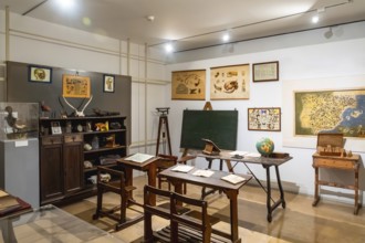
Vintage classroom with old wooden desks, a chalkbo...

BRK26C13_486
A traveler wearing a red jacket and backpack walks...
BRK26C15_272
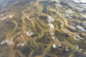
Aerial view of Iceland's rivers showcasing intrica...
BRK26C33_303
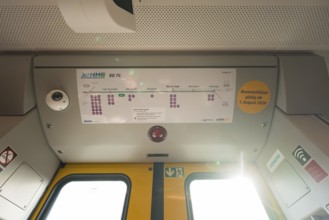
The interior of a train with a route plan and ligh...
BRK26C22_216
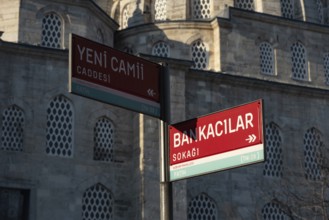
Street sign for Yeni Cami Caddesi and Bankacilar S...

BRK26C28_444
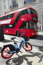
London, UK. January 30th 2025. Lime Electric E bik...
BRK26C23_373
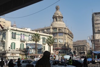
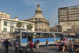
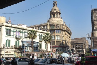
Cairo, Egypt. December 7th 2022 Busy Traffic cross...
BRK26C35_425
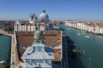
Drone footage of the Dogana da Mar, moving wind va...
BRK26C22_239
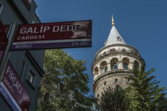
Istanbul, Turkey. October 5th 2021 The Galata Towe...

BRK26C53_004
Dhaka, Bangladesh- 07 May 2025: Google Maps app ic...

BRK26C49_496
Concept of global international trade and commerce...
BRK26C47_178
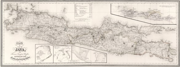
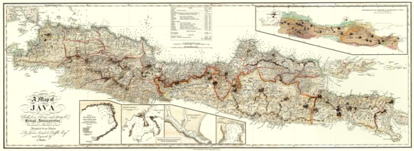
Map of Java, 1817, from History of Java by Sir Tho...
BRK26B81_394
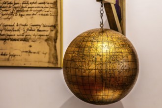
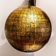
Jagiellonian globe, first globe, with the newly di...

BRK26B98_459
Dhaka, Bangladesh- 28 Oct 2025: An iPad displaying...
BRK26B81_481
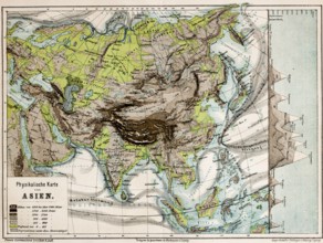
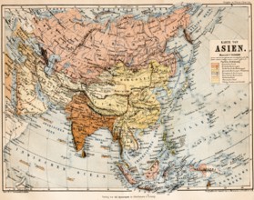
Colored physical map of the continent of Asia, alt...
BRK26B77_136
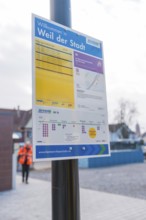
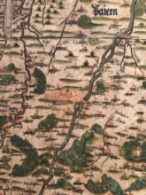
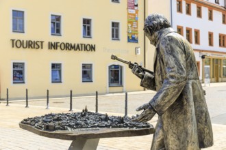
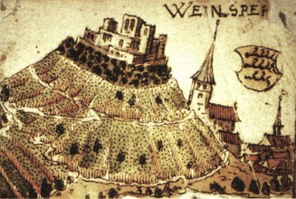
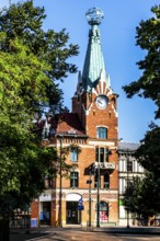
Weinsberg is a town in the district of Heilbronn, ...
BRK26B81_483
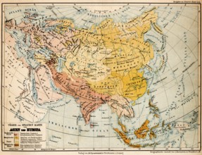
Coloured topographic map of the continent of Asia ...
BRK26B81_484
Color topographic map of the peoples and languages...

BRK26B96_045
Dhaka, Bangladesh- 01 Dec 2025: A close-up of the ...

BRK26B98_467
Dhaka, Bangladesh- 30 Oct 2025: Google Maps app di...
BRK26C00_456
Map of Java, 1817, from History of Java by Sir Tho...
BRK26B85_087
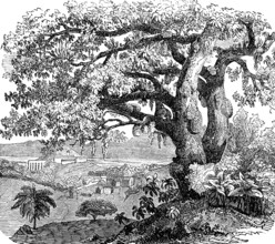
Breadfruit tree (Artocarpus altilis), also (Artoca...
BRK26B55_020
Cairo, Egypt. December 7th 2022 Busy Traffic cross...
BRK26B55_050
Cairo, Egypt. December 7th 2022 Busy Traffic cross...
BRK26B89_114
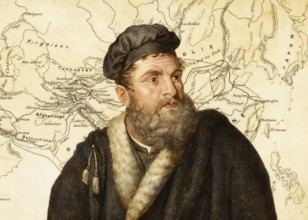
Marco Polo, c.?1254 –1324, an Italian merchant, ex...

BRK26B98_440
Dhaka, Bangladesh- 01 Dec 2025: A close-up of the ...

BRK26B98_461
Dhaka, Bangladesh- 30 Oct 2025: Google maps app on...

BRK26B96_095
Dhaka, Bangladesh- 01 Dec 2025: Google maps and Ap...

BRK26B98_464
Dhaka, Bangladesh- 24 Oct 2025: A iPad screen disp...
BRK26B85_086
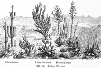
Various cactus species in the wild in the mountain...
BRK26B98_444
Dhaka, Bangladesh - 15 March 2025: The app of the ...

BRK26B96_112
16 Nov 2025- Dhaka, Bangladesh: Close-up of Apple ...

BRK26B98_497
Dhaka, Bangladesh- 02 Dec 2025: A Close-up of a la...
BRK26B85_082
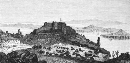
Fort San Giovanni near Sebenico or Šibenik, Croati...

BRK26B98_450
16 Nov 2025- Dhaka, Bangladesh: Stylus touching th...
BRK26B85_081
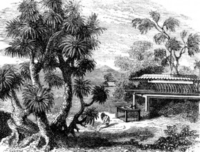
A Pandanus (Pandanus) tree, screw tree family (Pan...
BRK26B12_019
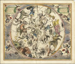
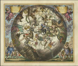
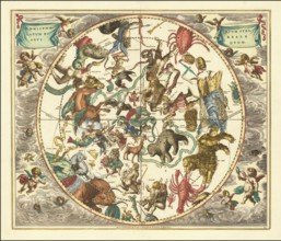
Celestial map entitled Hæmisphærium Stellatum Bore...
BRK26B12_023
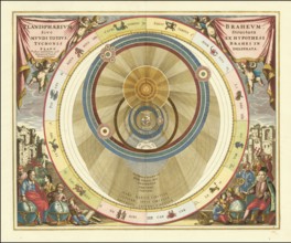
Planisphaerium Braheum, a famous historical celest...
BRK26B12_034
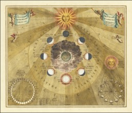
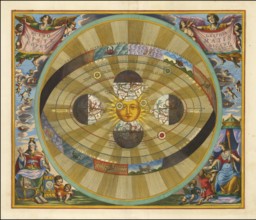
Historical copper engraving entitled Phases of the...

BRK26B12_036
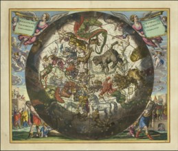
Sky map of the northern sky, known as Hemisphaeriu...
BRK26B12_044
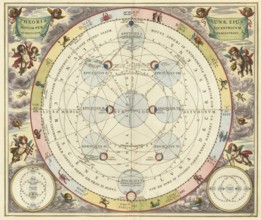
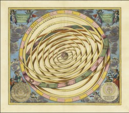
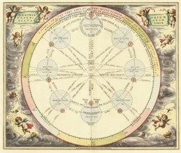
Historical astronomical map Theoria Lunae, Eius Mo...
BRK26B12_483
Jagiellonian globe, first globe, with the newly di...
BRK26B12_035
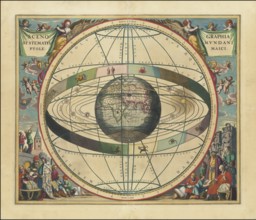
Planisphaerium of Aratos from the famous celestial...
BRK26B07_430
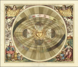
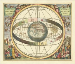
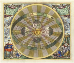
Historical sky map known as Scenographia Systemati...
BRK26B12_043
Scenographia Systematis Copernicani, scenography o...
BRK26B12_029
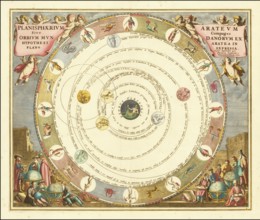
Orbium Planetarum Terram Complectentium Scenograph...
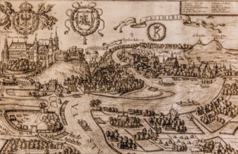
BRK26B12_349
Map of Kazimierz, copper engraving, 1608, Kazimier...
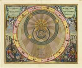
BRK26B07_429
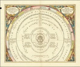
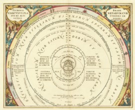
Historical presentation of the tychonic world view...
BRK26B12_022
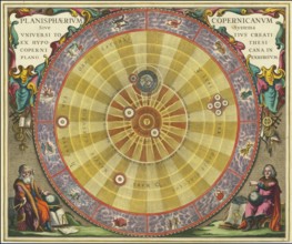
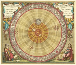
Planisphaerium Copernicanum sky diagram by Andreas...
BRK26B12_027
Ancient star map, specifically a depiction of the ...
BRK26B12_040
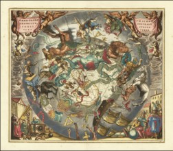
Haemisphaerium Stellatum Boreale Antiquum, a histo...
BRK26B12_041
Scenographia Systematis Copernicani, scenography o...
BRK26B12_264
House under the globe, 1904, headquarters of the K...
BRK26B12_030
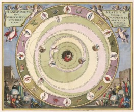
Planisphaerium Arateum, part of the famous celesti...
BRK26B12_031
A 17th century illustration of Tycho Brahe's geo-h...
BRK26B12_018
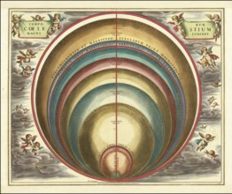
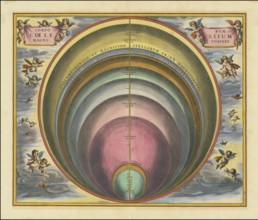
Sky map with the title Corporum Coelestium Magnitu...
BRK26B12_024
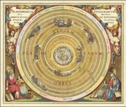
Historical celestial map depicting the Ptolemaic, ...
BRK26B12_032
Historical astronomical map titled Planisphaerium ...
BRK26B12_021
Historical sky map with Ptolemy's geocentric world...
BRK26B12_026
Haemisphaerium Stellatum Boreale cum Subiecto Hæmi...
BRK26B12_039
Historical sky map Haemisphaerium Scenographicum A...
BRK26B12_017
Historical presentation of the Tychonic world syst...
BRK26B12_038
Historical sky map Corporum Coelestium Magnitudine...
BRK26B12_042
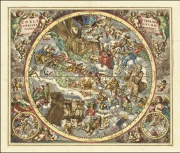
Sky map titled Coeli Stellati Christiani Haemispha...
BRK26B12_048
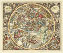
Historical sky map titled Coeli Stellati Christian...
BRK26B12_232
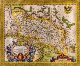
Map of Silesia as described by Martin Helwig from ...
BRK26B12_016
Theoria Trium Superiorum Planetarum sky map, theor...
BRK26B12_020
Historical map titled Scenographia Systematis Cope...
BRK26B12_037
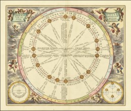
Historical sky map with the title Theoria Solis pe...
BRK26B12_045
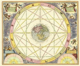
Celestial map Typus Aspectuum Oppositionum et Coni...
- Page
-
- of
- 16