Caption
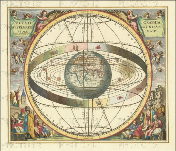
Historical sky map with Ptolemy's geocentric world view. This illustration is from the famous sky atlas Harmonia Macrocosmica by Andreas Cellarius, which was first published in 1660. The model illustrates the theory that the Earth is at the center of the universe while the Sun, Moon, and planets orbit it, in an ornate Baroque style, with allegorical scenes, cherubs and representations of astronomers using instruments such as quadrants, digitally restored reproduction from a 17th century original, authentic, exact date of presentation unknown
Date
1660
Credit line
Photo12/imageBROKER/Sunny Celeste
Reference
BRK26B12_021
Model release
No
Property release
No
License type
Royalty free
Available size
416.2Mb (35.7Mb) / 43.5in x 37.2in / 13036 x 11158 (300dpi)