Caption
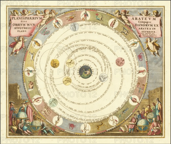
Planisphaerium Arateum, part of the famous celestial atlas Harmonia Macrocosmica by Andreas Cellarius. Description The map shows the geocentric world view based on the observations and writings of the ancient Greek poet and astronomer Aratos (ca. 315 - 240 BC) . In this model, the earth is at the centre of the universe, surrounded by the orbits of the moon, the sun and other planets, embedded in an outer ring with the signs of the zodiac, digitally restored reproduction from a 17th century original, authentic, exact date of depiction unknown
Credit line
Photo12/imageBROKER/Sunny Celeste
Reference
BRK26B12_030
Model release
No
Property release
No
License type
Royalty free
Available size
430.7Mb (34.3Mb) / 44.5in x 37.6in / 13339 x 11285 (300dpi)