162 résultats pour : archival maps
- Page
-
- sur
- 2
Connectez-vous pour plus de résultats
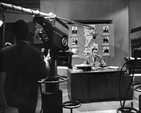
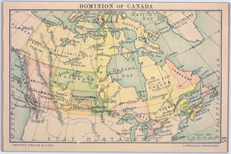
UMG23A56_183
New York
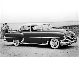
UMG23A55_177
Chrysler New Yorker Deluxe
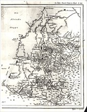
UMG23A54_161
A photocopy of a part of the map of the Western Al...
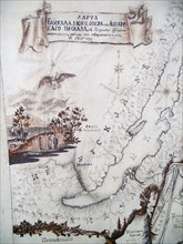
UMG23A53_289
Irkutsk
UMG23A54_488
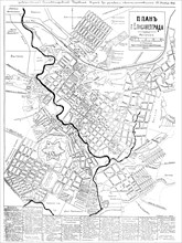
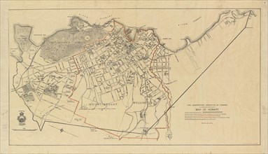
Long-standing map of the city of Elisavetgrad
UMG22A55_423
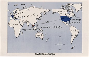
Propaganda Posters
UMG22A56_387
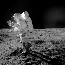
Astronaut Edgar D. Mitchell
UMG22A57_279
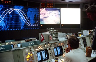
An overall view of activity in the mission operati...
UMG22A55_424
Propaganda Posters
UMG22A56_124
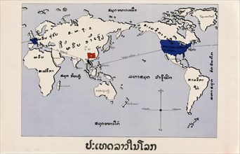
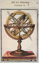
Géographie

UMG22A54_002
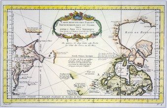
Géographie
UMG22A54_026
Géographie

UMG22A54_027
Géographie

UMG22A55_228
Géographie
UMG22A54_388
Géographie
UMG22A56_125
Géographie
UMG22A56_204
Géographie

UMG22A54_185
Géographie
UMG22A54_471
Géographie
UMG22A55_078
Géographie
UMG22A54_393
Géographie
UMG22A54_020
Géographie

UMG22A54_025
Géographie
UMG22A54_494
Géographie
UMG22A55_004
Géographie
UMG22A55_036
Géographie
UMG22A55_075
Géographie
UMG22A56_119
Géographie
UMG22A55_072
Géographie
UMG22A53_445
Géographie
UMG22A54_089
Illustration
UMG22A56_200
Géographie
UMG22A54_184
Géographie
UMG22A55_250
Géographie
UMG22A55_073
Géographie
UMG22A56_118
Géographie
UMG22A54_028
Géographie
UMG22A54_397
Géographie
UMG22A55_067
Géographie
UMG22A54_391
Géographie
UMG22A54_499
Géographie
UMG22A54_340
Géographie
UMG22A55_066
Géographie
UMG22A57_424
Géographie
UMG22A54_081
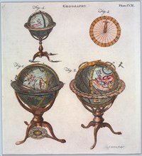
Illustration
UMG22A54_032
Géographie
UMG22A54_003
Géographie
UMG22A54_004
Géographie
UMG22A55_074
Géographie
UMG22A54_183
Géographie
UMG22A54_180
Géographie
UMG22A54_182
Géographie
UMG22A54_035
Géographie
UMG22A55_077
Géographie
UMG22A53_499
Géographie
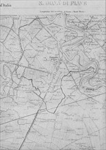
UMG22A33_182
Part of the topographic map of 1892 of the IGM wit...
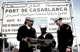
UMG22A39_305
U.S. Sailors look at their map at the entrance to ...
UMG22A40_075
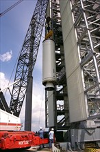
Workers erect the first stage of a Lockheed Martin...
UMG22A40_063
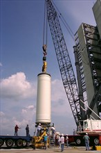
Workers hoist the first stage of a Lockheed Martin...
UMG22A40_050
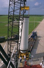
Workers erect the first stage of a Lockheed Martin...

UMG22A27_082
Young America hams and breakfast bacon, E.S. Baker...
UMG22A23_357
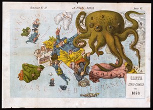
La piovra Russa (Italian political cartoon by Gros...
UMG22A25_068
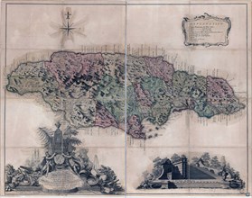
Vintage Maps / Antique Maps - A plan of the town o...
UMG22A25_363
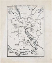
The novel & interesting game of matrimony. Map of ...
UMG22A27_339
portrait of Italian balloonist Luigi Piana. Includ...
UMG22A24_478
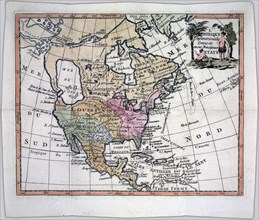
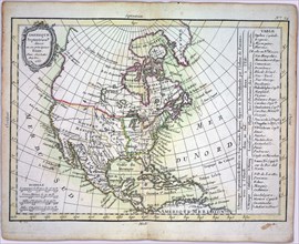
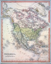
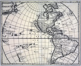
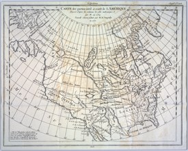
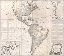
Antique map of North and South America - ca. 1772
UMG22A28_370
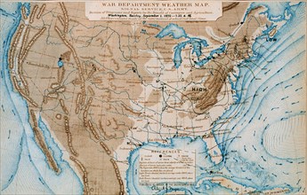
An early Signal Service weather map from September...
UMG22A24_479
Vintage Maps / Antique Maps - A map of the British...
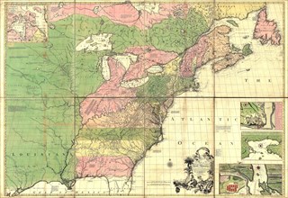
UMG22A24_363
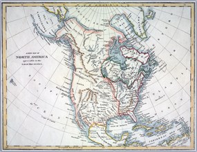
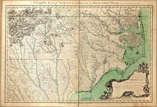
Vintage Maps / Antique Maps - A compleat map of No...
UMG22A30_048
Vintage Maps / Antique Maps - Theatrum belli in Am...
UMG22A29_400
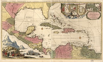
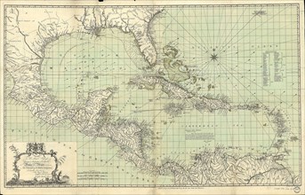
Vintage Maps / Antique Maps - Mexico, Cuba, Caribb...
UMG22A32_376
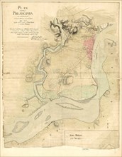
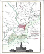
Vintage Maps / Antique Maps - Map of the city of P...
UMG22A29_294
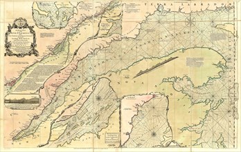
Vintage Maps / Antique Maps - An exact chart of th...
UMG22A24_353
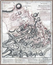
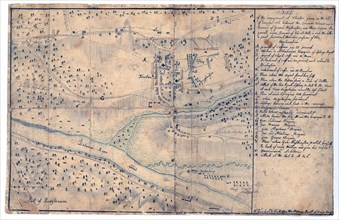
Vintage Maps / Antique Maps - Sketch of the engage...
UMG22A30_049
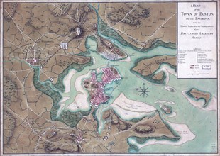
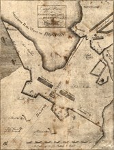
Vintage Maps / Antique Maps - Boston Harbour, with...
UMG22A26_052
Vintage Maps / Antique Maps - A survey of the city...
UMG22A30_050
Vintage Maps / Antique Maps - A trader's map of th...
UMG22A30_051
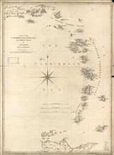
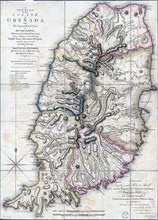
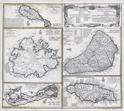
Vintage Maps / Antique Maps - A plan of the island...
UMG22A30_052
Vintage Maps / Antique Maps - A map of the city an...
UMG22A30_153
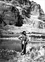
John F. Steward, a member of the Powell Survey, in...
UMG22A30_053
Vintage Maps / Antique Maps - To His Royal Highnes...
UMG22A30_103
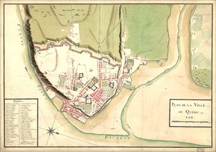
Vintage Maps / Antique Maps - map of the city of Q...
UMG22A30_104
Vintage Maps / Antique Maps - ca. 1759 maps of var...
UMG22A29_485
Vintage Maps / Antique Maps - Exact plan of Genera...
UMG22A19_094
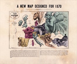
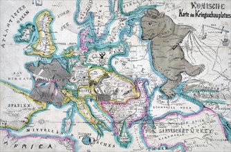
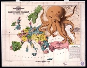
Comic war map for the year 1877
UMG22A20_477
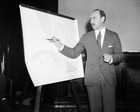
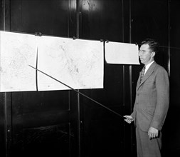
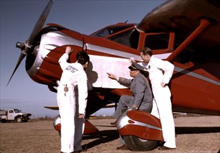
Man pointing to a map chart
UMG22A20_479
Man pointing to weather maps
UMG22A23_162
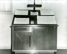
Weather Map Desk Weather Bureau Scottsbluff
UMG22A20_261
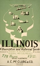
Illinois: A descriptive and historical guide ca. 1...
UMG22A22_220
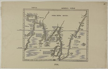
Tabula Moderna Indiae 1513
UMG22A20_026
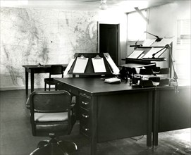
Forecast Desk With World Map on Wall Scottsbluff
UMG22A20_278
Instructor and students studying a map
UMG22A17_295
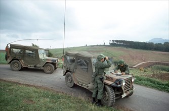
A member of the 11th Armored Cavalry in an M551 li...
UMG22A20_450
Man creating weather maps
UMG22A13_149
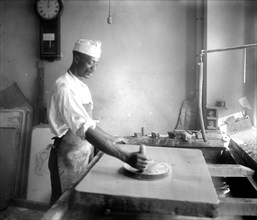
African American man in the process of map making,...
UMG22A06_361
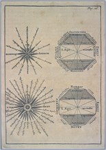
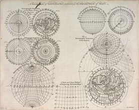
A second plate of geography containing the project...
UMG22A06_497
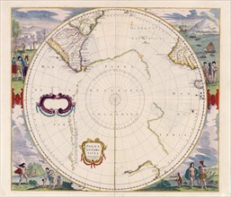
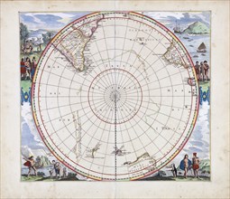
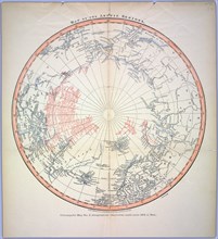
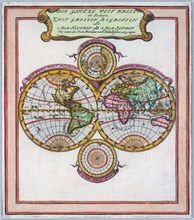
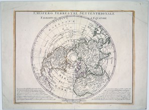
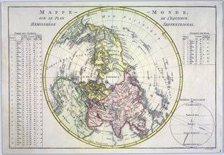
World map on the plane of the equator. Northern He...

UMG22A07_161
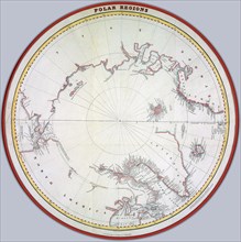
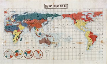
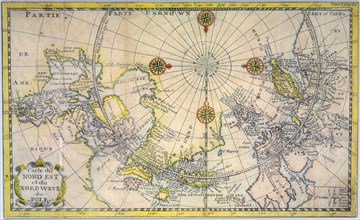
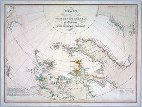
Reduced map of the northern parts of the world
UMG22A07_247
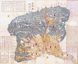
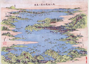
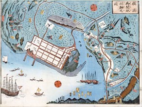
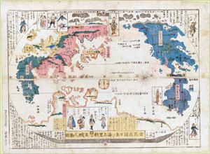
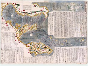
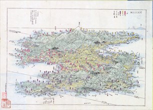
Panoramic view of the mountains and rivers of Sado...
UMG22A06_110
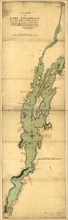
Vintage Maps / Antique Maps
- Page
-
- sur
- 2