Sujet
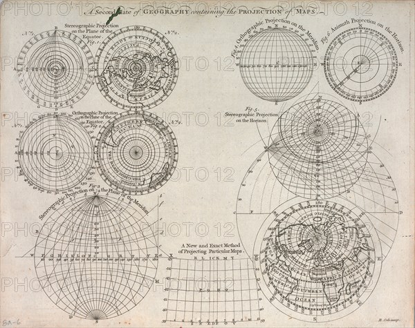
A second plate of geography containing the projection of maps ca. 1759
Légende
A second plate of geography containing the projection of maps ca. 1759
A second plate of geography containing the projection of maps ca. 1759 Credit: UBC Library
Crédit
Photo12/Universal Images Group
Notre référence
UMG22A06_361
Licence
Droits gérés
Format disponible
13.1Mo (1.4Mo) / 20.4cm x 16.1cm / 2404 x 1905 (300dpi)