873 results for: sky map
- Page
-
- of
- 9
Please sign in for more results

BRK26C77_206
A female tourist stands in front of an ornate wood...

BRK26C57_290
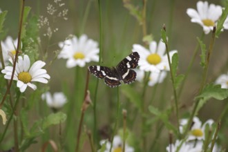
A map butterfly (Araschnia levana) flies over bloo...

BRK26C78_037
The Parable of the Weeds, New Testament, steel eng...
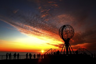
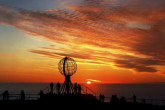
BRK26C42_368
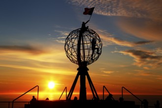
North Cape sunset with iconic globe and people in ...

BRK26C15_384
A Latino transgender man in a hat and sunglasses e...
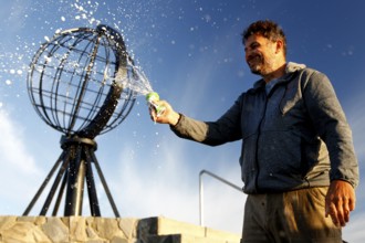
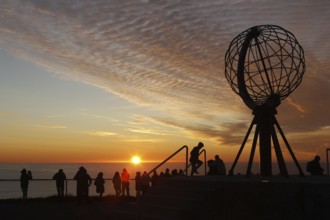
BRK26C42_372
Man spraying globe sculpture at North Cape against...
BRK26C42_248
Happy person in front of the distinctive symbol of...

BRK26C11_102
A Latino transgender man, wearing casual denim and...

BRK26C48_284
Dhaka, Bangladesh- 27 July 2025: Agoda app from Go...
BRK26C32_412
Silver figure explorer traveling by Ekaterina Kova...
BRK26C32_414
Silver figure explorer traveling by Ekaterina Kova...
BRK26C13_486
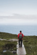
A traveler wearing a red jacket and backpack walks...
BRK26C15_272
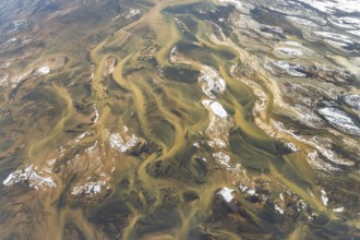
Aerial view of Iceland's rivers showcasing intrica...
BRK26C22_239
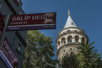
Istanbul, Turkey. October 5th 2021 The Galata Towe...

BRK26C11_104
A whimsical illustration of a woman with a globe h...

BRK26C03_267
Dhaka, Bangladesh- 27 July 2025: Agoda app from Go...

BRK26C03_271
Dhaka, Bangladesh - 27 July 2025: The logo of Agod...

BRK26C03_254
Dhaka, Bangladesh- 15 June 2025: A smartphone disp...
BRK26B85_079
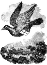
Pigeon flying with mail, dove breed domestic pigeo...

BRK26B85_083
Taming a wild elephant, shackles, pegs in soil, at...
BRK26B12_019
Celestial map entitled Hæmisphærium Stellatum Bore...
BRK26B12_023
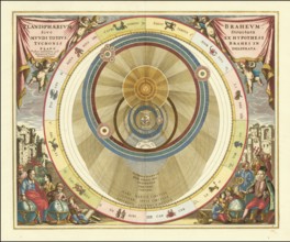
Planisphaerium Braheum, a famous historical celest...
BRK26B12_034
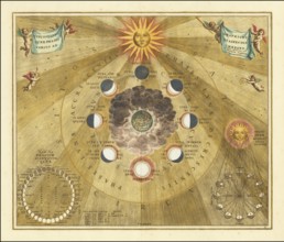
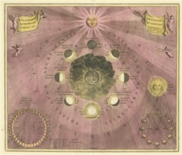
Historical copper engraving entitled Phases of the...

BRK26B12_036
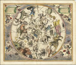
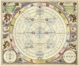
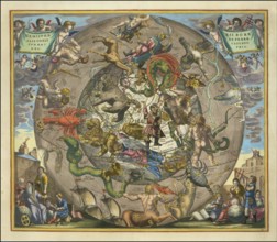
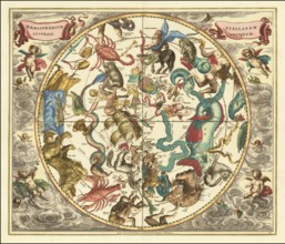
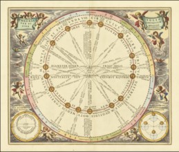
Sky map of the northern sky, known as Hemisphaeriu...
BRK26B12_044
Historical astronomical map Theoria Lunae, Eius Mo...
BRK26B12_035
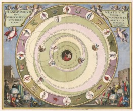
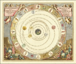
Planisphaerium of Aratos from the famous celestial...
BRK26B12_046
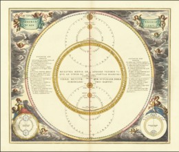
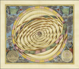
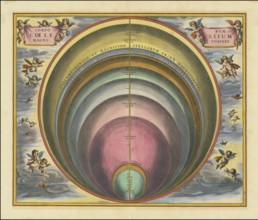
Historical illustration of the orbits of Mercury a...
BRK26B07_430
Historical sky map known as Scenographia Systemati...
BRK26B12_025
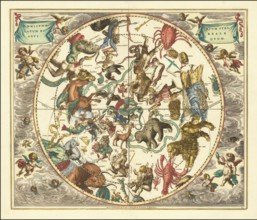
Sky map Hemisphaerii Borealis Coeli et Terrae Spha...
BRK26B12_043
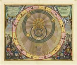
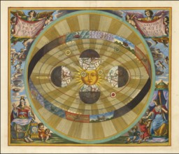
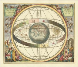
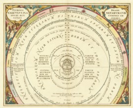
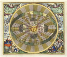
Scenographia Systematis Copernicani, scenography o...
BRK26B12_029
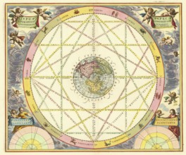
Orbium Planetarum Terram Complectentium Scenograph...
BRK26B07_429
Historical presentation of the tychonic world view...
BRK26B12_022
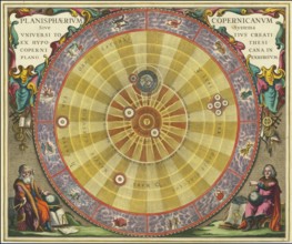
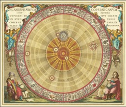
Planisphaerium Copernicanum sky diagram by Andreas...
BRK26B12_027
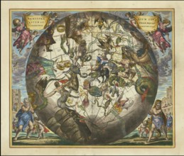
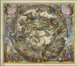
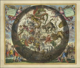
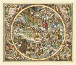
Ancient star map, specifically a depiction of the ...
BRK26B12_040
Haemisphaerium Stellatum Boreale Antiquum, a histo...
BRK26B12_041
Scenographia Systematis Copernicani, scenography o...
BRK26B12_030
Planisphaerium Arateum, part of the famous celesti...
BRK26B12_031
A 17th century illustration of Tycho Brahe's geo-h...
BRK26B12_028
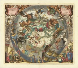
Celestial map of the southern hemisphere with the ...
BRK26B12_018
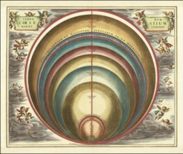
Sky map with the title Corporum Coelestium Magnitu...

BRK26B12_024
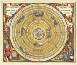
Historical celestial map depicting the Ptolemaic, ...
BRK26B12_032
Historical astronomical map titled Planisphaerium ...
BRK26B12_021
Historical sky map with Ptolemy's geocentric world...
BRK26B12_026
Haemisphaerium Stellatum Boreale cum Subiecto Hæmi...
BRK26B12_039
Historical sky map Haemisphaerium Scenographicum A...
BRK26B12_033
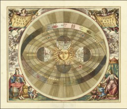
Presentation of the geocentric world view based on...
BRK26B12_017
Historical presentation of the Tychonic world syst...
BRK26B12_038
Historical sky map Corporum Coelestium Magnitudine...
BRK26B12_042
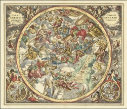
Sky map titled Coeli Stellati Christiani Haemispha...
BRK26B12_047
Historical sky map titled Haemisphaerium Stellatum...
BRK26B12_048
Historical sky map titled Coeli Stellati Christian...
BRK26B12_016
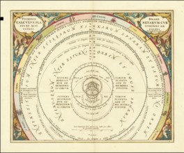
Theoria Trium Superiorum Planetarum sky map, theor...
BRK26B12_020
Historical map titled Scenographia Systematis Cope...
BRK26B12_037
Historical sky map with the title Theoria Solis pe...
BRK26B12_045
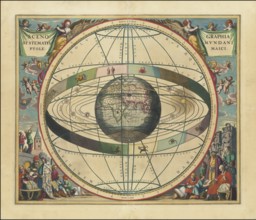
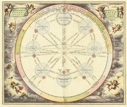
Celestial map Typus Aspectuum Oppositionum et Coni...
BRK26B12_015
Historical astronomical depiction of the phases of...
BRK26B48_277
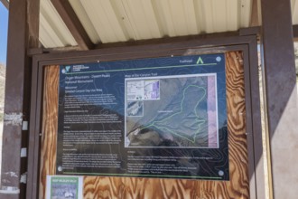
Sign at trailhead provides information for the Bar...
BRK26A63_295
Man on the North Cape globe with flag at spectacul...

BRK26A72_428
Diverse group of engineers and architects collabor...

BRK26A63_296
Silhouette of a climber on the North Cape globe in...
BRK26A63_292
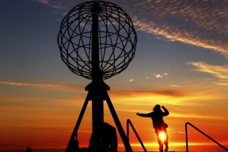
Person jumping on the North Cape globe in front of...
BRK26A63_297
Silhouettes of people on the North Cape globe in f...
BRK26A63_287
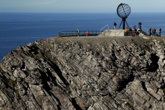
Panorama of cliffs at the North Cape with the glob...
BRK26A63_294
Sunset on the North Cape with colorful clouds and ...
BRK26A63_291
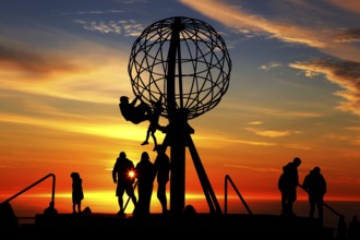
Crowd of people at the North Cape globe at a pictu...
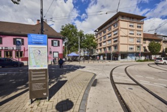
BRK26A59_253
Site plan, public city map, sign for the building,...
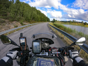
BRK26A81_161
A motorcyclist's view of an empty country road sur...
BRK26A73_055
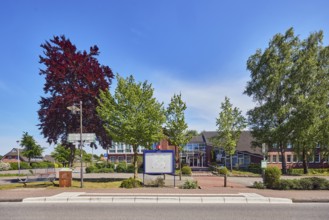
Neuenkirchen Rathaus bus stop, town hall of the mu...

BRK26A35_217
Three cheerful young women using smartphone and ri...

BRK26A35_210
Three friends enjoying a sunny summer day, riding ...
BRK26A39_413
Woman in a red dress looking at a map near a struc...
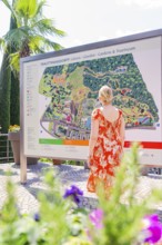
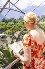
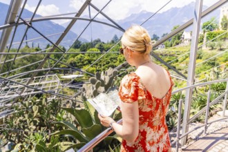
BRK26A39_423
Woman in orange dress looking at a large map in a ...

BRK26A43_419
Two women are walking and using a smartphone in a ...
BRK26A39_395
Woman in a red summer dress looking at a map in fr...

BRK26A17_208
Tourist using a smartphone while surrounded by the...

BRK26A21_237
Tourist waiting at the baggage claim area in an ai...
BRK26A11_045
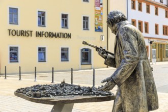
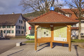
Information pavilion, information, tourism, site p...
BRK26A51_429
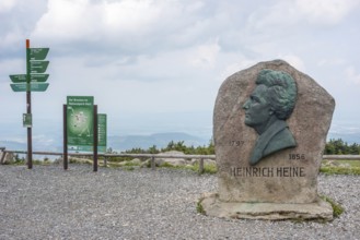
Heinrich Heine memorial, Heine memorial on the sum...
BRK25M60_397
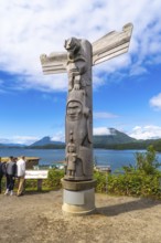
Wooden totem pole standing on a base overlooking t...
BRK25M60_210
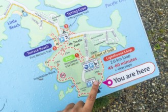
Tourist pointing at you are here indicator on a we...
BRK25M93_464
Land carat (Araschnia levana), summer generation, ...
BRK25L84_141
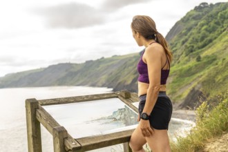
Sportswoman enjoying the view of the sakoneta beac...
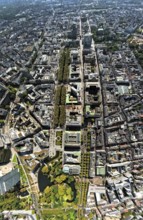
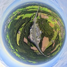
BRK25K62_480
Aerial view, central station station, redesign of ...
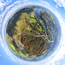
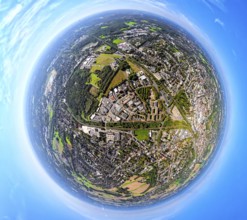
BRK25K87_298
Aerial view, villa hill and hill park with autumna...
BRK25K62_485
Aerial view, central station and city city center,...
BRK25K52_480
Aerial view, town view of Wesel, Rhine river and W...
BRK25K52_477
Aerial view, town view of Wesel, Rhine river and W...
BRK25K62_481
Aerial view, central station station, redesign of ...
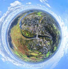
BRK25K87_307
Aerial view, residential area town view Werden dis...
BRK25K87_318
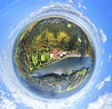
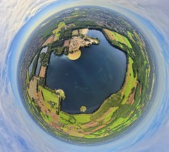
Aerial view, Lake Baldeney with dam RWE hydroelect...
BRK25K87_270
Aerial view, Lake Baldeney with dam RWE hydroelect...
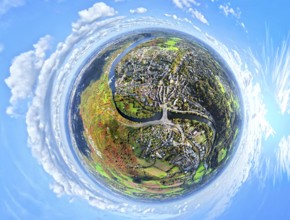
BRK25K87_313
Aerial view, residential area town view Werden dis...
BRK25K32_240
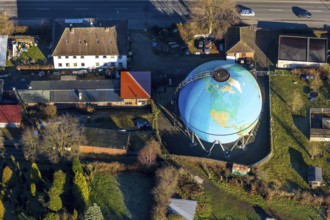
Aerial view, Oberwengerner Straße globe, gas globe...
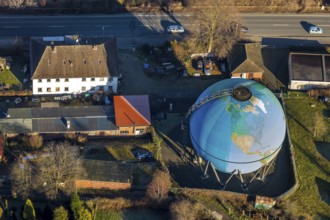
BRK25K32_285
Aerial view, Oberwengerner Straße globe, gas globe...

BRK25J92_494
A serene desert landscape painting depicts a river...
BRK25J62_375
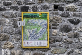
Hiking map hiking trails, Arosa, Graubünden, Switz...
BRK25J73_122
Aerial view, Königsallee with tree avenue, city ce...
BRK25J81_394
Aerial view, service area Hünxe-Ost and Hünxe-West...
BRK25J81_405
Aerial view, Tenderingssee and lido, globe, fishey...
BRK25J81_486
Aerial view, town hall district administration Rec...
- Page
-
- of
- 9