50 résultats pour : hrmcartes12
- Page
-
- sur
- 1
Connectez-vous pour plus de résultats
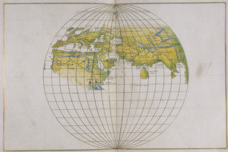
HRM25A14_489
Global map, 1540.
HRM25A14_491
Map of Mexico, 1567. Mexico, conquered by the Span...
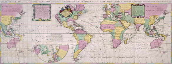
HRM25A14_177
Map of the World, c1701. Nautical table showing ma...
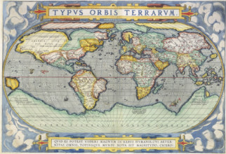
HRM25A14_474
Ortelius World Map, 1570. The map speculates the e...
HRM25A14_484
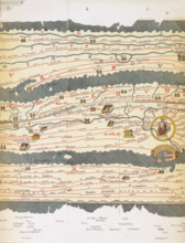
Rome and its roads, from the Peutinger table, 19th...
HRM25A14_283
World Map, 1542. On the left is the 'New World', t...
HRM25A14_275
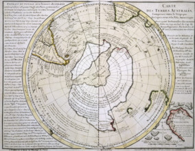
Map of Australasia and Antarctica, 1739. 'Cartes d...
HRM25A14_488
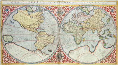
World Map, 1587. 'Orbis terrae compendiosa descrip...
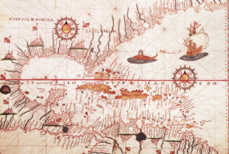
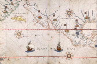
HRM25A15_417
Map of the Caribbean, c1578. Showing 'Niova Spagna...
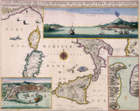
HRM25A14_281
'A Map Containing the Island and Kingdome of Sicil...
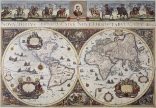
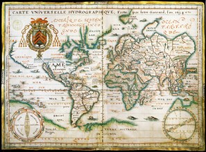
HRM25A14_143
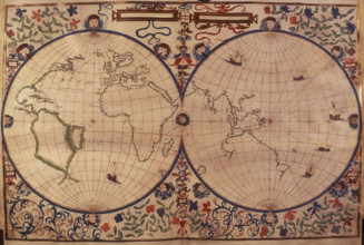
Map of the world, 1680. 'Nova Totius Terrarum Sive...
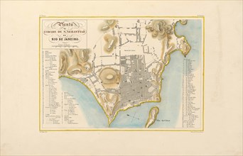
HRM24A16_236
Plan of the city of Rio de Janeiro. From "Voyage p...
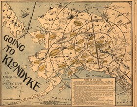
HRM24A00_009
Going to Klondyke, 1897. Creator: May Bloom.
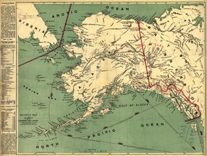
HRM24A00_027
Millroy's map of Alaska and the Klondyke gold fiel...
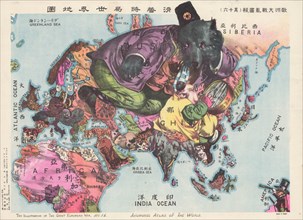
HRM23A20_164
The Illustration of the Great European War. A sati...
HRM21A25_423
Atlas of Borso d'Este , ca 1466-1467. Found in the...
HRM19G31_081
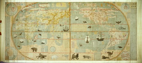
Kunyu Wanguo Quantu (Map of the Myriad Countries o...
HRM19F30_212
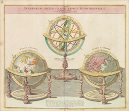
The Globes (From the Grand Atlas of all the World)...
HRM19F13_442
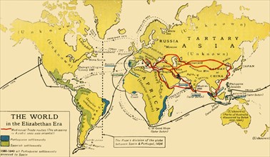
The World in the Elizabethan Era', 1926. s
HRM19E20_139
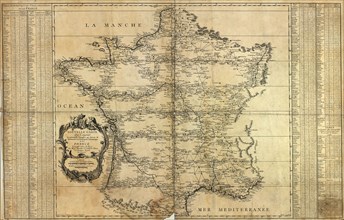
Nouvelle carte de la France, 1744. Artist: Maraldi...
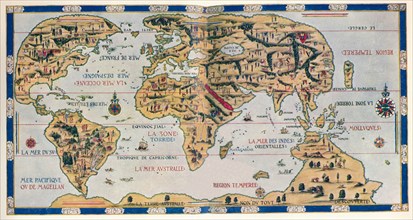
HRM19E20_148
World map with Magellan?s circumnavigation (From S...
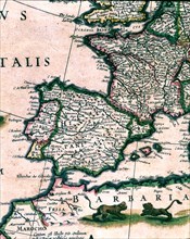
HRM19E91_226
Spain and Africa, colored engraving from the book ...
HRM19E20_135
Kunyu Wanguo Quantu (A Map of the Myriad Countries...
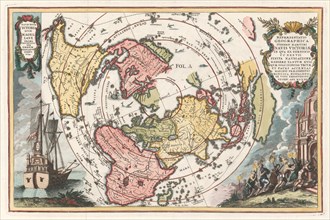
HRM19E62_268
Nautical world map. (Australia is suggested but st...
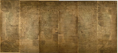
HRM19E04_175
Map of the world, c. 1490. Artist: Martellus Germa...
HRM19E20_140
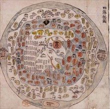
Ch'onhado (Map of All Under Heaven), Mid of the 18...
HRM19E36_394
The three continents with Jerusalem in the center ...
HRM19E22_132
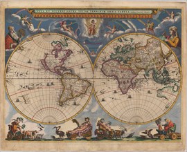
Double hemisphere map of the World. Artist: Blaeu,...
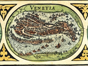
HRM19E92_317
Venice, colored engraving from the book 'Le Theatr...
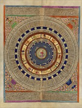
HRM19E39_284
Mapamundi. Calendar.
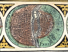
HRM19E92_313
Paris, colored engraving from the book 'Le Theatre...
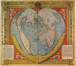
HRM19E23_362
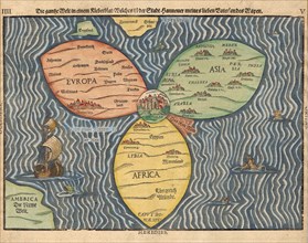
Heart Shaped World Map. Artist: Fine, Oronce (1494...
HRM19E20_123
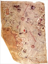
The Piri Reis world map, 1513. Artist: Piri Reis (...
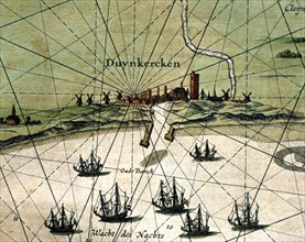
HRM19E92_311
Dunkirk, colored engraving from the book 'Le Theat...
HRM19E20_483
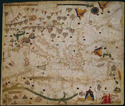
Nautical chart of the Mediterranean Sea and the Bl...
HRM19C63_182
The Dauphin Map of the World, (1546), 1912. Artist...
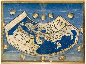
HRM19C63_170
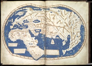
Ptolemy's Map of the World cA.D 150. (1912) Artist...
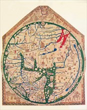
HRM19C63_176
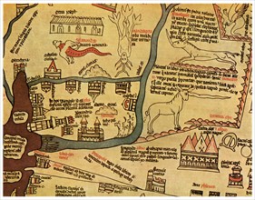
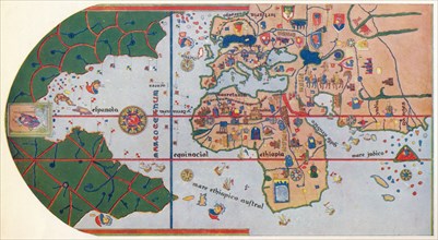
The Hereford Mappa Mundi', (c1285), 1912. Artist: ...
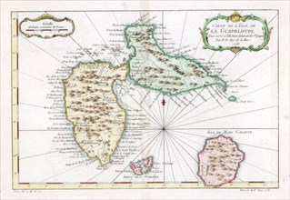
HRM19C57_088
Map of the Caribbean island of Guadeloupe, c1764. ...
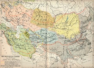
HRM19C74_183
'The Mongolian Empire from 12th-15th Century', c19...
HRM19C29_275
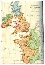
The dominions of the Angevins, 1892. Artist: Unkno...
HRM19C30_243
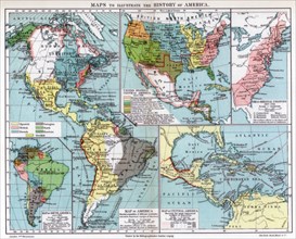
Maps to illustrate the history of America, 1901. A...
HRM19C53_026
The Nile Delta, Egypt, c1280 (1956). Artist: Unkno...
HRM19C74_128
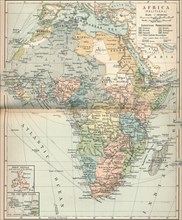
'Africa (Political)', c1902, (1903). Artist: Unkno...
HRM19C63_180
The First map to Show America, (1500) 1912. Artist...
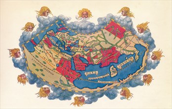
HRM19D46_286
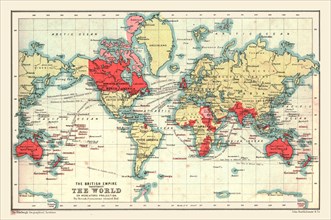
World Map showing the British Empire, 1902. Creat...
HRM19C05_344
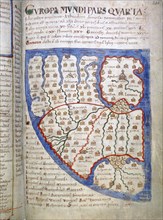
Map of Europe, a page from Liber Floridus, 12th ce...
HRM19B03_367
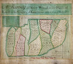
Map of Abbey Wood, part of Erith or Lesnes Manor o...
HRM19A83_052
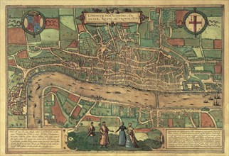
Earliest printed map of London, 1574. Artist: Unkn...
HRM19A97_104