même sujet
Hrmcartes12
Sujet
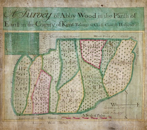
Map of Abbey Wood, part of Erith or Lesnes Manor on the eastern boundary of Woolwich, Kent, 1791. Artist: Anon
Légende
Map of Abbey Wood, part of Erith or Lesnes Manor on the eastern boundary of Woolwich, Kent, 1791. The map shows field names and acreages.
Date
1791
Crédit
Photo12/Heritage Images/City of London : The London Archives
Notre référence
HRM19B03_367
Model release
NA
Property release
NA
Licence
Droits gérés
Format disponible
30.1Mo (1.3Mo) / 29.2cm x 25.8cm / 3452 x 3046 (300dpi)