747 résultats pour : atlas
- Page
-
- sur
- 8
Connectez-vous pour plus de résultats
HRM26A25_485
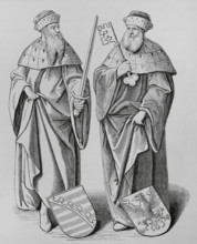
The Duke of Saxony and the Marquis of Brandenburg,...
HRM26A12_411
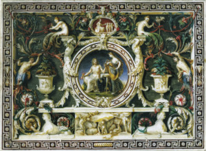
Jupiter and Hebe, c1775-1790. Creator: Ignaz Unter...
HRM26A10_487
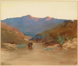
Sunset in Morocco, 1895. Creator: Arthur Melville.
HRM26A06_094
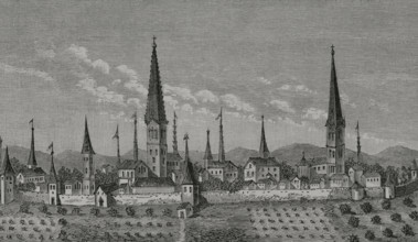
View of Dortmund, Germany, 17th century, (1878). ...

HRM26A09_174
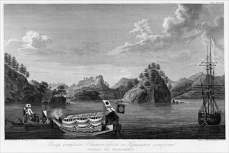
A Visit to Tafilet: landing in Saffi, 1895. Creato...
HRM26A09_175
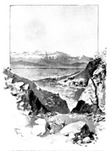
A Visit to Tafilet: in view of the Atlas Mountains...
HRM26A09_178
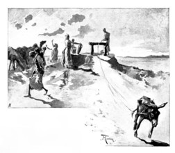
A Visit to Tafilet: a well at sunset, 1895. Creato...
HRM26A09_176
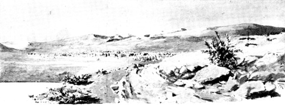
A Visit to Tafilet: from Saffi to Morocco City: a ...
HRM26A09_177
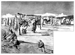
A Visit to Tafilet: a corner of a sôk, early in th...
HRM25A57_245
The late Mr. Edward Lloyd, Proprietor of the "Dail...
HRM25A23_474
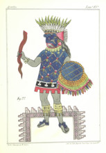
Inhabitant of New Spain, 1867. Creator: Unknown.
HRM25A33_175
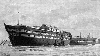
The Smallpox Hulks, Atlas and Endymion, at Deptfor...
HRM25A14_499
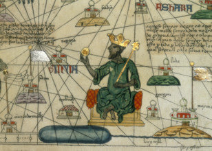
Mansa Musa, King of Mali, 1375. Depiction of Mansa...
HRM25A15_413
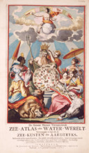
Title page from van Keulen's Chart Atlas, 1682. 'D...
HRM25A15_424
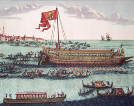
The Venetian Doge's State Galley, 1693. The splend...
HRM25A14_482
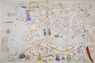
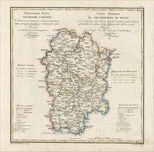
Map of Europe, North Africa and the Mediterranean,...
HRM25A14_500
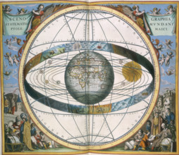
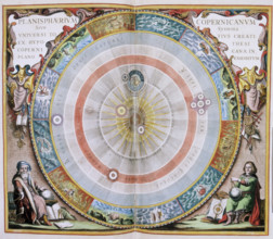
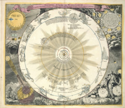
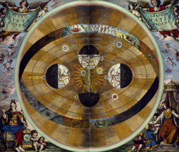
Ptolemaic Solar System, 1660. Scenographia Systema...
HRM25A14_492
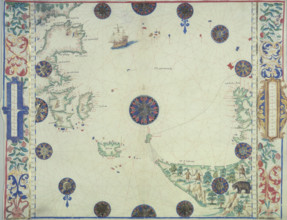
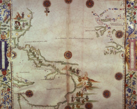
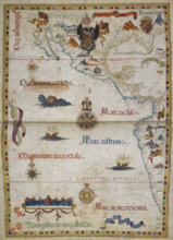
Chart of the Atlantic Ocean, c1535-1542. The map i...
HRM25A16_322
Haemisphaeri Graphicum Coeli Tiet, 1660. An extens...
HRM25A16_367
Zodiac chart, 1742. From Atlas Novus Coelestis In ...
![Map of Great Britain and Ireland, c1564-c1570. 'A general description of England & Irelad [sic]](https://lres.photo12.com/th/t-hrm25a14_268.jpg)
HRM25A14_268
Map of Great Britain and Ireland, c1564-c1570. 'A ...
HRM25A15_416
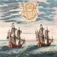
Two Dutch ships at sea, 17th century. The Dutch ca...
HRM25A16_378
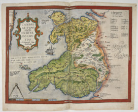
Coloured printed map of Wales and Anglesey, 1579. ...
HRM25A14_278
Chart of the Gulf of Mexico and the Pacific Ocean,...
HRM25A16_377
Coloured manuscript plan of Falmouth Haven, or Har...
HRM25A14_277
Map of the Black Sea coastline, 1536. The coast of...
HRM25A14_496
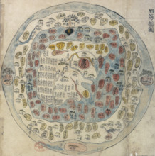
Korean world map, 19th century. Printed and hand-c...
HRM25A16_316
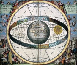
The Copernican System, 1660.
HRM25A15_016
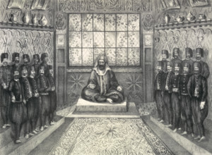
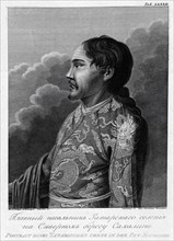
Audience of Hussein II Bey, 1835. Engraving showin...
HRM25A15_333
Ptolemaic Solar System, 1660. Scenographia Systema...
HRM25A15_391
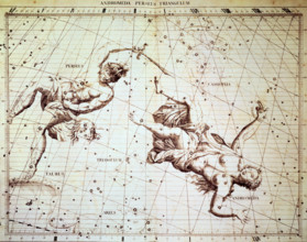
The star constellations Perseus and Andromeda, 172...
HRM25A14_203
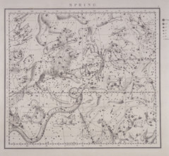
Spring, from a celestial atlas, 1843.
HRM25A16_318
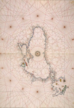
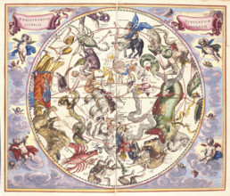
Hemisphaerium Australe. Southern hemisphere contai...
HRM25A14_488
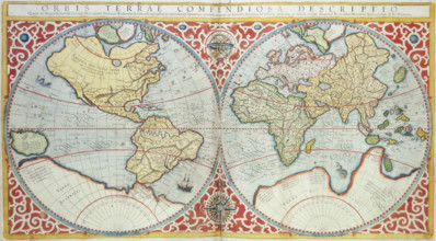
World Map, 1587. 'Orbis terrae compendiosa descrip...
HRM25A15_435
William Hack's atlas of the South Sea of America, ...
HRM25A16_379
Engraved map of Northumberland, from drawings of C...
HRM25A15_428
Frontispiece of Mortier's "Neptune François", 1693...
HRM25A16_380
Printed map of Devon, dated 1575, with marginal no...
HRM25A16_391
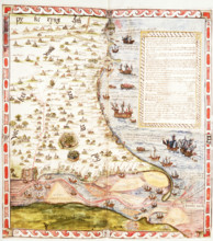
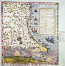
The eastern Pacific Ocean with Central America and...
HRM25A15_427
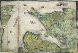
Map of the River Humber and land between Hull and ...
HRM25A15_429
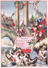
Title page of a maritime atlas, c1693-c1694. This ...
HRM25A14_382
Top half of Lord Burghley's chart of the Humber, 1...
HRM25A11_407
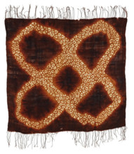
Woman's Headscarf, about 1900. Creator: Unknown.
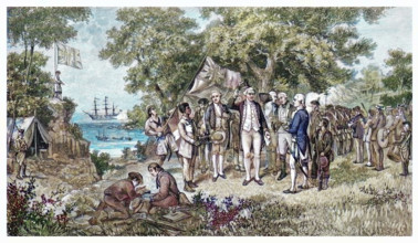
HRM25A12_270
Captain Cook claims Botany Bay, New South Wales, A...
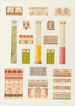
HRM25A05_322
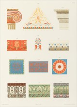
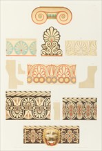
Colonnes, pilastre, ornements, portes, cymaises, a...
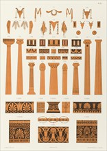
HRM25A05_323
Offrandes, colonnes, stèles et ornements divers ti...
HRM25A05_416
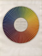
Colour wheel divided into 72 clear hues, 1861. Cr...
HRM25A05_415
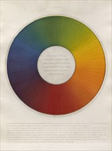
Chromatic circle divided into 72 equal sections, 1...
HRM25A05_327
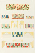
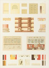
Capitals and other coloured parts of the Erechthei...
HRM25A05_326
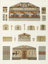
Painted moldings of the temples and propylaea of A...
HRM25A05_325
Ionic marble capital, antefix and cymaises in marb...
HRM25A05_324
Plans, coupes et détails de tombeaux étrusques et ...
HRM25A05_321
État actuel et restauration de l'église de Saint-U...
HRM24A57_200
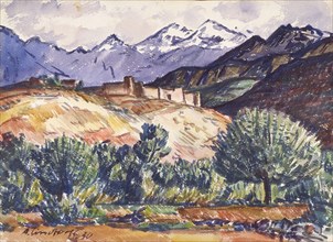
From the Atlas Mountains, 1930. Creator: Anton Lin...
HRM24A51_233
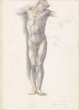
Sketchbook - Study for Atlas in Atlas Turned to St...
HRM24A41_013
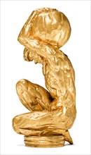
Atlas (hood ornament), 1915. Creator: Bugatti; Rem...
HRM24A34_162
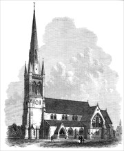
All Saints' Church, Sheffield, 1869. Creator: Unkn...
HRM24A24_412
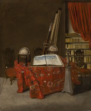
Corner of a Library, 1711. Creator: Jan van der He...
HRM24A10_359
Workers and residents of the Znamensky glass facto...
HRM24A18_121
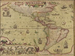
America. From Mercator-Hondius Atlas, c.1620. Crea...
HRM24A00_045
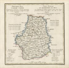
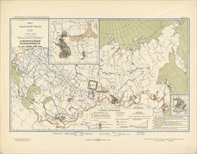
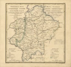
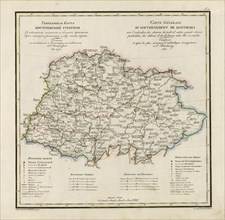
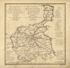
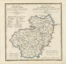
General Map of Tula Province: Showing Postal and M...
HRM24A00_056
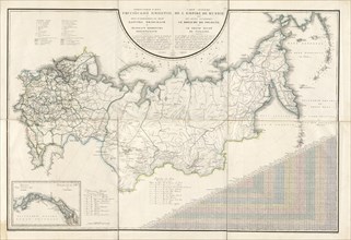
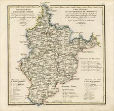
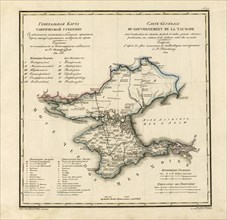
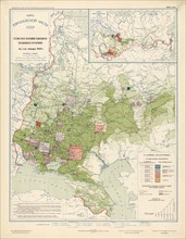
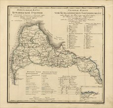
General Map of the Russian Empire and the Neighbor...
HRM24A00_083
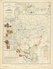
Coal industry on January 1, 1933, 1934. Creator: M...
HRM24A02_203
View of Papenberkh Island and Rat's Island, 1813. ...
HRM24A03_049
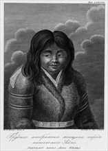
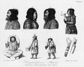
Main Chief of the Tatar Settlement on the Northern...
HRM24A00_046
General Map of Ryazan Province: Showing Postal and...
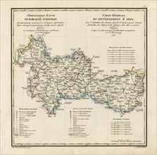
HRM24A00_055
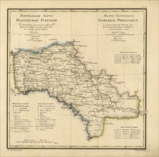
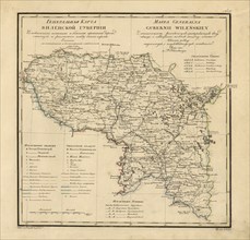
General Map of Voronezh Province: Showing Postal a...
HRM24A00_084
Oil industry on January 1, 1933, 1934. Creator: Mi...
HRM24A02_204
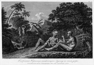
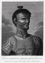
Illustration of a Nukagiva Man Making Tattoos on A...
HRM24A02_449
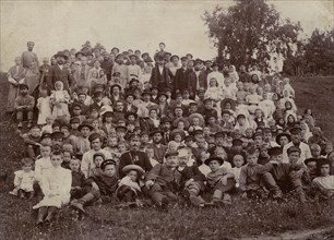
Parents of D. N. Mamonov with his sister, 1870-187...
HRM24A03_050
Illustration of an Ainu Woman, 1813. Creator: Jego...
HRM24A00_047
General Map of Taurida Province: Showing Postal an...
HRM24A00_058
General Map of Grodno Province and the Belostok Re...
HRM24A00_094
Chemical industry of the USSR on January 1, 1933, ...
HRM24A02_452
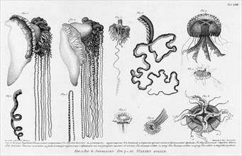
Fig.1.2. Stinging Cubomedusae; F.3.4. Its Long Ten...
HRM24A03_051
A Woman From Nukagiva Island, 1813. Creator: Jegor...
HRM24A00_048
General Map of Orel Province: Showing Postal and M...
HRM24A00_057
General Map of Podolsk Province: Showing Postal an...
HRM24A00_093
Agricultural engineering as of January 1, 1933, 19...
HRM24A02_451
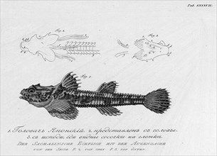
F.1. Japanese "Golovach"; F.2. Its Head; F.3. From...
HRM24A03_052
A Man From Nukagiva Island, 1813. Creator: Jegor S...
HRM24A00_049
General Map of Kostroma Province: Showing Postal a...
HRM24A00_060
General Map of Courland Province: Showing Postal a...
HRM24A00_123
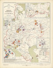
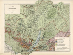
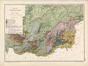
Map of Irkutsk Province, 1914. Creator: Resettleme...
HRM24A02_234
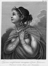
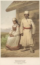
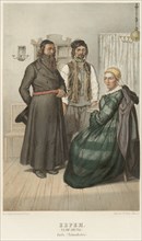
Belarusians (Mogilev province), 1862. Creator: Kar...
HRM24A03_045
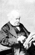
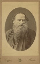
Count Leo Tolstoy, half-length portrait, facing ri...
HRM24A03_056
Ainu, 1813. Creator: Jegor Skotnikoff.
HRM24A00_050
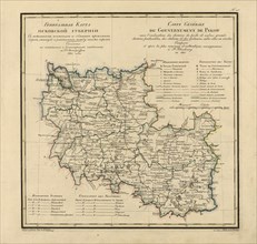
General Map of the Polish Empire: Showing Postal a...
HRM24A00_059
General Map of Vilnius Province: Showing Postal an...
HRM24A00_124
Map of Zabaikal Province, 1914. Creator: Resettlem...
HRM24A02_233
Jews. (Talmudists), 1862. Creator: Karl Fiale.
HRM24A03_046
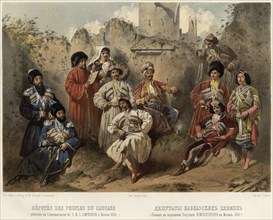
Deputies of the Caucasian tribes (who were at the ...
HRM24A03_055
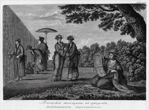
Japanese Women on a Stroll, 1813. Creator: Jegor S...
HRM24A00_044
General Map of Kaluga Province: Showing Postal and...

HRM24A00_051
General Map of Kursk Province: Showing Postal and ...
HRM24A00_062
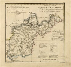
General Map of Saint Petersburg Province: Showing ...
HRM24A02_403
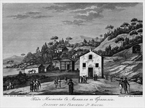
View of Sao Miguel Settlement in Brazil, 1813. Cre...
HRM24A02_448
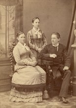
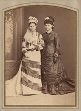
Photo of two young women, late 19th cent - early 2...
HRM24A03_047
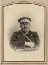
Firefighter A.F. Domishkevich in uniform, late 19t...
HRM24A00_034
General Map of Pskov Province: Showing Postal and ...
- Page
-
- sur
- 8