Légende
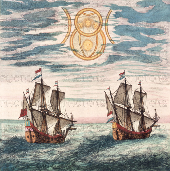
Two Dutch ships at sea, 17th century. The Dutch cartographer Willem Blaeu and his son Joan were amongst the foremost producers of sea charts and atlases in the 17th century. The Netherlands became a major naval and trading power after gaining their independence from Spain in 1579, and this was reflected in their becoming the main centre of maritime chart production as well. From the Blaeu Atlas.
Date
1600
Crédit
Photo12/Heritage Images/Heritage Art
Notre référence
HRM25A15_416
Model release
NA
Property release
NA
Licence
Droits gérés
Format disponible
50.0Mo (5.6Mo) / 35.3cm x 35.4cm / 4172 x 4186 (300dpi)