Sujet
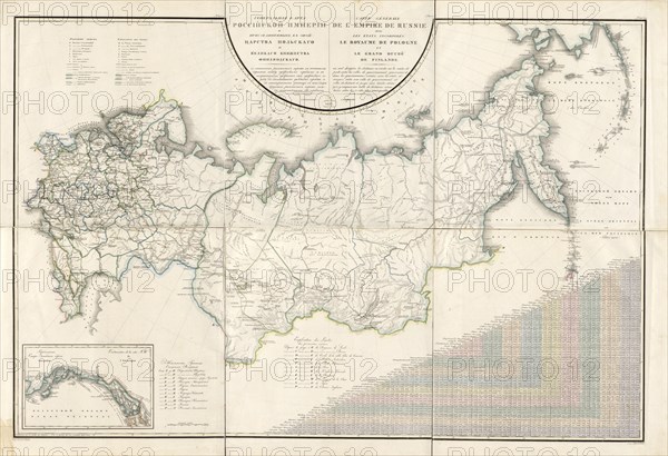
General Map of the Russian Empire and the Neighboring Polish.., 1827. Creators: Vasilii Petrovich Piadyshev, Ieremin.
Légende
General Map of the Russian Empire and the Neighboring Polish Empire and Grand Duchy of Finland: With the Distance in Versts on Postal Roads between Provincial Cities; and in Boundary Provinces from the Provincial City to County Towns and Foreign Borders; with a Table of Distance in Versts between 73 Notable Cities, 1827. This 1827 map of the Russian Empire is from a larger work, Geograficheskii atlas Rossiiskoi imperii, tsarstva Pol'skogo i velikogo kniazhestva Finliandskogo (Geographical atlas of the Russian Empire, the Kingdom of Poland, and the Grand Duchy of Finland), containing 60 maps of the Russian Empire. It reflects the detailed mapping carried out by Russian military cartographers in the first quarter of the 19th century.
Crédit
Photo12/Heritage Images/Heritage Art
Notre référence
HRM24A00_056
Model release
NA
Property release
NA
Licence
Droits gérés
Format disponible
350.2Mo (24.3Mo) / 113.2cm x 77.5cm / 13373 x 9153 (300dpi)