1684 résultats pour : map,
- Page
-
- sur
- 17
Connectez-vous pour plus de résultats
UMG24A04_262
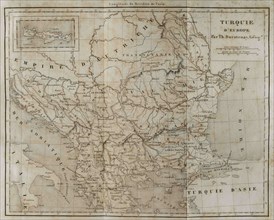
European Turkey map by Thunot Duvotenay. Historia ...
UMG24A04_273
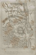
Holy Roman Empire. Plan of the Battle of Vienna, 1...
UMG24A04_265
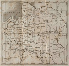
General map of Poland. Engraved by Lemaitre. Histo...
UMG24A04_275
Partitions of Poland. The First Partition of Polan...

UMG24A03_284
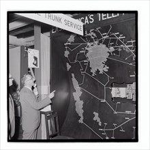
Royal Show East Africa Post and Telecommunications...
UMG24A03_285
Royal Show East Africa Post and Telecommunications...

UMG24A03_286
Royal Show East Africa Post and Telecommunications...

UMG24A03_302
Royal Show Settlement Board Stand

UMG24A03_362
Royal Show Nyali Estate Stand

UMG24A03_383
Royal Show East Africa Post and Telecommunications...

UMG24A03_301
Royal Show Settlement Board Stand
UMG24A01_243
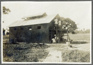
Nairobi P.W.D apprentices with map cabinet
UMG23A66_397
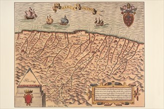
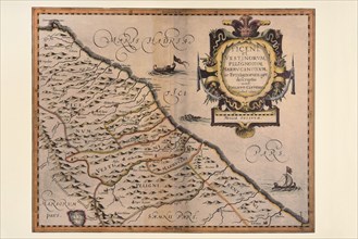
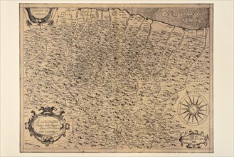
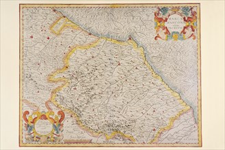
Carte géographique du 17e siècle
UMG23A66_398
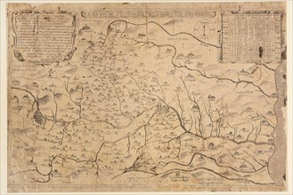
Carte géographique du 16e siècle
UMG23A66_399
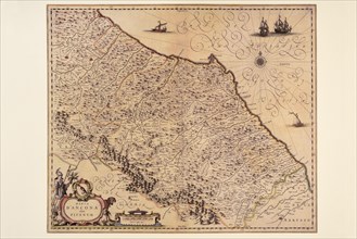
Carte géographique du 16e siècle
UMG23A66_391
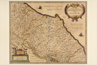
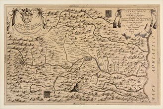
Carte géographique du 17e siècle
UMG23A66_393
Carte géographique du 17e siècle

UMG23A66_392
Carte géographique du 17e siècle
UMG23A66_394
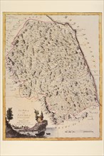
Carte géographique du 17e siècle
UMG23A66_395
Carte géographique du 17e siècle
UMG23A66_396
Carte géographique du 17e siècle
UMG23A66_387
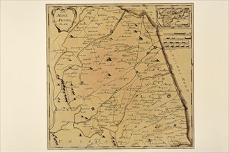
Carte géographique du 19e siècle
UMG23A66_388
Carte géographique du 17e siècle
UMG23A66_389
Carte géographique du 17e siècle
UMG23A66_390
Carte géographique du 17e siècle
UMG23A66_384
Carte géographique du 18e siècle
UMG23A66_385
Carte géographique du 18e siècle
UMG23A66_386
Carte géographique du 19e siècle
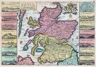
UMG23A62_310
Map of Scotland dating from the early 18th century...
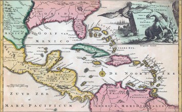
UMG23A62_325
18th century map of Central America and the Gulf o...
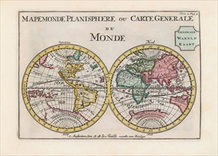
UMG23A62_334
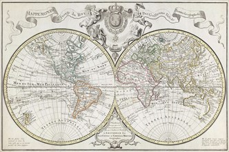
World map dating from the late 17th or early 18th ...
UMG23A58_180
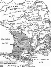
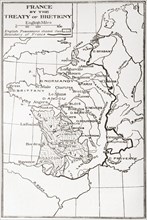
A map of France after the Treaty of Bretigny.
UMG23A58_459
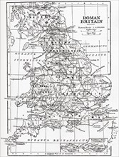
Map of Roman Britain showing the area of the islan...
UMG23A58_100
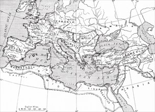
Map of the Roman Empire.
UMG23A58_421
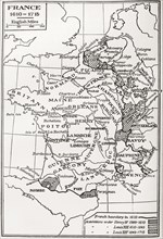
Map of France.
UMG23A60_343
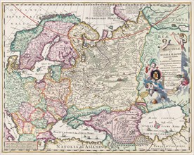
17th century map of Russia and surrounding countri...
UMG23A58_376
Map of France by the Treaty of Bretigny.
UMG23A61_178
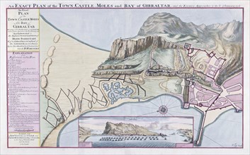
An Exact Plan of the Town Castle Moles and Bay of ...
UMG23A57_364
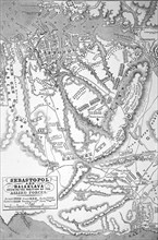
A map showing position of allied forces in Sebasto...
UMG23A58_420
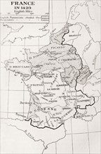
Map of France in 1429.
UMG23A62_060
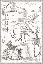
Imagined situation of the Garden of Eden.
UMG23A58_375
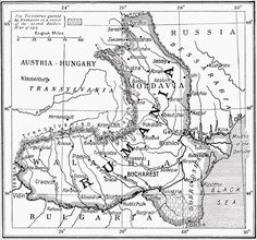
Map of Romania at the outbreak of WWI.
UMG23A61_201
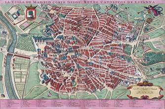
Anonymous map of Madrid dating from late 17th or e...
UMG23A59_110
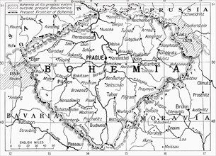
Map of Bohemia at the outbreak of WWI.
UMG23A60_110
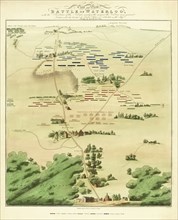
Souvenir Battle of Waterloo map.
UMG23A59_243
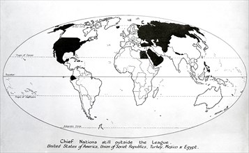
Map of 1920, Chief nations still outside the leagu...
UMG23A60_090
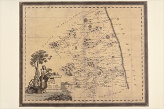
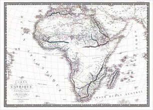
Map of the African continent by the geographer A.H...
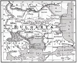
UMG23A58_373
Map of Bulgaria at the outbreak of WWI.
UMG23A62_131
Plan of Madrid.
UMG23A62_270
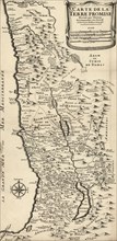
French map from 1720 of Palestine.
UMG23A61_155
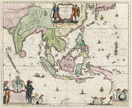
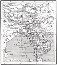
Map of South-East Asia.
UMG23A62_069
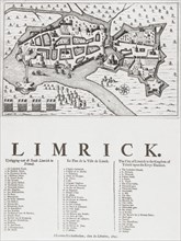
Map of Limerick.
UMG23A60_344
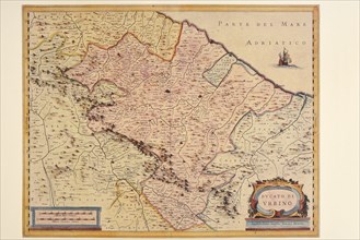
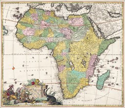
Map of Africa dating from the late 17th century.
UMG23A61_061
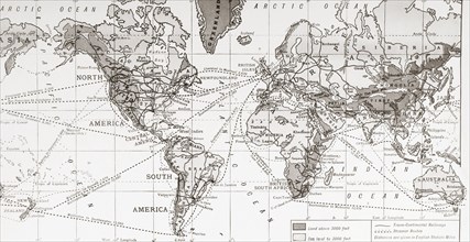
Physical map of the world.

UMG23A62_481
Nathaniel Nye.
UMG23A61_133
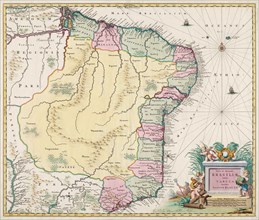
Map of Brazil.
UMG23A58_371
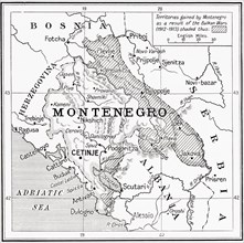
Map of Montenegro at the outbreak of WWI.
UMG23A57_177
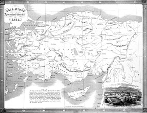
A Map Of The Seven Apocalyptic Churches Of Asia.
UMG23A58_414
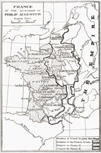
Map of France at the accession of Philip II, aka P...
UMG23A62_411
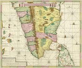
Map of Southern India and Ceylon.
UMG23A61_153
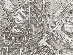
Map of the centre of Rome.

UMG23A61_161
The beheading of Cornelis de Hooghe.
UMG23A58_312
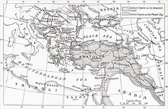
Map of Turkey at the outbreak of WWI.
UMG23A58_413
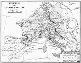
Map of France showing the Empire of Charlemagne.
UMG23A62_303
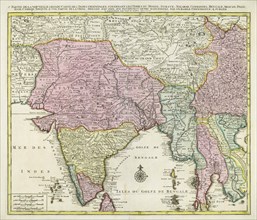
Map of India and Southern Asia dating from 1792.
UMG23A58_351
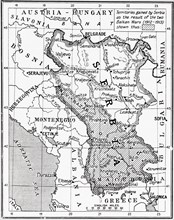
Map of Serbia at the start of WWI.
UMG23A62_474
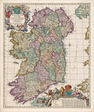
Map of Ireland.
UMG23A56_245
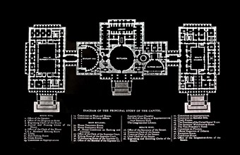
Principal Story Of The Capitol Building.
UMG23A59_426
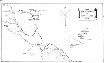
Map Of Lindisfarne and farn.
UMG23A58_328
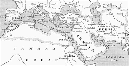
Map of the Umayyad Caliphate at its height around ...
UMG23A63_006
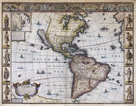
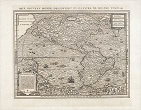
Map of America.
UMG23A58_429
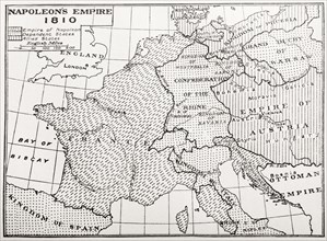
Map showing Napoleon's Empire, France.
UMG23A58_437
Map of the Indo-Chinese nations as at 1915.
UMG23A61_164
World Map.
UMG23A59_427
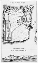
A map of the Farne Island.
UMG23A58_063
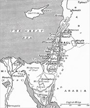
Map showing the kingdoms of Judah and Israel.
UMG23A62_478
Map of North and South America.
UMG23A59_174
Bird's-eye view of Mesopotamia showing William Wil...
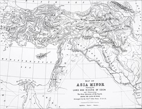
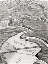
UMG23A57_178
Map Of Asia Minor Showing Rivers Of Eden.
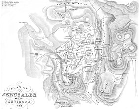
UMG23A57_217
Plan Of Jerusalem And The Environs In 1861.
UMG23A58_179
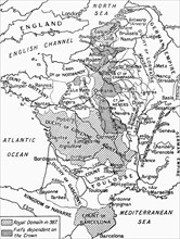
A map of feudal France in 987.
UMG23A58_188
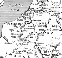
Map of Belgium.
UMG23A60_172
The sea chart of Juan de la Cosa.
UMG23A58_290
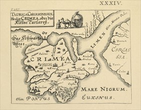
Map of Crimea published in Kiev.
UMG23A58_189
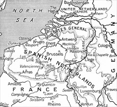
Map of the Spanish Netherlands following the peace...
UMG23A62_062
Map showing the extent of the damage caused by the...
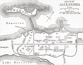
UMG23A65_271
Map of ancient Alexandria.
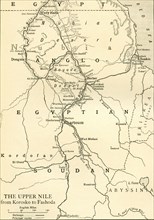
UMG23A64_308
Map of Anglo Egyptian Soudan showing The Upper Nil...
UMG23A65_099
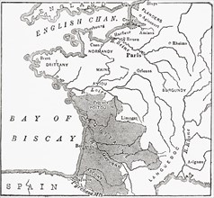
Map showing French territory held by the English w...
UMG23A64_108
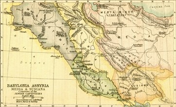
Map of Babylon.
UMG23A65_098
Map Showing The English Dominions In France At The...
UMG23A64_304
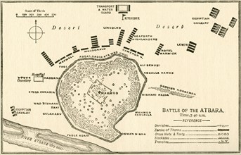
Map showing The Battle of Atbara during the Second...
UMG23A64_312
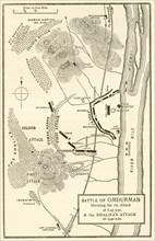
Map of the Battle of Omdurman.
UMG23A64_331
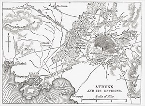
Map of Athens and Piraeus.
UMG23A64_339
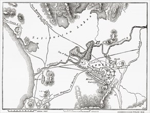
Plan of Ephesus.
UMG23A65_097
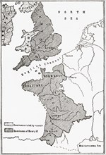
Map showing the French dominions of Henry II.
UMG23A64_337
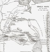
Map Showing The Israelites Route To The Red Sea Du...
UMG23A64_269
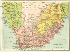
Map Of South Africa Since 1815.
UMG23A64_295
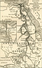
Map of Egypt and the Anglo-Egyptian Sudan at the t...
UMG23A65_051
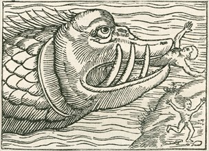
Man being eaten by a sea serpent.
- Page
-
- sur
- 17