Sujet
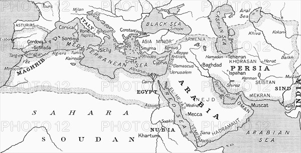
Map of the Umayyad Caliphate at its height around the turn of the 8th century.
Légende
Map of the Umayyad Caliphate at its height around the turn of the 8th century. From Hutchinson's History of the Nations, published 1915.
Date
1915
Crédit
Photo12/UIG/Universal History Archive
Notre référence
UMG23A58_328
Model release
Non
Property release
Non
Licence
Droits gérés
Format disponible
38.1Mo (2.3Mo) / 43.2cm x 22.1cm / 5100 x 2609 (300dpi)