Sujet
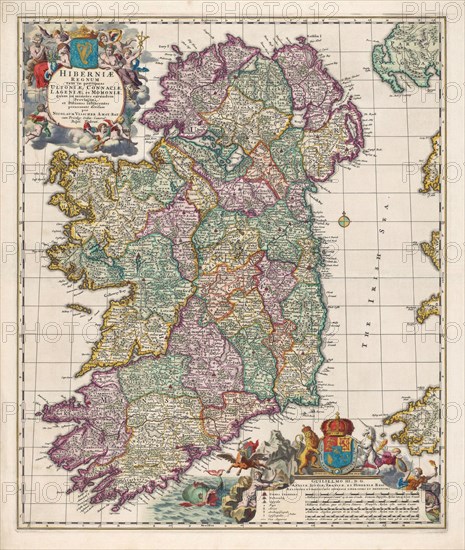
Map of Ireland.
Légende
Map of Ireland circa 1650-1675 by Dutch engraver, cartographer and publisher Nicolaes Visscher.
Crédit
Photo12/UIG/Universal History Archive
Notre référence
UMG23A62_474
Model release
Non
Property release
Non
Licence
Droits gérés
Format disponible
50.1Mo (4.5Mo) / 32.6cm x 38.5cm / 3848 x 4551 (300dpi)