Sujet
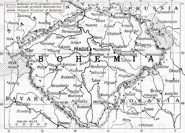
Map of Bohemia at the outbreak of WWI.
Légende
Map of Bohemia at the outbreak of WWI. The lined areas show its extent in the 14th century, the dotted line shows its frontier in 1914. From Hutchinson's History of the Nations, published 1915.
Date
1915
Crédit
Photo12/UIG/Universal History Archive
Notre référence
UMG23A59_110
Model release
Non
Property release
Non
Licence
Droits gérés
Format disponible
53.6Mo (2.9Mo) / 43.2cm x 31.1cm / 5100 x 3673 (300dpi)