Sujet
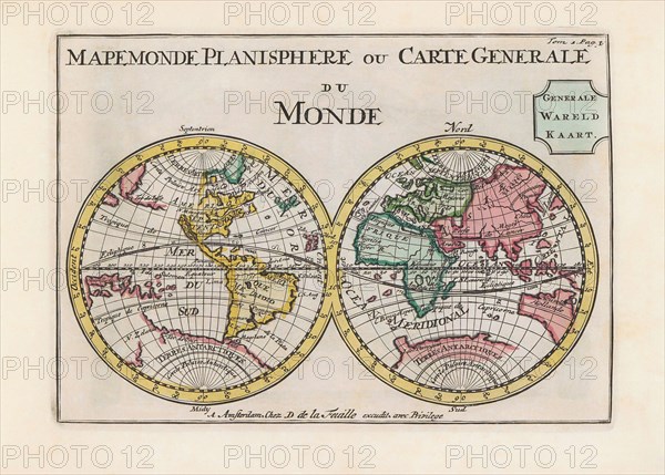
World map dating from the late 17th or early 18th century.
Légende
World map dating from the late 17th or early 18th century and published in Amsterdam showing the western and eastern hemispheres. Amongst many inaccuracies, the California area is shown as an island.
Crédit
Photo12/UIG/Universal History Archive
Notre référence
UMG23A62_334
Model release
Non
Property release
Non
Licence
Droits gérés
Format disponible
52.8Mo (2.7Mo) / 43.0cm x 30.8cm / 5079 x 3636 (300dpi)