Sujet
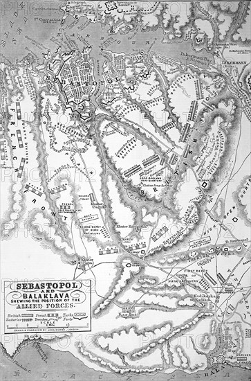
A map showing position of allied forces in Sebastopol and Balaclava.
Légende
The Illustrated London News etching from 1854. A map showing position of allied forces in Sebastopol and Balaclava.
Date
1854
Crédit
Photo12/UIG/Universal History Archive
Notre référence
UMG23A57_364
Model release
Non
Property release
Non
Licence
Droits gérés
Format disponible
49.2Mo (5.1Mo) / 28.5cm x 43.2cm / 3369 x 5100 (300dpi)