Sujet
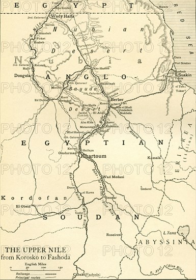
Map of Anglo Egyptian Soudan showing The Upper Nile from Korosko to Fashoda.
Légende
Map of Anglo Egyptian Soudan showing The Upper Nile from Korosko to Fashoda, at the time of the Mahdist War. From Field Marshal Lord Kitchener, His Life and Work for the Empire, published 1916.
Date
1916
Crédit
Photo12/UIG/Universal History Archive
Notre référence
UMG23A64_308
Model release
Non
Property release
Non
Licence
Droits gérés
Format disponible
52.2Mo (4.4Mo) / 30.3cm x 43.2cm / 3579 x 5100 (300dpi)