468 résultats pour : history of earth
- Page
-
- sur
- 5
Connectez-vous pour plus de résultats
BRK26C74_158
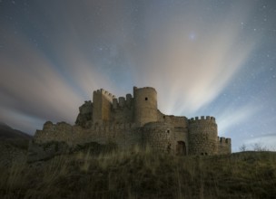
Night falls over the Manqueospese Castle in Avila,...
BRK26D02_265
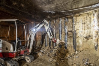
An excavator operates in an underground constructi...
BRK26D03_298
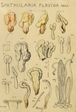
Mushroom, fungi, yellow earth tongue, yellow spatu...
BRK26D01_276
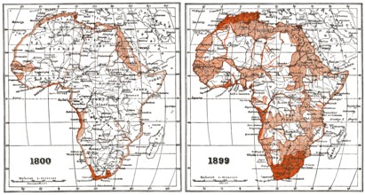
Map of Africa according to the state of research a...
BRK26C98_244
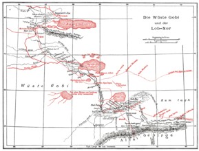
The Gobi Desert with Lop Nur or Lop Nor, East Asia...
BRK26C85_048
Oberhausen, North Rhine-Westphalia, Germany, Gasom...
BRK26C77_365
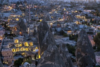
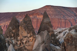
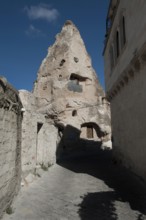
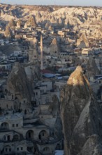
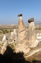
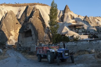
Cappadocia, Turkey. September 19th 2018 The Turkis...
BRK26C88_158
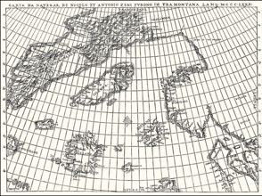
Facsimlile of the Zeno map by the Zeno brothers, N...
BRK26D01_289
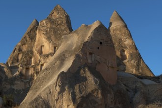
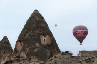
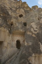
Rock carved dwellings in the dramatic cone shaped ...
BRK26D04_297
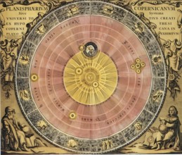
Copernicus' worldview, the sun as the center of th...
BRK26C78_037
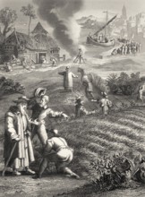
The Parable of the Weeds, New Testament, steel eng...
BRK26C85_186
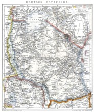
Map of the former German colony of East Africa, 18...
BRK26C82_301
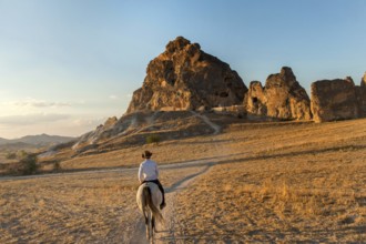
A local Turkish man rides a horse through the volc...
BRK26D00_438
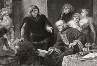
Martin von Behaim, German astronomer, showing his ...
BRK26C23_320
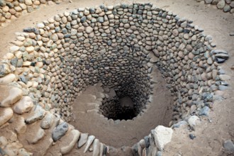
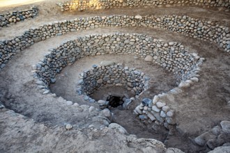
Tightly wound spiral of stones that reaches deep i...
BRK26C23_275
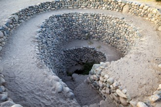
Large spiral structure of stones anchored in the e...

BRK26C23_274
Stone spiral with evenly arranged layers of stone ...
BRK26C23_276
Deep spiral of stones winding into the ground, The...
BRK26C18_012
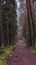
A winding path meanders through a pine forest (pin...
BRK26C30_099
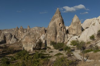
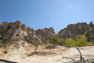
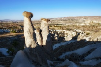
Cappadocia in heart of Anatolia
BRK26C19_158
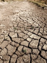
Dry cracked earth of a river bed in the desert dur...
BRK26C30_097
Cappadocia in heart of Anatolia
BRK26C30_098
Ortahisar, Cappadocia, Turkey. September 19th 2018...
BRK26C19_181
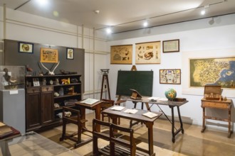
Vintage classroom with old wooden desks, a chalkbo...
BRK26C23_373
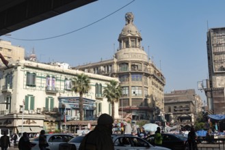
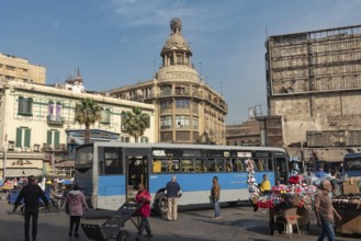
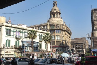
Cairo, Egypt. December 7th 2022 Busy Traffic cross...
BRK26C35_425
Drone footage of the Dogana da Mar, moving wind va...
BRK26C25_139
Arnold Böcklin (born 16 October 1827, died January...
BRK26C04_203
Hermann Ludwig Ferdinand Helmholtz, from 1883 von ...
BRK26C47_395
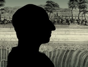
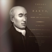
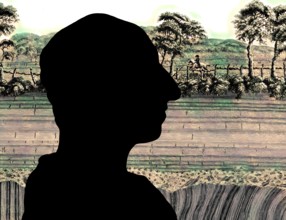
Silhouette of James Hutton, 1726 – 1797, Scottish ...
BRK26C06_050
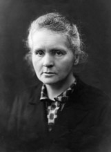
Marie Curie, portrait, around 1920. Marie Curie wa...
BRK26C41_045
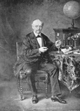
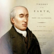
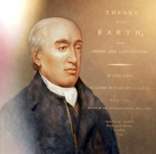
Portrait of James Hutton, 1726 – 1797, Scottish ge...

BRK26C06_058
The first Solvay conference of 1911 brought togeth...

BRK26C06_056
Marie and her man Pierre Curie in the laboratory. ...
BRK26C47_398
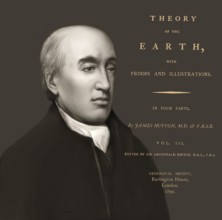
Portrait of James Hutton, 1726 – 1797, Scottish ge...
BRK26B81_394
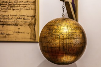
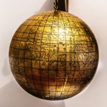
Jagiellonian globe, first globe, with the newly di...
BRK26B84_230
Astronomy, dimensions of the planets, seasons, spa...
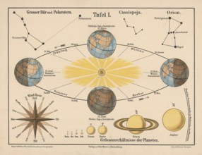
BRK26B55_479
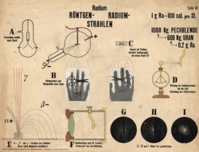
Educational board from general chemistry lessons, ...
BRK26B84_223
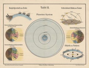
The planetary system and the earth in zoning of so...
BRK26B84_233
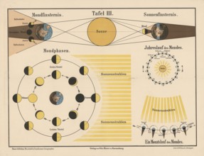
The phases of the moon and the mechanisms of solar...
BRK26B67_129
Cappadocia in heart of Anatolia
BRK26B67_146
Ortahisar, Cappadocia, Turkey. September 19th 2018...
BRK26B68_029
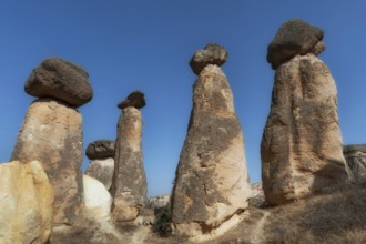
Soft morning light on the fairy chimney rock forma...
BRK26B86_483
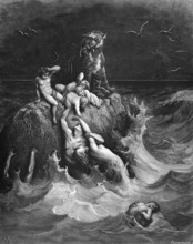
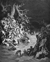
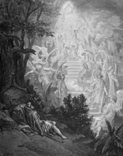
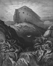
First book of Moses, chapter 7, verse 21, The floo...
BRK26B67_134
Beautiful morning light on the fairy chimney rock ...
BRK26B86_482
Genesis, chapter 7, verse 19, The flood, the earth...
BRK26B67_128
Cappadocia in heart of Anatolia
BRK26B67_135
Goreme, Cappadocia, Turkey. October 13th 2018 Hot ...
BRK26C01_385
Portrait of James Hutton, 1726 – 1797, Scottish ge...
BRK26B86_437
First book of Moses, chapter 28, verse 12, Jacob's...
BRK26B67_147
Ortahisar, Cappadocia, Turkey. September 19th 2018...
BRK26B74_384
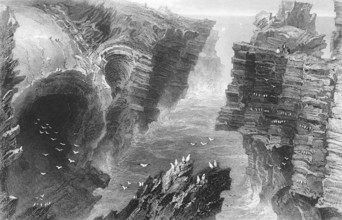
Surf niches on the Atlantic coast, Ireland, Atlant...
BRK26B85_077
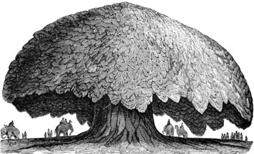
The baobab or baobab tree (Adansonia digitata) Gam...
BRK26B85_087
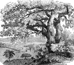
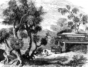
Breadfruit tree (Artocarpus altilis), also (Artoca...
BRK26B86_481
First book of Moses, chapter 8, verse 8, Noah's se...
BRK26B55_020
Cairo, Egypt. December 7th 2022 Busy Traffic cross...
BRK26B67_137
Goreme, Cappadocia, Turkey. September 19th 2018 Tr...
BRK26B85_084
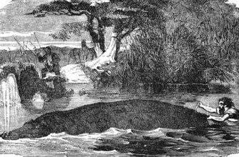
Hippopotamus (Hippopotamus amphibius) river, swim,...
BRK26B55_050
Cairo, Egypt. December 7th 2022 Busy Traffic cross...
BRK26B67_138
Goreme, Cappadocia, Turkey. September 18th 2018 Tu...
BRK26B67_140
Rock cut cave churches of Cappadocia
BRK26B74_383
Natural Bridge at Kilkee Cliffside, Nature's Bridg...
BRK26B67_139
Istanbul, Turkey. September 19th 2018 The beautifu...
BRK26B67_141
Ortahisar, Cappadocia, Turkey. September 19th 2018...
BRK26B67_132
Ortahisar, Cappadocia, Turkey. September 19th 2018...
BRK26B67_153
Soft morning light on the fairy chimney rock forma...
BRK26B85_086
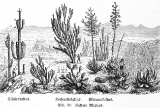
Various cactus species in the wild in the mountain...
BRK26B85_079
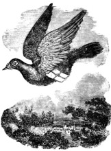
Pigeon flying with mail, dove breed domestic pigeo...
BRK26B85_078
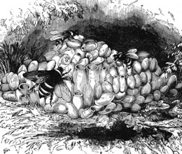
The Large earth bumblebee (Bombus terrestris) in i...
BRK26B85_085
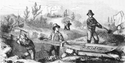
Gold seekers mining, USA, hilly landscape, mineral...
BRK26C02_125
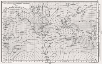
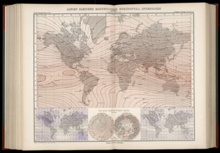
Atlas of Geomagnetism showing horizontal intensity...
BRK26B85_082
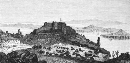
Fort San Giovanni near Sebenico or Šibenik, Croati...
BRK26C01_388
Silhouette of James Hutton, 1726 – 1797, Scottish ...

BRK26B85_083
Taming a wild elephant, shackles, pegs in soil, at...
BRK26B89_169
Portrait of James Hutton, 1726 – 1797, Scottish ge...
BRK26B85_081
A Pandanus (Pandanus) tree, screw tree family (Pan...
BRK26C02_121
Atlas of Geomagnetism showing horizontal intensity...
BRK26B12_019
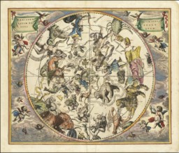
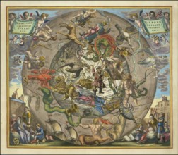
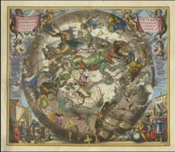
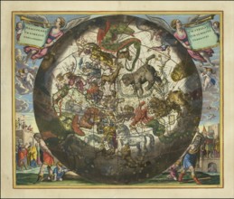
Celestial map entitled Hæmisphærium Stellatum Bore...
BRK26B12_023
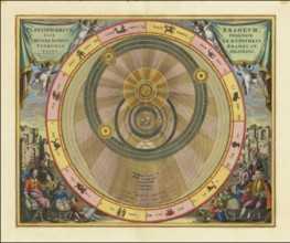
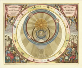
Planisphaerium Braheum, a famous historical celest...
BRK26B12_034
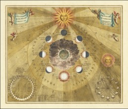
Historical copper engraving entitled Phases of the...
BRK26B12_044
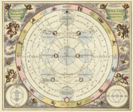
Historical astronomical map Theoria Lunae, Eius Mo...
BRK26B12_483
Jagiellonian globe, first globe, with the newly di...
BRK26B12_035
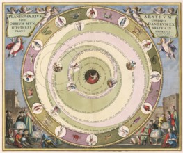
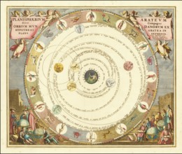
Planisphaerium of Aratos from the famous celestial...
BRK26B12_046
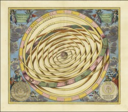
Historical illustration of the orbits of Mercury a...
BRK26B50_478
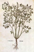
Ground ivy, Fumaria officinalis, coloured illustra...
BRK26B07_430
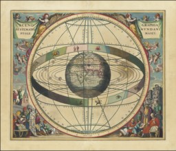
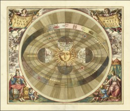
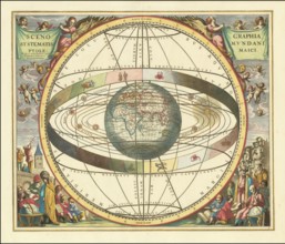
Historical sky map known as Scenographia Systemati...
BRK26B12_025
Sky map Hemisphaerii Borealis Coeli et Terrae Spha...
BRK26B12_043
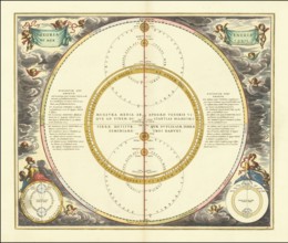
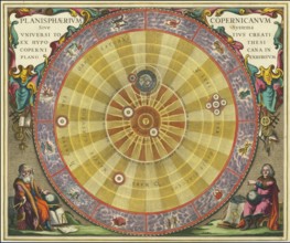
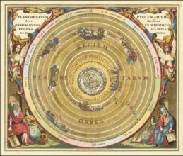
Scenographia Systematis Copernicani, scenography o...
BRK26B12_029
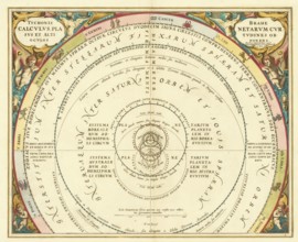
Orbium Planetarum Terram Complectentium Scenograph...
BRK26B07_429
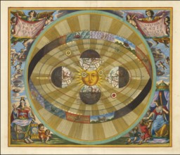
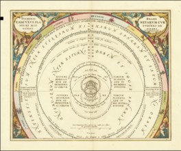
Historical presentation of the tychonic world view...
BRK26B12_022
Planisphaerium Copernicanum sky diagram by Andreas...
BRK26B12_041
Scenographia Systematis Copernicani, scenography o...
BRK26B12_264
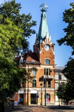
House under the globe, 1904, headquarters of the K...
BRK26B12_030
Planisphaerium Arateum, part of the famous celesti...
BRK26B12_031
A 17th century illustration of Tycho Brahe's geo-h...
BRK26B12_028
Celestial map of the southern hemisphere with the ...

BRK26B12_024
Historical celestial map depicting the Ptolemaic, ...
BRK26B12_021
Historical sky map with Ptolemy's geocentric world...
BRK26B12_026
Haemisphaerium Stellatum Boreale cum Subiecto Hæmi...
BRK26B12_033
Presentation of the geocentric world view based on...
BRK26B12_017
Historical presentation of the Tychonic world syst...
- Page
-
- sur
- 5