Légende
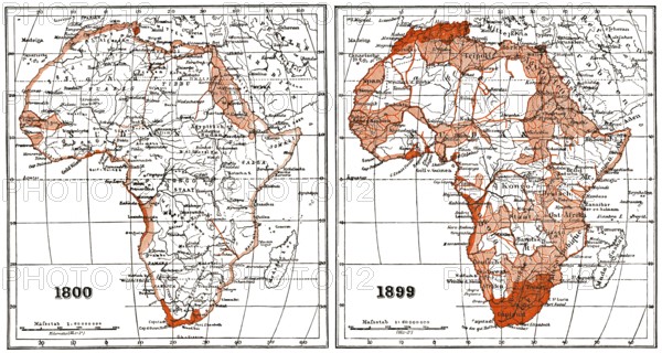
Map of Africa according to the state of research at the beginning and end of the 19th century
Crédit
Photo12/imageBROKER/Heinz-Dieter Falkenstein
Notre référence
BRK26D01_276
Model release
Non
Property release
Non
Licence
Droits gérés
Format disponible
94.9Mo (7.1Mo) / 66.7cm x 35.6cm / 7880 x 4210 (300dpi)