Légende
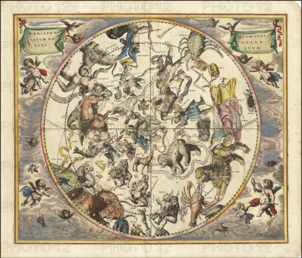
Celestial map entitled Hæmisphærium Stellatum Boreale Antiqvum, The Northern Stellar Hemisphere of Antiquity, by Andreas Cellarius. The map was originally published in 1660 in his famous atlas Harmonia Macrocosmica, one of the most magnificent celestial atlases ever produced. The map shows the constellations of the northern hemisphere (Boreale) as they were seen by ancient astronomers such as Ptolemy, and depicts the stars from a geocentric perspective centred on the Earth, digitally restored reproduction from a 17th century original, authentic, exact date of depiction unknown
Date
1660
Crédit
Photo12/imageBROKER/Sunny Celeste
Notre référence
BRK26B12_019
Model release
Non
Property release
Non
Licence
Libre de droits
Format disponible
445.3Mo (44.2Mo) / 114.0cm x 97.8cm / 13466 x 11557 (300dpi)