232 résultats pour : route map
- Page
-
- sur
- 3
Connectez-vous pour plus de résultats
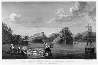
HRM24A02_203
View of Papenberkh Island and Rat's Island, 1813. ...
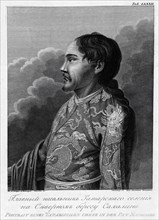
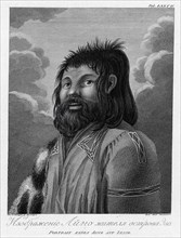
HRM24A03_049
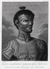
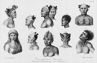
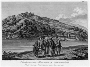
Main Chief of the Tatar Settlement on the Northern...
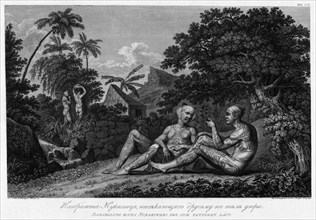
HRM24A02_204
Illustration of a Nukagiva Man Making Tattoos on A...
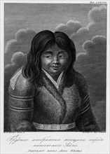
HRM24A03_050
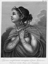
Illustration of an Ainu Woman, 1813. Creator: Jego...
HRM24A02_452
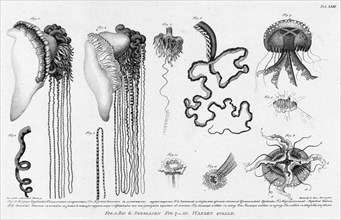
Fig.1.2. Stinging Cubomedusae; F.3.4. Its Long Ten...
HRM24A03_051
A Woman From Nukagiva Island, 1813. Creator: Jegor...
HRM24A02_451
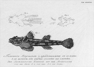
F.1. Japanese "Golovach"; F.2. Its Head; F.3. From...
HRM24A03_052
A Man From Nukagiva Island, 1813. Creator: Jegor S...
HRM24A04_194
Abosko-B'erneborg Province, 1856. Creator: Unknown...
HRM24A03_056
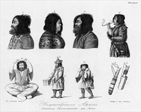
Ainu, 1813. Creator: Jegor Skotnikoff.
HRM24A00_014
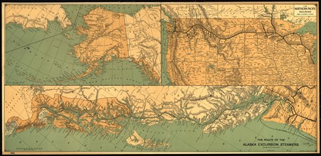
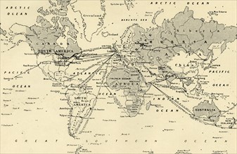
The route of the Alaska excursion steamers, 1891. ...
HRM24A03_055
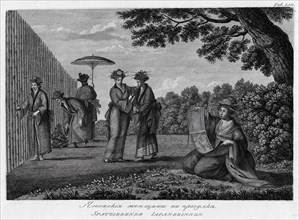
Japanese Women on a Stroll, 1813. Creator: Jegor S...
HRM24A02_403
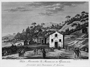
View of Sao Miguel Settlement in Brazil, 1813. Cre...
HRM24A03_057
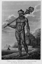
A Man From Nukagiva Island with Tattoos on His Bod...
HRM24A03_073
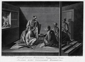
First Visit of Japanese Interpreters, 1813. Creato...
HRM24A00_075
Wall map showing Russian railroads, navigable rive...
HRM24A02_401
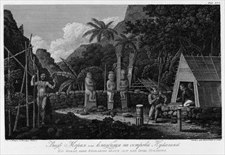
Nukagiva Natives, 1813. Creator: Ignaz Sebastian K...
HRM24A03_072
Tomb of Captain Clerc in Petropavlovsk, 1813. Crea...
HRM24A02_211
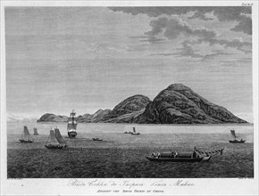
View of Boca De Tigres Near Macao, 1813. Creator: ...
HRM24A02_402
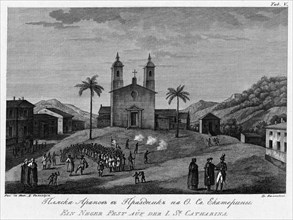
Holiday Dance on St. Catherine Island, 1813. Creat...
HRM24A00_011
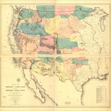
Map of part of the United States exhibiting the pr...
HRM24A02_210
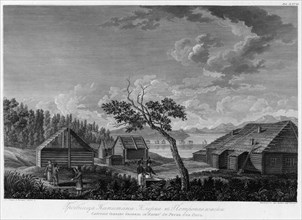
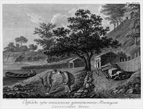
View of the Seashore Near Port Chichagov, 1813. Cr...
HRM24A02_471
Illustration of a Japanese Sentry Vessel and Fortr...
HRM24A00_021
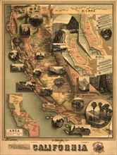
The unique map of California, 1888. Creator: E. Mc...
HRM24A00_030
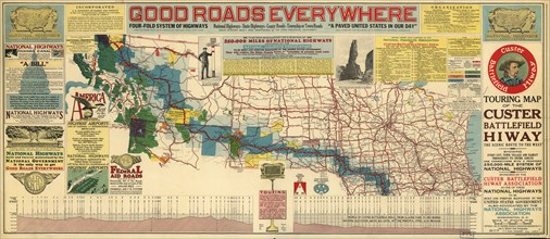
Touring map of the Custer Battlefield Hiway: the s...
HRM24A00_111
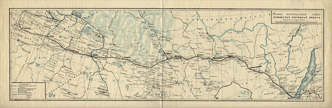
Map of the Route of the Siberian Railway Line, 189...
HRM24A02_198
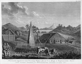
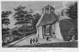
Monument to Captain Clerc and Delille De La Croere...
HRM24A02_209
View of Cemetery on Nukagiva Island, 1813. Creator...
HRM24A00_005
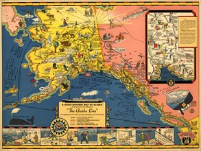
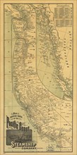
The Alaska Line, 1934. Creator: Alaska Steamship C...
HRM24A00_016
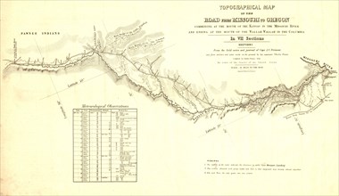
Topographical map of the road from Missouri to Ore...
HRM24A00_027
Millroy's map of Alaska and the Klondyke gold fiel...
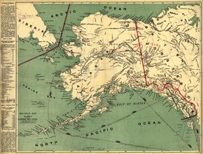
HRM24A00_070
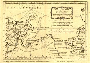
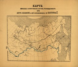
Reduced map of Russian discoveries, between Asia a...
HRM24A00_106
Map of designated national postal routes establish...
HRM24A02_199
Goppo, or the Custom Office Director in Canton, Sa...
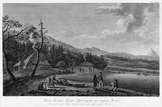
HRM24A02_208
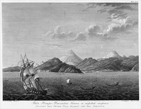
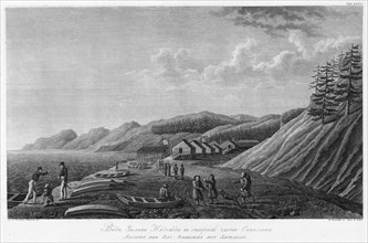
View of Petropavlovsk Harbour From the Seaside, 18...
HRM24A02_235
Japanese Interpreters Kneeling in Front of Their C...
HRM24A03_053
Illustration of a Japanese Sentry House, 1813. Cre...
HRM24A00_102
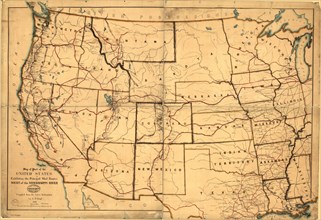
Map of the territory of the United States from the...
HRM24A00_105
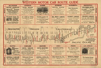
Western motor car route guide, (1915?). Creator: U...
HRM24A02_200
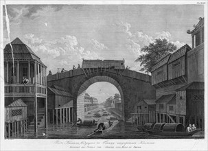
View of the Canal, Leading to Gonamu Opposite Cant...
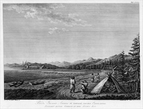
HRM24A02_207
View of Count Rumiantsev Bay on Esso Island, 1813....
HRM24A02_236
View of Aniva Bay in the Southern Part of Sakhalin...
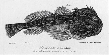
HRM24A02_453
Slimy "Golovach", 1813. Creator: Pavel Ivanovich M...
HRM24A03_054
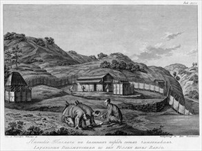
Illustration of an Ainu Man From Esso Island, 1813...

HRM24A03_140
A/ Brazil Frog; B/ Its Eyes; C/ Hind Leg; D/ Makak...
HRM24A00_018
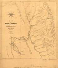
Map of the mining district of California, 1850. Cr...
HRM24A00_072
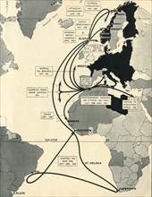
Map showing routes of the Pacific coast Steamship ...
HRM24A02_201
Japanese Greeting Rituals, 1813. Creator: Ivan Vas...
HRM24A02_206
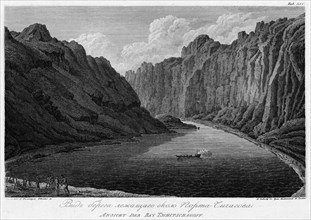
View of Nadezhda Bay in the Northern Part of Sakha...
HRM24A02_237
A Conversation Between Japanese Officials, 1813. C...

HRM24A03_141
Illustration of an Owl Caught on the Ship Near the...
HRM24A04_189
Yakutsk Region, 1856. Creator: Unknown.
HRM24A02_202
View of the Camoes Grotto in Mr. Drummond's Garden...
HRM24A02_205
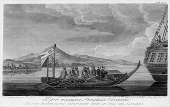
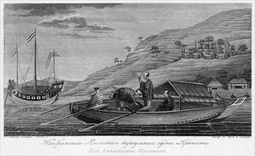
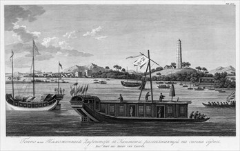
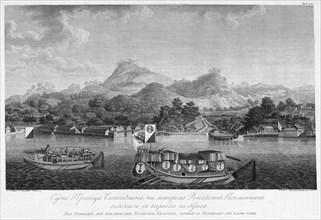
The Vessel of Prince Chingodzin, on Which the Russ...
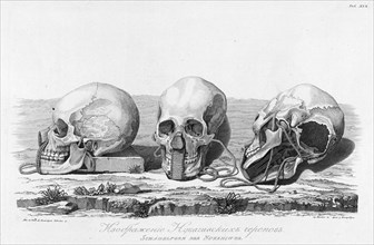
HRM24A03_142
Illustration of Nukagiva Skulls, 1813. Creator: Un...
HRM23B24_282
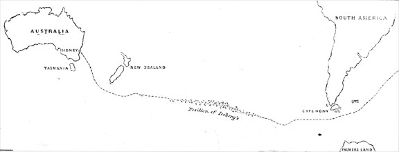
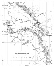
Course of the Damascus from Sydney to Cape Horn on...
HRM23B08_057
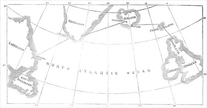
Proposed route of the North Atlantic Telegraph, 18...
HRM23A81_237
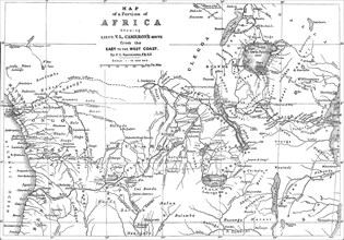
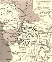
Map of a Portion of Africa, showing...Cameron's Ro...
HRM23A57_411
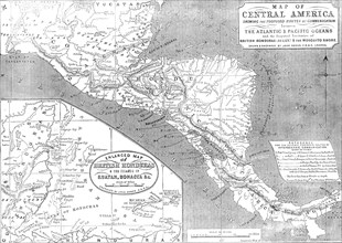
Map of Central America shewing the Proposed Routes...
HRM23A56_244
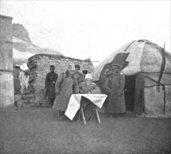
'Sur la route de Trebizonde; Le general Kalitine, ...
HRM23A40_266
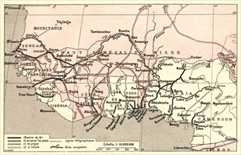
''Voies de communication de l'Afrique occidentale ...
HRM23A40_201
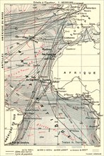
''Les routes l'Atlantique; L'Ouest Africain', 1914...
HRM23A40_294
''Voies de communication du bassin du Congo; L'Oue...

HRM23A40_320
''Canal de Suez; Le Nord-Est Africain', 1914. Crea...
HRM23A40_209
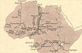
''Grands itineraires africains; L'Ouest Africain',...
HRM22B28_124
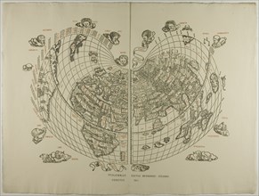
Map of the World: Tradewinds, 1511, reprinted 1889...
HRM23A00_165
''Map showing the Proposed Route of the British Ea...
HRM22A87_496
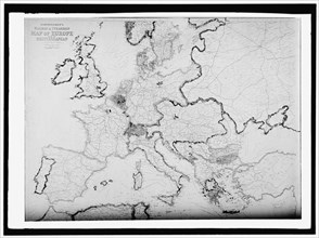
Map of Europe, between 1913 and 1917. Creator: Har...
HRM22B08_026
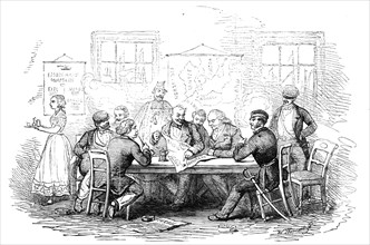
Discussing the War, in a Coffee-House, at Copenhag...
HRM22A56_487
On board the fishing boat Alden, out of Gloucester...
HRM22A59_354
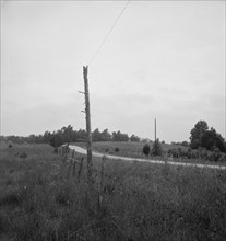
Route 501. One mile north of Bethel Hill High Scho...
HRM22A56_446
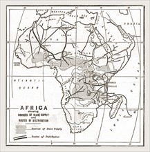
''Africa showing souces of Slave Supply', 1888. Cr...
HRM22A18_097
Westway Flyover, A40, Paddington, City of Westmins...

HRM21A73_485
Program from the March on Washington, August 28, 1...
HRM21A07_309
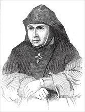
Irena Macrina Mieczyslaska, Superior of the Covent...
HRM19G32_276
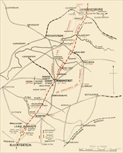
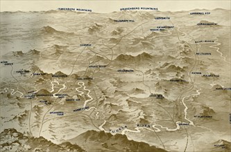
'Map Showing the Lines of Advance from Bloemfontei...
HRM19G32_195
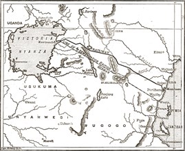
'Bird's-Eye View of the Country Covered by General...
HRM19G32_327
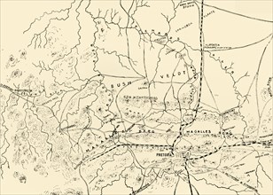
'The Battlefields of Pretoria. (From a personal su...
HRM19F80_455
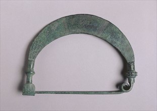
Fibula with Solar Design, c. 700-675 BC. Creator: ...
HRM19G03_082
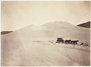
Sand Dunes, Carson Desert, Nevada, 1867. Creator: ...
HRM19F35_128
Map showing the movements of 'HMS Ark Royal', 1939...
HRM19G24_377
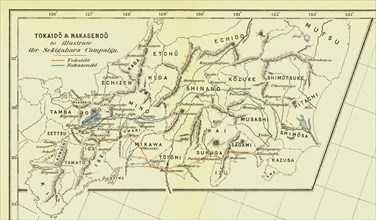
Tokaido & Nakasendo to illustrate the Sekigahara C...
HRM19G24_391
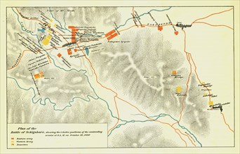
Plan of the Battle of Sekigahara, October 21st 160...
HRM19F29_232
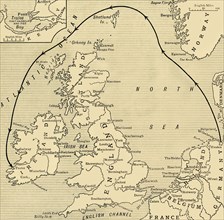
'Map of Greater Britain in Relation to the Homelan...
HRM19F27_029
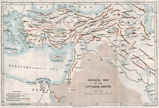
'Physical Map of the Ottoman Empire', c1915. Creat...
HRM19F27_043
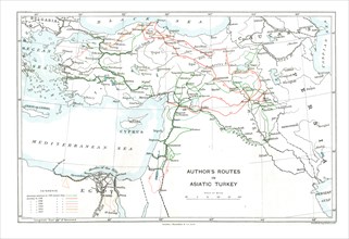
'Author's Routes in Asiatic Turkey', c1915. Creat...
HRM19F27_054
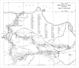
'Route from Chatal Zeitun to Kavza and from Kavak ...
HRM19F27_044
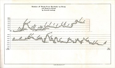
'Section of Route from Diarbekir to Sivas and Siva...
HRM19F27_053
'Route from Diarbekir to Zara', c1915. Creator: U...
HRM19F27_055
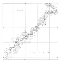
'Neri to Akra', c1915. Creator: Stanford's Geogra...
HRM19F29_156
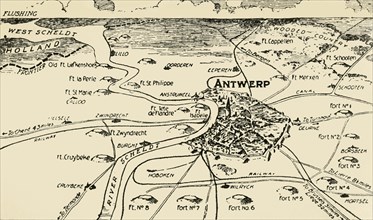
'Antwerp and its Roots', 1915. Creator: Unknown.
HRM19F27_051
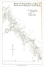
'Detail of Rocky Maze on Map of Route from Karaman...
HRM19F27_039
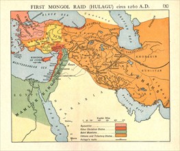
'First Mongol Raid (Hulagu), circa 1400 A.D.', c19...
HRM19F27_049
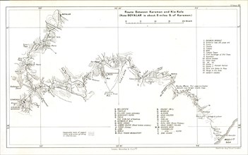
'Route between Karaman and Kiz Kale', c1915. Creat...
HRM19F29_148
'The Steady Progress of the Allies' Advance', 1915...
HRM19F27_048
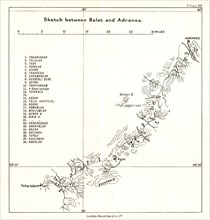
'Sketch between Balat and Adranos', c1915. Creator...
HRM19F27_354
'Germany and the Casement Plot', First World War, ...
HRM19F27_038
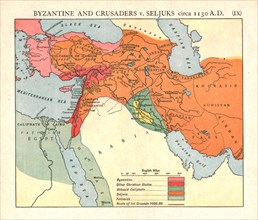
'Byzantine and Crusaders v. Seljuks, circa 1130 A....
HRM19F27_047
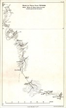
'Route to Petra from Teyaha', c1915. Creator: Stan...
HRM19F29_162
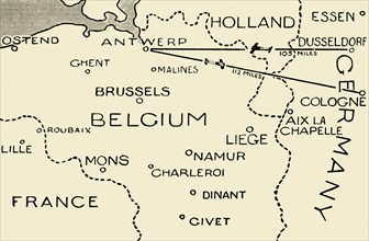
'The Route of the Airmen Who Raided Dusseldorf and...
- Page
-
- sur
- 3