Sujet
Map of the territory of the United States from the Mississippi to the Pacific Ocean..., (1858?). Creators: Gouverneur Kemble Warren, Edward Selmar Siebert.
Légende
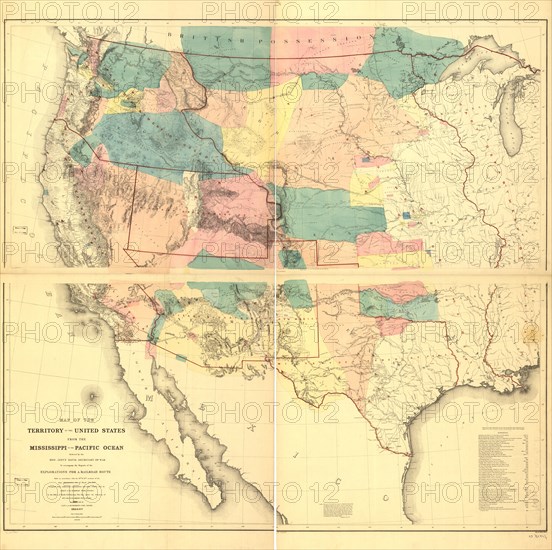
Map of the territory of the United States from the Mississippi to the Pacific Ocean; ordered by Jeff'n Davis, Secretary of War to accompany the reports of the explorations for a railroad route, (1858?). The United States gained vast territories in the West through the Mexican War of 1846-48 and the 1846 Oregon Treaty with Great Britain. By the early 1850s, government and commercial interests were debating the possibilities of building a transcontinental railroad to the Pacific. The Army Appropriations Act of 1853 provided for the completion of railroad surveys to determine possible routes. This map, issued in 1858 by Secretary of War Jefferson Davis, depicts the United States west of the Mississippi on the eve of the Civil War. California and Texas were at this time the only Western states.
Crédit
Photo12/Heritage Images/Heritage Art
Notre référence
HRM24A00_102
Model release
NA
Property release
NA
Licence
Droits gérés
Format disponible
572.3Mo (33.0Mo) / 120.0cm x 119.5cm / 14175 x 14112 (300dpi)