228 résultats pour : chart
- Page
-
- sur
- 3
Connectez-vous pour plus de résultats
HRM24A26_311
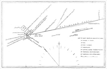
The Atlantic Telegraph Expedition: chart of the mo...

HRM24A15_129
Testimonial to Major-General Sir Andrew Scott Waug...

HRM24A08_217
Campanile di S. Rocco a Frescati, 1848. Creator: G...
HRM24A08_282
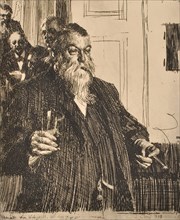
Portrait, 1893. Creator: Anders Leonard Zorn.
HRM24A08_201
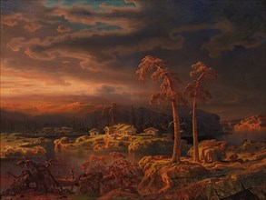
Wilderness landscape, 1861. Creator: Markus Larsso...
HRM24A09_253
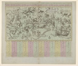
Path of the comet now visible, 1862. Creator: Unk...
HRM24A08_266
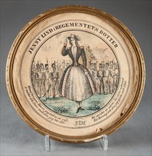
Jenny Lind in The Regiment's Daughter, (c1850s). C...
HRM24A00_021
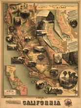
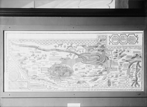
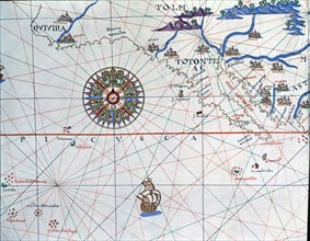
The unique map of California, 1888. Creator: E. Mc...
HRM24A00_089
General mechanical engineering on January 1, 1933,...

HRM23B24_283
The Sailors' Home at Great Yarmouth, 1861. Creator...
HRM23B15_243
Map of Britain and Ireland, 10th century AH/AD 16t...
HRM23A90_388
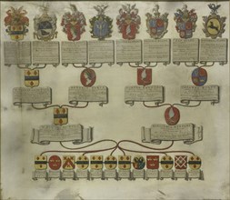
Family tree with the coats of arms of the six chil...
HRM23A89_155
Star chart or map of the heavens, 1684 and/or 1792...
HRM23A73_495
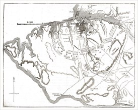
Conquest of Banda by the English on August 9, 1810...

HRM23A50_190
Chart room, S.S. J.H. Sheadle, between 1906 and 19...
HRM23A58_265
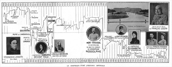
'Le Graphique d'une Existence Imperiale; les 68 ch...
HRM23A57_264
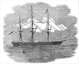
The Royal Mail Clipper "Schomberg", 1856. Creator...

HRM23A56_422
Centre-piece of the Wilcox and Anderson Services o...
HRM23A21_204
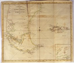
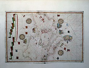
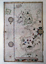
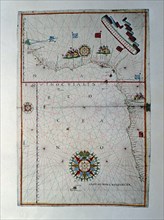
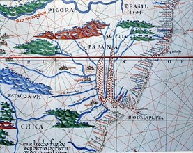
Coloured nautical chart of the end of South Americ...
HRM23A21_203
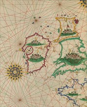
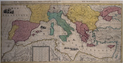
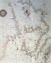
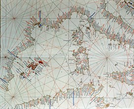
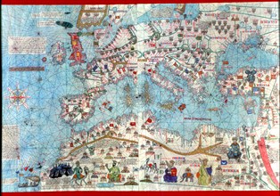
Marine chart of the eastern part of the Mediterran...
HRM23A40_088
'The North West Passage', after John Everett Milla...
HRM23A22_115
Greek Chart or Map, 1916. Creator: Harris & Ewing.
HRM23A18_068
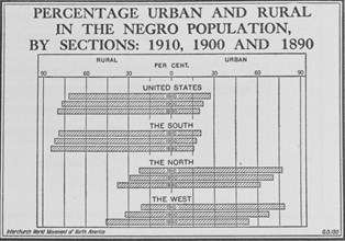
Percentage urban and rural in the Negro population...
HRM23A17_471
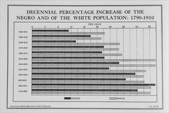
Decennial percentage increase of the Negro and of ...

HRM22B21_157
Sketch for the dome of the Denon pavilion at the L...
HRM22B20_035
'Chart showing the relative positions of the batte...
![Color Chart with Annotations [verso], 1884-1888.](https://lres.photo12.com/th/t-hrm22a90_273.jpg)
HRM22A90_273
Color Chart with Annotations [verso], 1884-1888.
HRM22B04_018
Bid Board Office of Supplies & Accounts Navy Dept,...
HRM22B07_452
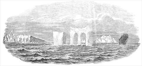
Passage of the Ship "Medway" through Icebergs, on ...

HRM22A77_235
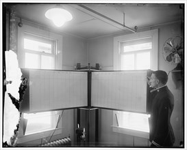
Locomotive lubrication chart in the laboratory of ...
HRM22A39_430
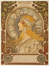
Zodiaque ("La Plume"), 1896-97. Creator: Alphonse ...
HRM22A60_326
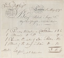
Trade Card for Robert Sayer & Co., Map, Chart and ...
HRM22A01_475
Manuscrit de Théorie No. 3, Lyon, 19th century.
HRM21B20_266
Viking 2 image of Mars Utopian Plain, September 3,...
HRM21B13_284
Chart of Coverlet Thread Construction, 1941. Creat...
HRM21A99_083
Buttons, c. 1937. Creator: Gertrude Lemberg.

HRM21A84_175
Laing office workers, Newport Pagnell, Milton Keyn...
HRM21A99_082
Buttons, c. 1937. Creator: Gertrude Lemberg.
HRM21A73_384
Display stand with spools of thread and needles fr...

HRM21A73_416
Door with rescue markings from Hurricane Katrina, ...
HRM21A47_234
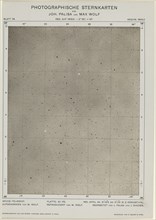
Photographische Sternkarten (April 24, 1901), 480.
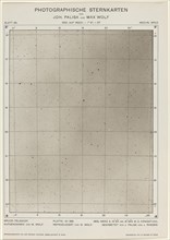
HRM21A47_233
Photographische Sternkarten (March 2, 1906), 2253.
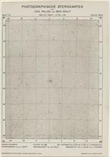
HRM21A47_236
Photographische Sternkarten (October 15, 1901), 65...
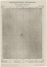
HRM21A47_235
Photographische Sternkarten (July 6, 1904), 1649.
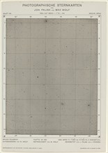
HRM21A47_237
Photographische Sternkarten (March 17, 1906), 2268...

HRM21A12_041
Captain Charles Stewart
HRM21A07_492
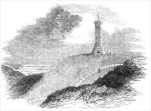
Monument to Admiral Sir Thomas Hardy, on Blagdon H...

HRM20B03_110
Trade Card for James Heskett
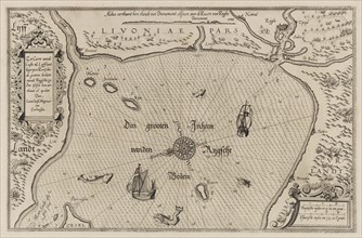
HRM20A84_300
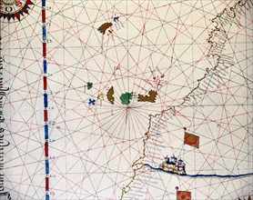
Nautical chart of the Gulf of Riga, Cartography. C...
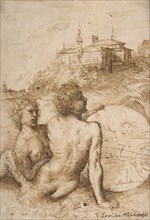
HRM20A63_196
Two Satyrs in a Landscape
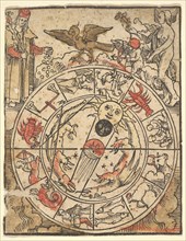
HRM20A53_203
Chart of the Signs of the Zodiac with Venus, Cupid...
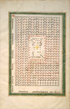
HRM20A39_389
Leaf from a Beatus Manuscript: Table of the Antich...
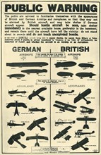
HRM19G33_110
Poster showing types of British and German aircraf...
HRM19G33_208
Chart showing windmills as landmarks on the north-...
HRM19G31_281
A Hansen, first officer on the 'Knivsberg', 1898. ...

HRM19G19_444
Winged Fortune, 1878. Creator: William Morris Hunt...
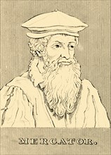
HRM19F37_371
'Mercator', (1512-1594), 1830. Creator: Unknown.
HRM19F13_197
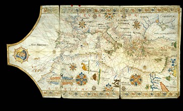
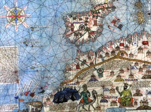
Portolan chart of the Mediterranean Sea, the Black...
HRM19E81_387
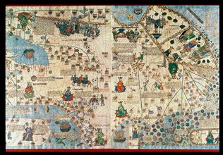
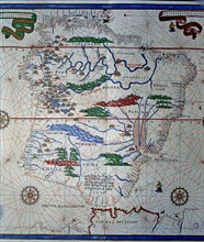
Atlas of Joan Martines, Messina, 1582. Portulan ch...
HRM19E81_398
Atlas of Joan Martines, Messina, 1582. Portulan ch...
HRM19E93_023
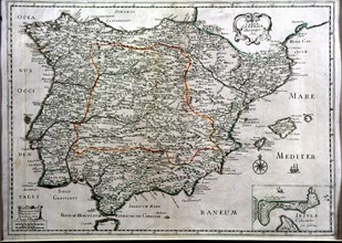
Colored map of Madrid and Castilla - La Mancha, en...
HRM19E81_388
Atlas of Joan Martines, Messina, 1582. Portulan ch...
HRM19E81_397
Atlas of Joan Martines, Messina, 1582. Portulan ch...
HRM19E93_334
Catalan Atlas (1375), detailed zodiac signs, repro...
HRM19E81_385
Atlas of Joan Martines, Messina, 1582. Portulan ch...

HRM19E81_396
Atlas of Joan Martines, Messina, 1582. Portulan ch...
HRM19E85_092
Map of Spain', 1500, work by the Spanish cartograp...
HRM19E93_335
Catalan Atlas of 1375, detail of North Africa and ...
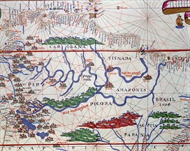
HRM19E94_405
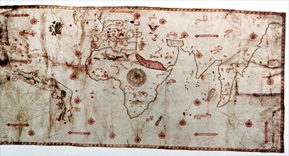
Nautical chart called 'King-Hamy', 1502, attribute...
HRM19E81_386
Atlas of Joan Martines, Messina, 1582. Portulan ch...
HRM19E81_395
Atlas of Joan Martines, Messina, 1582. Portulan ch...
HRM19E93_336
Catalan Atlas (1375), detail of Asia, reproduction...
HRM19E94_406
Niccolo Caveri Planisphere from 1502, this planisp...
HRM19E95_025
Atlas of Joan Martines, Messina, 1582. Portulan ch...
HRM19E81_394
Atlas of Joan Martines, Messina, 1582. Portulan ch...
HRM19E93_019
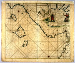
Map of Valencia, Balearic Islands and Catalonia. A...
HRM19E81_384
Atlas of Joan Martines, Messina, 1582, in the Iber...
HRM19E81_393
Atlas of Joan Martines, Messina, 1582. Portulan ch...
HRM19E82_176
Atlas of Joan Martines, Messina, 1582. Portulan ch...
HRM19E81_392
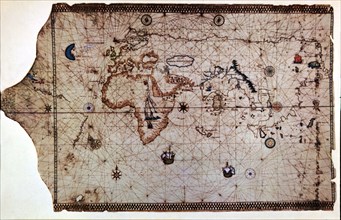
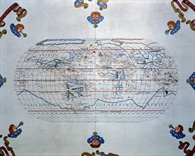
Atlas of Joan Martines, Messina, 1582. World map o...
HRM19E93_021
Schematic drawing of the harbor and the roads of t...
HRM19E81_227
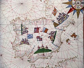
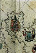
Map of Spain with all their kingdoms, Portugal and...
HRM19E81_391
Atlas of Joan Martines, Messina, 1582. Portulan ch...
HRM19E82_075
Catalan Atlas (1375). Detail of Spain and North A...
HRM19E94_200
Catalan Atlas (1375). Europe and North Africa. Rep...
HRM19E83_118
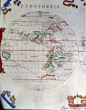
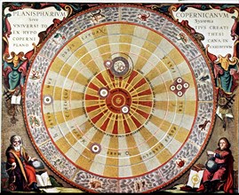
Planisphere by Copernicus, illustration in 'Harmon...
HRM19E93_018
Colored map of Spain, 1682, with the island and tu...
HRM19E82_381
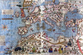
Portulan chart representing the Mediterranean, 156...
HRM19E93_017
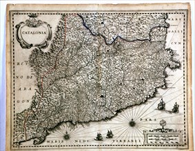
Colored map of Catalonia, from the 'Geographia Bla...
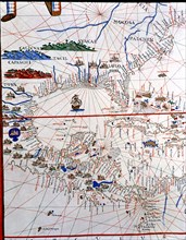
HRM19E81_389
Atlas of Joan Martines, Messina, 1582. Portulan ch...
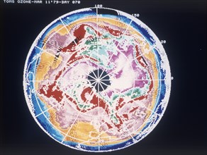
HRM19F02_354
North Pole total ozone maps with meteorological ch...
HRM19E81_390
Atlas of Joan Martines, Messina, 1582. Portulan ch...
HRM19E76_160
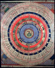
The chelestial chart of the southern hemisphere, e...
HRM19E91_225
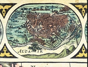
Andalusia, colored engraving from the book 'Le The...
HRM19E91_236
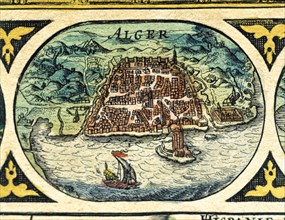
Algiers, colored engraving from the book 'Le Theat...
HRM19E91_237
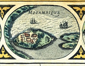
Mozambique, colored engraving from the book 'Le Th...
HRM19E92_155
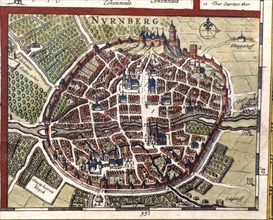
Nuremberg, colored engraving from the book 'Le The...
HRM19E91_227
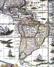
South America, colored engraving from the book 'Le...
HRM19E91_234
Cairo, colored engraving from the book 'Le Theatre...
HRM19E94_011
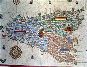
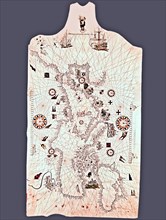
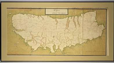
Manuscript map painted in gouache of the island of...
- Page
-
- sur
- 3