Sujet
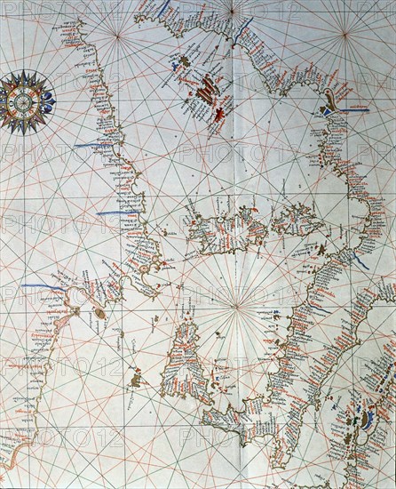
Atlas of Joan Martines, Messina, 1582. Portulan chart of the western Mediterranean, with Italy, E?
Légende
Atlas of Joan Martines, Messina, 1582. Portulan chart of the western Mediterranean, with Italy, Europe southern coasts and the islands of Sicily, Corsica, Sardinia, the Balearic Islands and North Africa.
Crédit
Photo12/Heritage Images/Index
Notre référence
HRM19E81_398
Model release
Non
Licence
Droits gérés
Format disponible
55.1Mo (5.5Mo) / 33.5cm x 41.2cm / 3954 x 4871 (300dpi)