Sujet
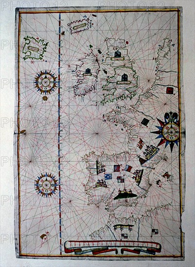
Atlas of Joan Martines, Messina, 1582. Portulan chart of Western Europe showing the Iberian penin?
Légende
Atlas of Joan Martines, Messina, 1582. Portulan chart of Western Europe showing the Iberian peninsula, France, the Netherlands, Great Britain, Ireland and Iceland.
Crédit
Photo12/Heritage Images/Index
Notre référence
HRM19E81_388
Model release
Non
Licence
Droits gérés
Format disponible
54.4Mo (6.9Mo) / 31.5cm x 43.2cm / 3726 x 5099 (300dpi)