673 résultats pour : cartographie
- Page
-
- sur
- 7
Connectez-vous pour plus de résultats

HRM21A12_407
Trade Card for Thomas Jefferys

HRM20B03_094
Trade card for John Dower

HRM20B03_110
Trade Card for James Heskett
HRM20A84_254
Map of Saint Petersburg, 1790. Creator: Khudyakov,...
HRM20A84_255
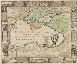
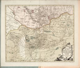
Map of the Black Sea and the Crimea, c. 1740. Crea...
HRM20A84_300
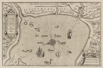
Nautical chart of the Gulf of Riga, Cartography. C...
HRM20A84_343
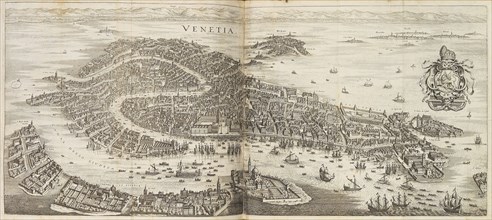
Panorama of Venice. From Newe Archontologia cosmic...
HRM20A84_252
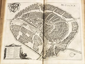
Map of Moscow. From: Newe Archontologia cosmica by...
HRM20A84_253
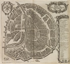
Map of Moscow. From: Vermehrte Newe Beschreibung d...
HRM20A84_250
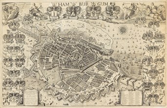
Map of Hamburg, 1644. Creator: Pietersen (Petersen...
HRM20A83_332
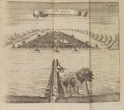
Beijing. Travelogue of an embassy to Beijing arran...
HRM20A84_080
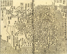
Gujin Huayi quyu zongyao tu (General Map of Chines...
HRM20A84_372
Pianta della Piazza di Messina, 1753. Creator: Ott...
HRM20A85_198
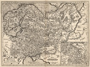
Russia cum Confinijs. Map of Russia, 1587. Creator...
HRM20A80_440
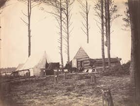
Copying Maps, Photographic Headquarters, Petersbur...
HRM20A43_212
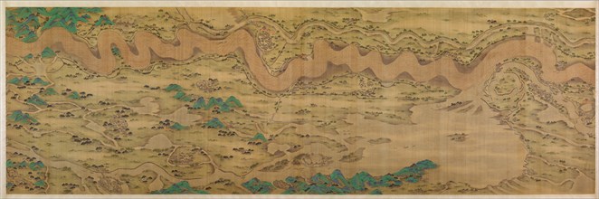
Ten Thousand Miles along the Yellow River, datable...
HRM19G32_475
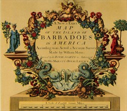
'Cartouche on W. Mayo's Map of Barbados, 1722', (1...
HRM19G29_336
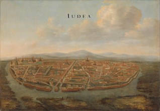
View of Judea (Ayutthaya), ca 1662-1665. Creator: ...
HRM19G30_067
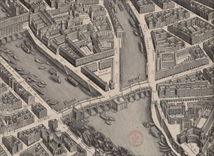
Pont Neuf. Plan de Paris, dit Turgot, 1739. Creato...
HRM19G32_156
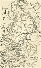
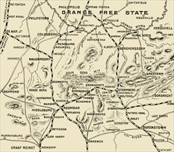
'Map of Northern Natal. Scale 15 Statute Miles to ...
HRM19G32_139
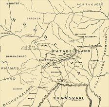
'Matabeleland', 1900. Creator: Unknown.
HRM19G32_055
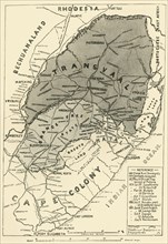
'Map of the Boer Republics', 1900. Creator: Unknow...
HRM19G32_132
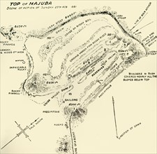
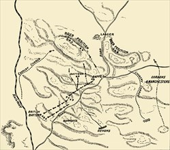
'Top of Majuba - Scene of Action of Sunday 27th Fe...
HRM19G32_098
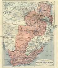
'General Map of British South Africa', 1900. Creat...
HRM19G32_188
'Map Illustrating the Operations on the South of t...
HRM19G32_478
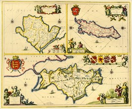
'The Isle of Anglesey, The Isle of Man and the Isl...
HRM19G32_159
'Plan of battle of Elandslaagte', 1900. Creator: U...
HRM19G30_154
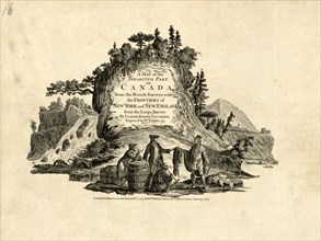
Indians in the Fur Trade in Canada, 1777. Creator:...
HRM19G31_081
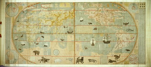
Kunyu Wanguo Quantu (Map of the Myriad Countries o...
HRM19G32_127
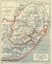
'Map of the Seat of War', 1900. Creator: Unknown.
HRM19G32_163
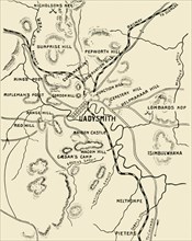
'Map of Ladysmith and Surrounding Heights', 1900. ...

HRM19G24_393
'Plan of the Osaka Second or Summer Campaign, 1615...
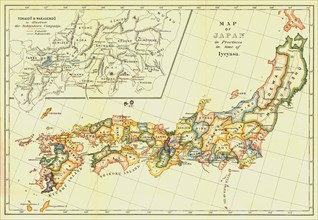
HRM19G24_383
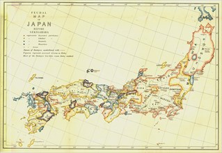
'Map of Japan in Provinces in time of Iyeyasu', 19...
HRM19G24_392
Plan of the Osaka First or Winter Campaign, 1614',...
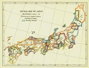
HRM19G24_387
Feudal Map of Japan between 1564 -73', (1903). Cre...
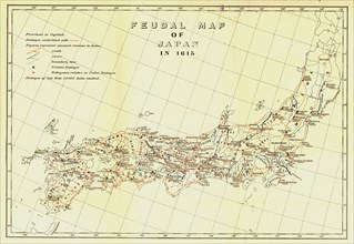
HRM19G26_243
'Feudal Map of Japan in 1615', (1903). Creator: Un...
HRM19G24_389
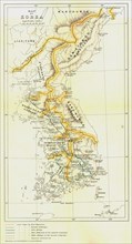
Map of Korea', 1903. Creator: Unknown.
HRM19G24_377
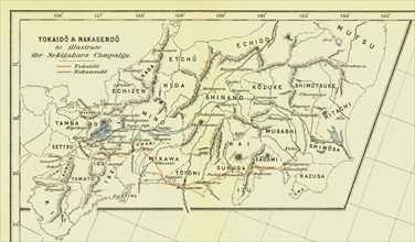
Tokaido & Nakasendo to illustrate the Sekigahara C...
HRM19G24_388
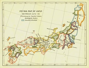
Feudal Map of Japan between 1573 -83', (1903). Cre...
HRM19G24_391
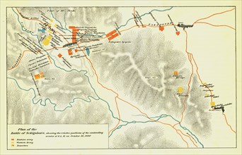
Plan of the Battle of Sekigahara, October 21st 160...
HRM19G24_390
Feudal Map of Japan before Sekigahara', 1903. Crea...
HRM19F30_152
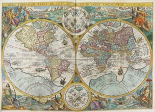
Itinerarium. World map with costumes, natives, shi...
HRM19F30_153
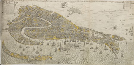
Vero e real disegno della inclita cita di Venetia....
HRM19F30_173
General map of Estonia and Latvia. (Atlas de la Li...
HRM19F30_212
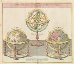
The Globes (From the Grand Atlas of all the World)...
HRM19F29_201
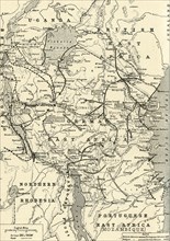
'The Campaign in German East Africa', 1917. Creato...
HRM19F29_191
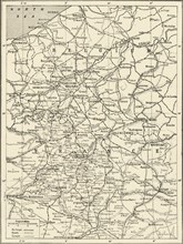
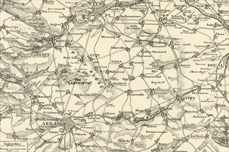
'The Great Arras Battle Area', 1917. Creator: Unkn...
HRM19F29_194
'Map Showing German Retreat in the West, 1917', 19...
HRM19F29_205
'Map of Two and a Half Years' Campaign in Mesopota...
HRM19F29_196
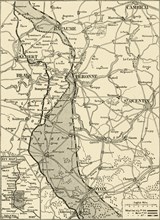
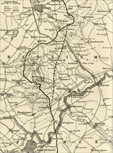
'Detailed Map of the Arras Fighting Area', 1917. C...
HRM19F29_198
'The Battle of Messines', 1917. Creator: Unknown.
HRM19F29_209
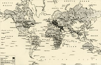
'Map of the World After Three Years of War', 1917....
HRM19F24_187
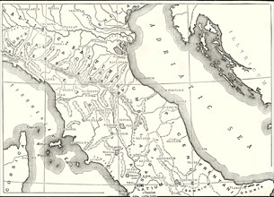
'Map of Northern and Central Italy',1890
HRM19F24_238
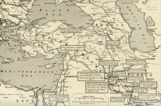
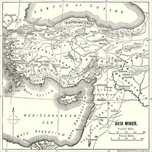
'Asia Minor - Map',1890
HRM19F24_251
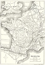
'Map of Gaul and Part of Britain',1890
HRM19F24_217
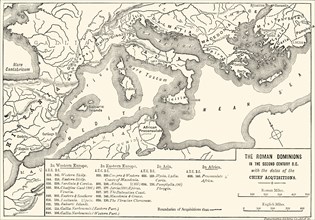
'The Roman Dominions in the Second Century B,
HRM19F24_202
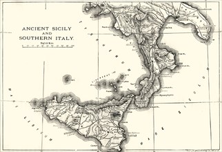
'Ancient Sicily and Southern Italy',1890
HRM19F24_302
'Plan of Jerusalem in the First Christian Century'...
HRM19F10_054
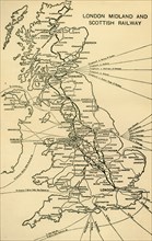
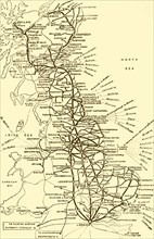
London Midland and Scottish Railway', 1930.
HRM19F10_062
The Great Western Railway', 1930.
HRM19F17_124
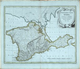
General map of Crimea, 1791.
HRM19F17_133
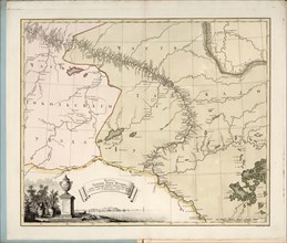
Map of the Irtysh River, the southern part of the ...
HRM19F07_442
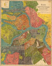
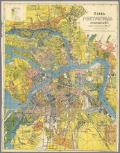
Plan of Petrograd, 1918.
HRM19F17_134
Plan of Petrograd, 1915.
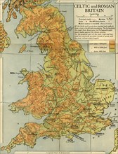
HRM19F13_439
Celtic and Roman Britain', 1926.
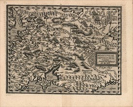
HRM19F17_144
Moscoviae Imperium, 1600.

HRM19F07_422
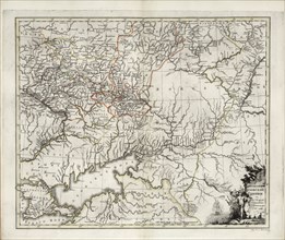
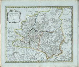
General Map of Novorossiysk Governorate, 1779.
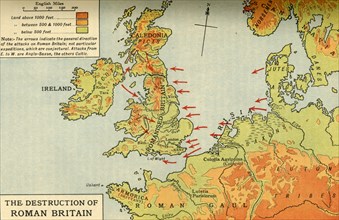
HRM19F13_440
The Destruction of Roman Britain', 1926. s
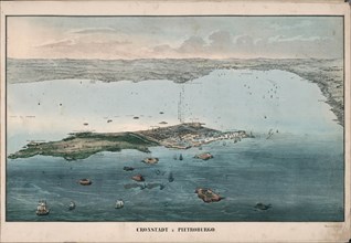
HRM19F17_143
Panoramic view of Kronstadt, 1853.

HRM19F07_423
General Map of Kazan Governorate, 1779.
HRM19F07_432
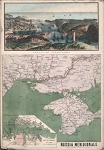
Map of southern Russia with view of Sevastopol Bay...
HRM19F10_057
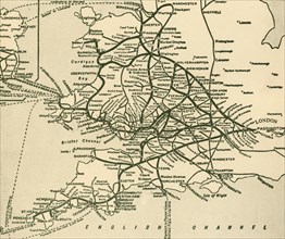
The London and North Eastern Railway', 1930.
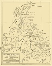
HRM19F13_441
England, Scotland and Ireland - Time of Viking Inv...
HRM19F16_410
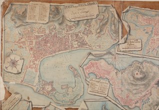
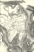
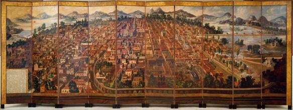
The City of Mexico, ca 1690.
HRM19F13_442
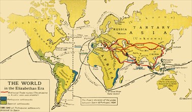
The World in the Elizabethan Era', 1926. s
HRM19F07_385
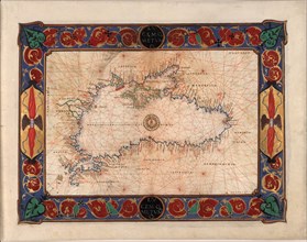
Map of the Black Sea, c. 1544.
HRM19F13_445
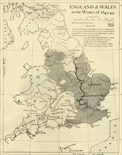
England & Wales in the Winter of 1643-44', 1926. s
HRM19F17_127
General Map of Kazan Governorate, 1779.

HRM19F07_429
Map of the Irtysh River, the southern part of the ...

HRM19F17_105
Map of the Black Sea including part of present-day...
HRM19F13_197
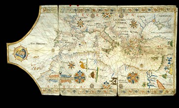
Portolan chart of the Mediterranean Sea, the Black...
HRM19F13_446
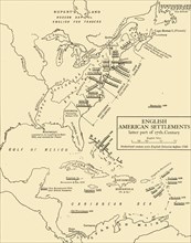
English American Settlements - latter part of 17th...
HRM19F17_128
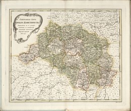
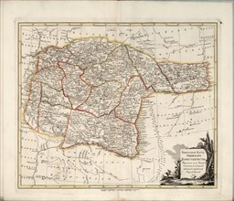
General Map of Kursk Governorate, 1788.
HRM19F07_428
Map of the flow of the Irtysh River from Omsk fort...

HRM19F07_437
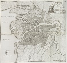
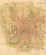
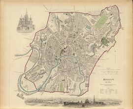
Plan of Moscow, 1836.

HRM19F17_139
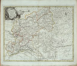
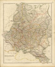
Map of Russia and Poland, 1832.
HRM19F17_125
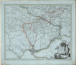
General Map of Azov Governorate, 1782.
HRM19F17_142
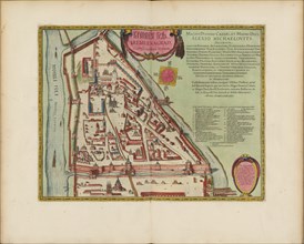
The Moscow Kremlin Map of the 16th century (Castel...

HRM19F07_420
General map of Crimea, 1791.
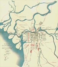
HRM19F07_431
Plan of Moscow, 1916.
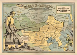
HRM19F07_434
Mongolia and Manchukuo, 1936.
HRM19F17_126
General Map of Novorossiysk Governorate, 1779.

HRM19F07_421
General Map of Azov Governorate, 1782.

HRM19F07_430
Plan of Petrograd, 1915.
HRM19F07_435
Map of Russia and Poland, 1832.
HRM19F17_141
Plan of Moscow, 1836.
HRM19F17_131
General Map of Vyatka Governorate, 1791.
HRM19F07_425
General Map of Ufa Governorate, 1791.

HRM19F07_440
Panoramic view of Kronstadt, 1853.

HRM19F17_136
Map of southern Russia with view of Sevastopol Bay...
- Page
-
- sur
- 7