Sujet
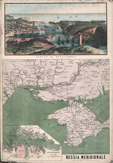
Map of southern Russia with view of Sevastopol Bay and its fortifications, 1853.
Légende
Map of southern Russia with view of Sevastopol Bay and its fortifications, 1853. Private Collection.
Date
30 nov. 1999
Crédit
Photo12/Heritage Images/Fine Art Images
Notre référence
HRM19F07_432
Model release
Non
Licence
Droits gérés
Format disponible
100.1Mo (8.6Mo) / 41.8cm x 60.0cm / 4939 x 7087 (300dpi)