Sujet
Celtic and Roman Britain', 1926.
Légende
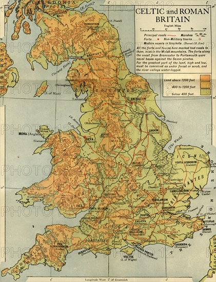
'Celtic and Roman Britain', 1926. Map of Britain during the Roman (43 to 410 AD) and Celtic periods. 'All the forts and towns here marked had roads to them, even in the Welsh mountains. The forts along the coast from Brancaster to Portsmouth were naval bases against the Saxon pirates. Far the greatest part of the land, high and low, must be conceived as under forest or scrub, and the river valleys water-logged.' From "History of England", by George Macaulay Trevelyan. [Longmans, Green and Co. Ltd, London, 1926]
Date
1926
Crédit
Photo12/Heritage Images/The Print Collector
Notre référence
HRM19F13_439
Model release
Non
Licence
Droits gérés
Format disponible
56.9Mo (6.9Mo) / 33.1cm x 43.1cm / 3906 x 5093 (300dpi)