46 résultats pour : vintage cartography
- Page
-
- sur
- 1
Connectez-vous pour plus de résultats
UMG26A10_109
The first cartographic laboratory of the Italian T...
UMG26A02_132
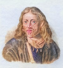
Johannes Hevelius.
UMG26A02_129
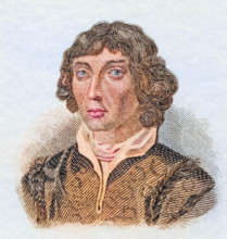
Nicolaus Copernicus.
UMG24A16_123
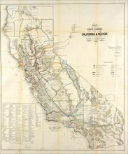
California Resources Map In 1866
UMG23A00_243
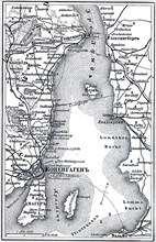
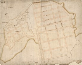
Map of Copenhagen.
UMG23A02_037
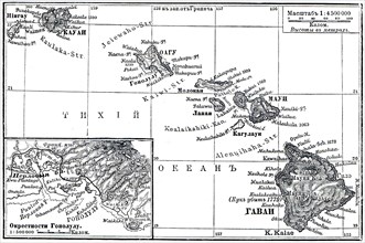
Map of Archipelago Hawaii.
UMG23A02_072
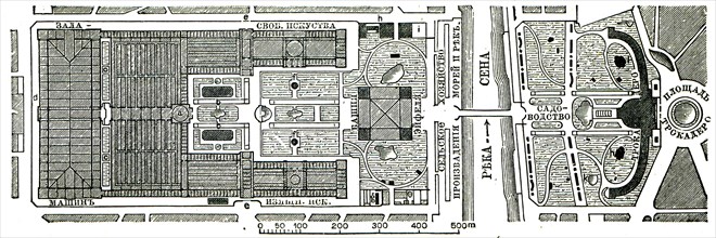
Paris Exhibition.
UMG23A02_073
Vienna Exhibition.
UMG23A02_038
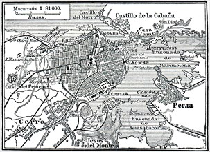
Plan of La Habana.
UMG23A02_039
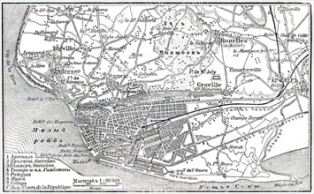
Plan of Le Havre.
UMG23A02_068
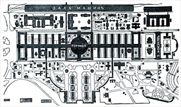
Berlin Exhibition.
UMG23A02_069
Paris Exhibition.
UMG23A02_070
Paris Exhibition.
UMG23A02_071
Paris Exhibition.
UMG22A54_081
Illustration
UMG22A24_363
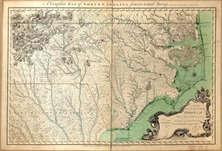
Vintage Maps / Antique Maps - A compleat map of No...
UMG22A29_400
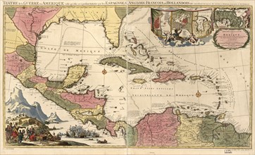
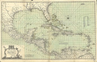
Vintage Maps / Antique Maps - Mexico, Cuba, Caribb...
UMG22A32_376
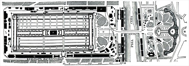
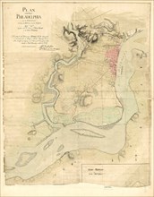
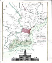
Vintage Maps / Antique Maps - Map of the city of P...
UMG22A24_353
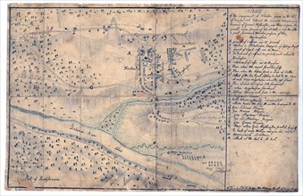
Vintage Maps / Antique Maps - Sketch of the engage...
UMG22A26_052
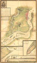
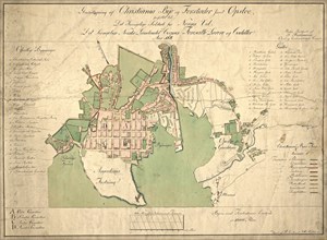
Vintage Maps / Antique Maps - A survey of the city...
UMG22A30_052
Vintage Maps / Antique Maps - A map of the city an...
UMG22A30_053
Vintage Maps / Antique Maps - To His Royal Highnes...
UMG22A30_104
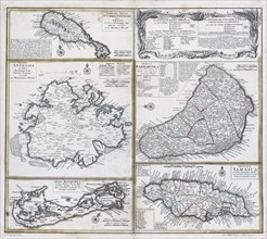
Vintage Maps / Antique Maps - ca. 1759 maps of var...

UMG22A05_426
Antique map
UMG22A04_187
Reichborns kart over Christiania
UMG22A03_495
Geelkercks kart over Christiania
UMG22A03_072
Linschotens kart over Vardø - Cartographer Jan Huy...
UMG22A03_311
Cornelis De Jodes verdenskart
UMG21A22_217
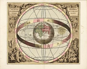
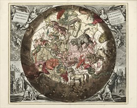
Cellarius' Scenographia Systematis Mundani Ptolema...
UMG21A21_004
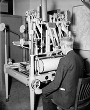
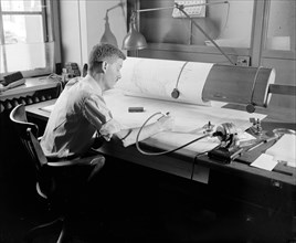
A worker using a planimetor, which measures the ex...
UMG21A22_218
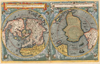
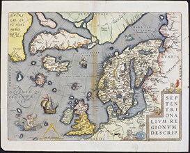
Abraham Ortelius nordenkart, 1601 - Map of Norther...
UMG21A21_003
A worker is shown making a stereoscopic examinatio...
UMG21A22_215
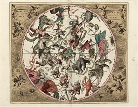
Cellarius' Hæmisphærium Stellatum Boreale Antiqvum...
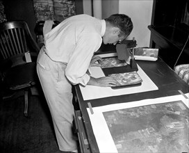
UMG21A21_002
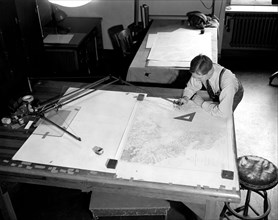
Map maker fitting together photos for the final ma...

UMG21A21_279
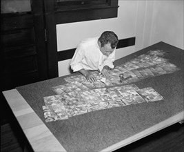
Geological Survey. Washington, D.C., March 13. Alb...
UMG21A22_216
Cellarius' Hæmisphærium Stellatvm Boreale cvm Subi...
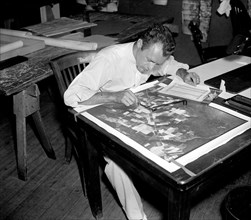
UMG21A21_001
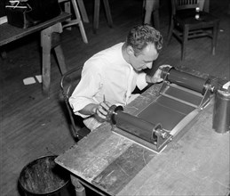
A worker is shown inspecting a roll of film for fl...
UMG21A21_280
Geological Survey, Dept. Interior. Washington, D.C...
UMG21A22_213
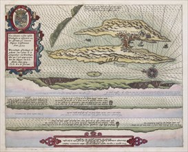
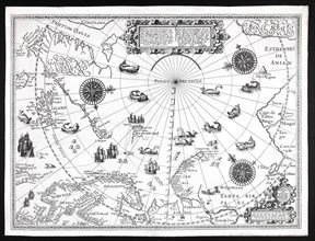
Barentskartet, 1598.
UMG21A22_214
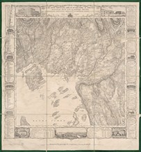
Cartographer Vibe og Irgens - Vibe og Irgens kart ...
UMG21A22_026
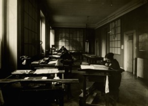
Map-making Division of Coast & Geodetic Survey, De...
UMG21A22_027
Map-making Division of Coast & Geodetic Survey, De...
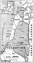
UMG20A12_340
Palestine State Proposal
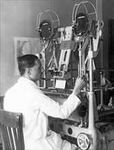
UMG20A12_341
Aerocartograph Mapping
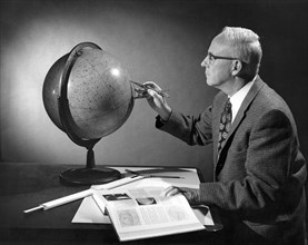
UMG20A12_342
Stellar Navigation
UMG20A18_247