84 results for: old map
- Page
-
- of
- 1
Please sign in for more results
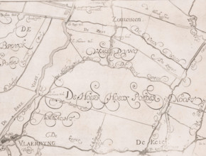
LZT26B32_497
Map of the Schieland Water Board, with Vlaardingen...
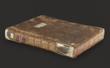
LZT26A40_066
Atlas contenant les cartes générales suivant la co...

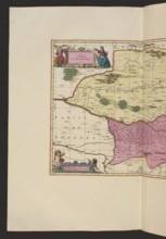
LZT26A39_383
Allard, Hugo (1620–1684), cartographer; Wit, Frede...
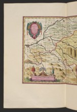
LZT26A06_301
Le comte de Perigort; Schenck, Pieter 1660-1711 pu...
LZT26A06_311
Le pays de Béarn; Pieter Schenck 1660–1711 and Ger...
LZT26A06_296
Diocese du Mans, vulgo le Maine, ubi olim Cenomani...
LZT26A06_298
La Saintonge vers le Midy auecq. le Brovageais, te...
LZT26A06_307
Le duché d'Aiguillon, Schenck, Pieter 1660–1711 cr...
LZT20A47_130
Map, A new map of Libya or old Africk shewing its ...
LZT19B45_290
Bohn, François, KAMPEN, N.G. FROM. State and geogr...

LZT19B56_362
Elias van Nijmegen, Biblical representation: Abime...

LZT19B56_329
Elias van Nijmegen, Esther receives the command of...

LZT19B56_365
Elias van Nijmegen, Naomi, Ruth and Orpa, wallpape...

LZT19B56_363
Elias van Nijmegen, Laban with Jacob, wallpaper pa...

LZT19B56_367
Elias van Nijmegen, Eliezer for Betuël, wallpaper ...

LZT19B56_369
Elias van Nijmegen, Abigael for David, wallpaper p...

LZT19B56_368
Elias van Nijmegen, Bathsheba asks Solomon to cons...

LZT19B56_371
Elias van Nijmegen, Spy escape from Jericho, wallp...
LZT19B45_185
Halma, Henricus (printer), VITRINGA, CAMPEGIUS. Co...
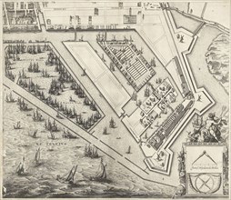
LZT19B56_294
Map of the Leproos- and Proveniershuis in Rotterda...

LZT19B56_330
Elias van Nijmegen, God's covenant with Noah, wall...
LZT16A22_184
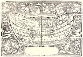
Anonymous. Map: The World of Volpellio (Typo de la...
LZT16A06_408
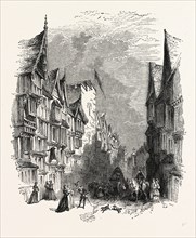
Barbican. Designed old Maps Elevations, London, En...
LZT16A02_307
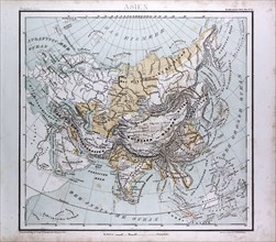
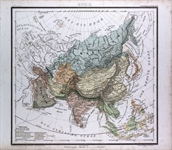
Asia Map, atlas by Th. von Liechtenstern and Henry...
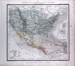
LZT16A02_316
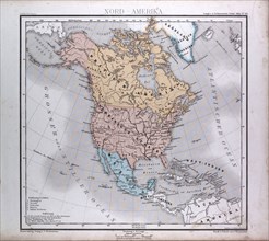
North America Map, atlas by Th. von Liechtenstern ...
LZT16A02_306
Asia Map, atlas by Th. von Liechtenstern and Henry...
LZT16A02_317
North American and Central America, atlas by Th. v...
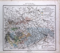
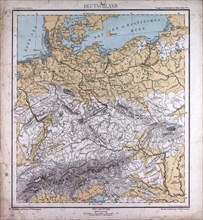
LZT16A02_287
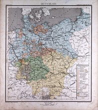
Germany, Deutschland, atlas by Th. von Liechtenste...
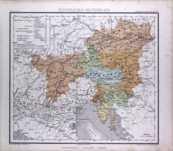
LZT16A02_296
South East Germany, Sudostliches Deutschland, atla...
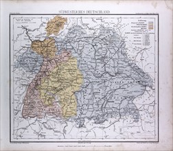
LZT16A02_297
South West Germany, Sudwestliches Deutschland, atl...
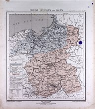
LZT16A02_286
Germany, Prussia, Poland, atlas by Th. von Liechte...
LZT16A33_087
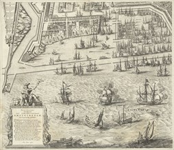
Map of Amsterdam (leaf middle left), 1625, The Net...
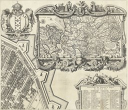
LZT16A33_088
Map of Amsterdam (leaf right), 1625, The Netherlan...

LZT16A00_295
The Plumb pudding in danger, or, State epicures ta...
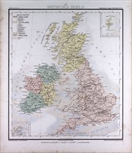
LZT16A02_308
Great Britain and Ireland, atlas by Th. von Liecht...
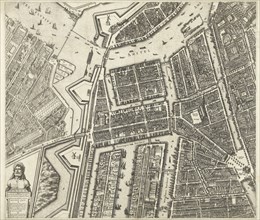
LZT16A33_086
Map of Amsterdam, The Netherlands, leaf left, 1625...
LZT16A02_281
Germany, atlas by Th. von Liechtenstern and Henry ...
LZT16A02_290
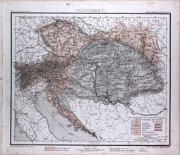
Austria, Oesterreich, atlas by Th. von Liechtenste...
LZT16A02_299
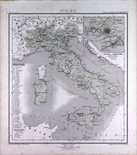
Italy, atlas by Th. von Liechtenstern and Henry La...
LZT16A02_309
Western Asia or West Asia, atlas by Th. von Liecht...
LZT16A37_343
Map of Amsterdam (middle leaves), 1625, The Nether...
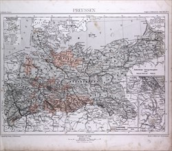
LZT16A02_280
Prussia, Preussen, atlas by Th. von Liechtenstern ...
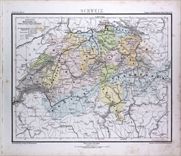
LZT16A02_291
Switzerland, atlas by Th. von Liechtenstern and He...
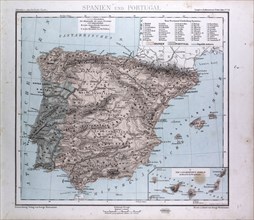
LZT16A02_298
Spain and Portugal Map, atlas by Th. von Liechtens...
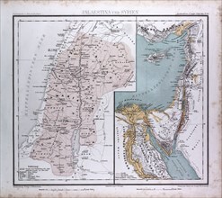
LZT16A02_310
Israel, Syria, Palestina, atlas by Th. von Liechte...
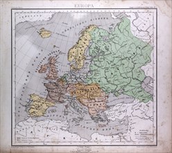
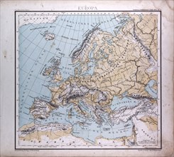
LZT16A02_279
Europe, Europa, atlas by Th. von Liechtenstern and...
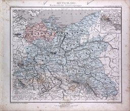
LZT16A02_288
Germany, Deutschland, atlas by Th. von Liechtenste...
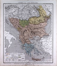
LZT16A02_301
Turkey and Greece, atlas by Th. von Liechtenstern ...

LZT16A00_223
Picture of Europe for July 1772, Catherine II, Leo...
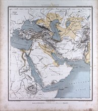
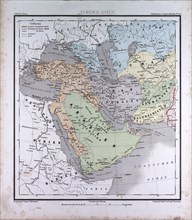
LZT16A02_311
Western Asia or West Asia, atlas by Th. von Liecht...
LZT16A33_085
Map of Amsterdam (leaf right), 1625, The Netherlan...
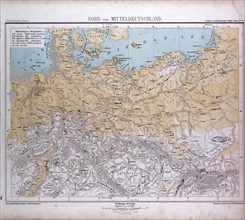
LZT16A02_289
North and Middle Germany, Nord und Mittel Deutschl...
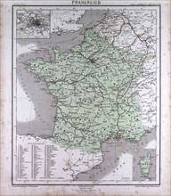
LZT16A02_300
France, atlas by Th. von Liechtenstern and Henry L...
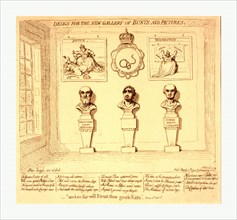
LZT16A00_222
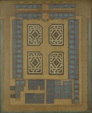
Design for the new gallery of busts and pictures, ...
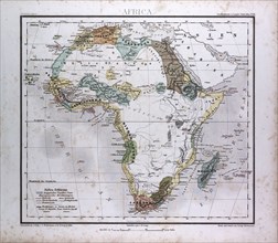
LZT16A02_312
Africa Map, atlas by Th. von Liechtenstern and Hen...
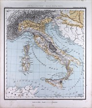
LZT16A02_321
Italy, atlas by Th. von Liechtenstern and Henry La...
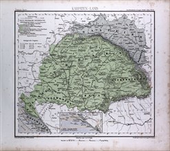
LZT16A02_294
Carpathian Mountains, Karpaten, Karpaty, Atlas by ...
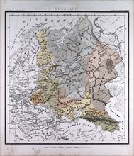
LZT16A02_303
Russia, atlas by Th. von Liechtenstern and Henry L...
LZT16A02_285
Europe, atlas by Th. von Liechtenstern and Henry L...
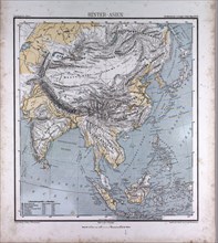
LZT16A02_313
Asia, atlas by Th. von Liechtenstern and Henry Lan...
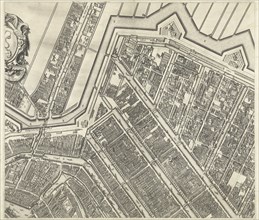
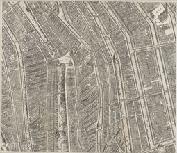
LZT16A33_089
Map of Amsterdam (leaf top center), 1625, The Neth...
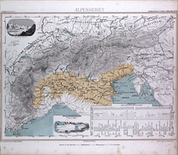
LZT16A02_295
Alps, Alpengebiet, atlas by Th. von Liechtenstern ...
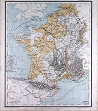
LZT16A02_302
Europe, France, Belgium, The Netherlands, atlas by...
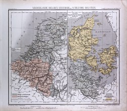
LZT16A02_284
The Netherlands, Belgium, Danmark, Schleswig-Holst...
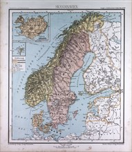
LZT16A02_305
Scandinavia, Northern Europe, atlas by Th. von Lie...
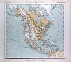
LZT16A02_314
North America Map, atlas by Th. von Liechtenstern ...
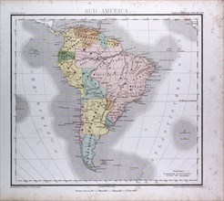
LZT16A02_319
South America Map, atlas by Th. von Liechtenstern ...
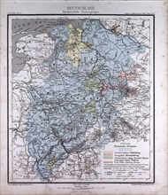
LZT16A02_292
Germany, atlas by Th. von Liechtenstern and Henry ...
LZT16A02_283
Germany, atlas by Th. von Liechtenstern and Henry ...
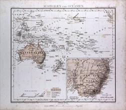
LZT16A02_318
Australia and Oceania Map, atlas by Th. von Liecht...
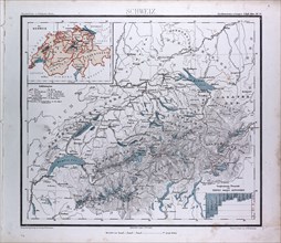
LZT16A02_293
Switzerland, Schweiz, atlas by Th. von Liechtenste...
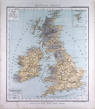
LZT16A02_304
Great Britain and Ireland, atlas by Th. von Liecht...
LZT16A02_282
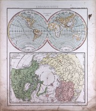
Earth Map, atlas by Th. von Liechtenstern and Henr...
LZT13A39_261
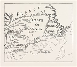
OLD MAP OF ACADIE, CANADA, 1870s engraving
LZT13A31_455
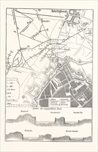
Franco-Prussian War: Schiltigheim, France, Old map
LZT13A44_048
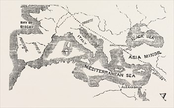
MAP OF THE EUPHRATES VALLEY ROUTE TO INDIA
LZT13A23_043
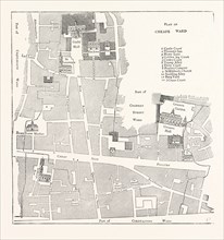
OLD MAP OF THE WARD OF CHEAP, ABOUT 1750, LONDON
LZT13A23_311
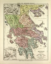
OLD MAP OF GREECE
LZT13A23_313
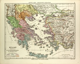
OLD MAP OF GREECE AND CRETE
LZT13A23_342
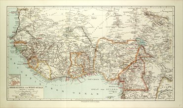
OLD MAP OF SOUTH WESTERN AFRICA
LZT13A23_341
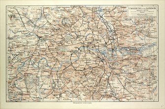
OLD MAP OF LONDON
LZT13A23_338
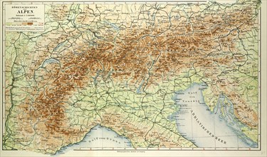
OLD MAP OF THE ALPS
LZT13A23_340
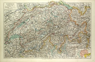
OLD MAP OF SWITZERLAND
LZT13A23_337