373 results for: map
- Page
-
- of
- 4
Please sign in for more results
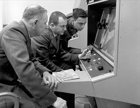
ARP15A02_444
Cuban Missile Crisis
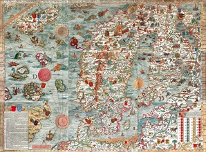
ARP15A02_459
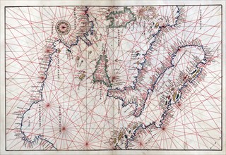
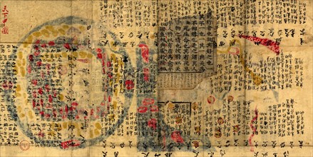
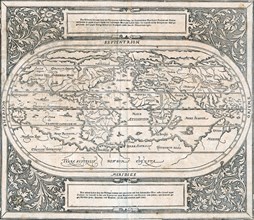
The Carta Marina
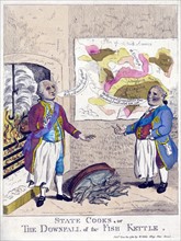
ARP15A02_301
Satire about George III, Lord North and the Americ...
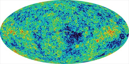
ARP15A02_095
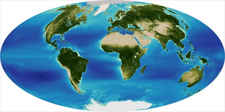
Microwave light emitted 380,000 years after the Bi...
ARP15A02_088
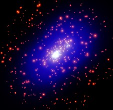
The total mass within giant galaxy cluster
ARP15A02_074
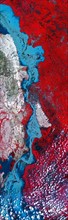
Image strip over the Indus River, Pakistan
ARP15A02_097
Global Positioning System
ARP15A02_113
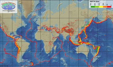
The Sea-viewing Wide Field-of-view-Sensor
ARP24A00_432
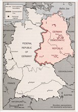
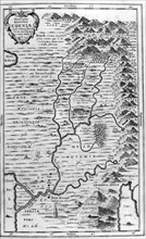
Map of Germany's Post-World War II boundaries
ARP24A00_410
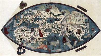
Genoese world map, 1457
ARP24A01_032
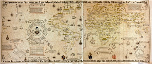
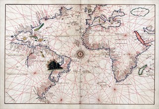
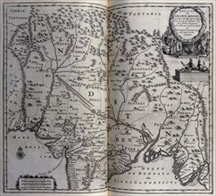
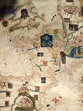
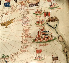
Portolan atlas of nine charts and a world map, etc...
ARP24A01_409
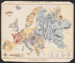
Map of the European states during World War One
ARP24A00_409
Genoese world map, 1457
ARP24A00_478
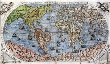
Vniversale descrittione di tvtta la terra conosciv...
ARP24A00_382
Portolan atlas of 9 charts and a world map, etc. D...
ARP24A00_381
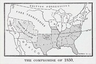
The Compromise of 1850 was a package of five separ...

ARP24A01_167
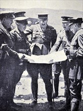
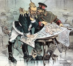
German officers viewing a map of Europe during Wor...
ARP24A00_437
Die erst general Tafel die Beschreibung und den Ci...
ARP24A00_416
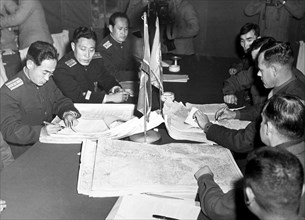
The Panmunjom cease fire talks, 1951
ARP24A01_238
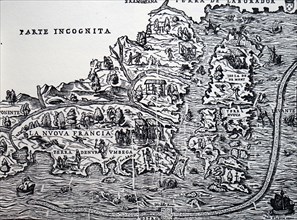
Gastaldi's map of New France
ARP24A00_408
Genoese world map, 1457
ARP24A01_017
Portolan atlas of nine charts and a world map, etc...
ARP24A00_387
Portolan atlas of 9 charts and a world map, etc. D...
ARP24A00_386
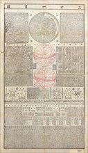
Buddhist geography maps
ARP24A01_023
Portolan atlas of nine charts and a world map, etc...
ARP24A00_400
San cai yi guan tu. Map of the three powers unifie...
ARP23A10_113
Illustration showing a map of the garden of Eden, ...
ARP23A10_271
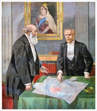
Underneath a portrait of Queen Victoria, Lord Sali...
ARP23A10_123
World map showing land formations and continents a...
ARP23A17_417
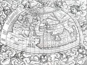
Ptolemy of Alexandria's map of the then known worl...
ARP23A10_313
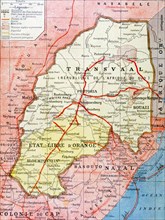
French map of the Transvaal at the outbreak of the...
ARP23A18_403
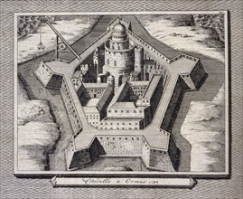
Fortified city at Hormuz, Persia, Iran, 17th centu...
ARP23A10_415
Illustration showing a plan of the exhibition area...
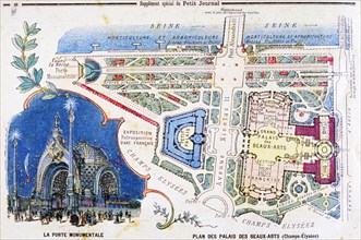
ARP23A10_414
Illustration showing a plan of the exhibition area...
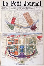
ARP23A10_413
Illustration showing a plan of the exhibition area...
ARP23A10_284
French map of territories controlled by the coloni...
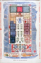
ARP23A10_412
Illustration showing a plan for the Exposition Uni...
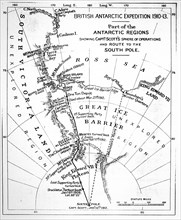
ARP23A12_252
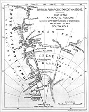
Map illustrating an Expedition of Captain Robert F...
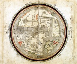
ARP23A15_110
Medieval 10th century World map by Abu Ishaq Ibrah...
ARP23A10_063
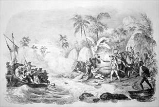
19th century illustration showing the death of Cap...
ARP23A11_106
Photograph of Adolf Hitler
ARP23A10_401
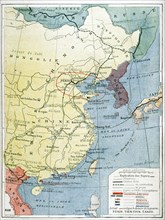
Map showing European presence in China during the ...
ARP23A18_402
Map of Mughal empire in India circa 1680, 17th cen...
ARP23A12_251
Map illustrating an Expedition of Captain Robert F...
ARP18A03_258
England and Ireland depicted in Jacopo Russo Map o...
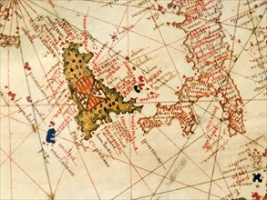
ARP18A03_269
Italy and Sicily depicted in Jacopo Russo Map of t...
ARP18A05_021
Don Miguel Primo de Rivera, 1925
ARP18A05_093
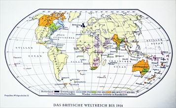
British world map 1914. WWI.
ARP18A07_288
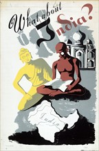
What About India? By Robert Merlin
ARP18A07_395
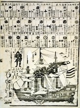
Perry's steamship
ARP18A11_186
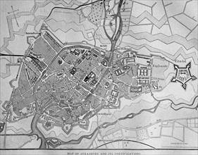
Map of Strasburg
ARP18A19_450
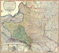
Map showing the partition of the Kingdom of Poland...
ARP18A27_193
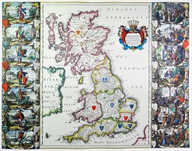
Antique map of Britain. Published 1635
ARP18A29_233
Print titled 'How the 'Herald' does it'
ARP18A29_155
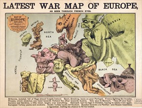
Map of Europe characterising the rival super power...
ARP18A07_375
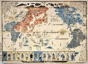
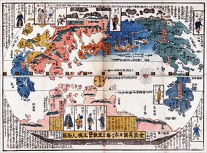
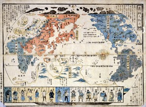
Bankoku jinbutsu no zu (People of many nations)
ARP18A27_299
Illustration depicting a French expedition arrivin...
ARP18A27_305
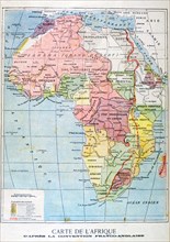
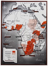
Map of Africa with a colour key identifying the Br...
ARP18A28_339
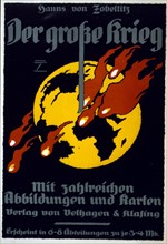
Poster is an advertisement for The Great War by Ha...
ARP18A03_270
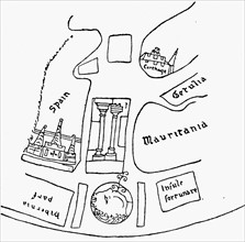
Spain and Portugal depicted in Jacopo Russo Map of...
ARP18A27_106
Part of North America, showing Sebastian Cabot's v...
ARP18A27_199
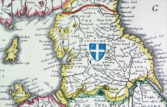
Shield of Northumberland, from the Heptarchy; a co...

ARP18A28_298
Poster for Brookfield Zoo, 1938
ARP18A09_329
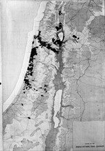
Extent of Jewish land holdings in Palestine
ARP18A07_420
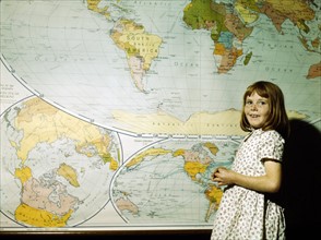
School Girl
ARP18A16_372
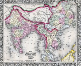
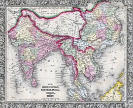
19th Century Map of India, Tibet, China and Southe...
ARP18A27_078
The Pillars of Hercules, as shown in a mediaeval m...
ARP18A27_095
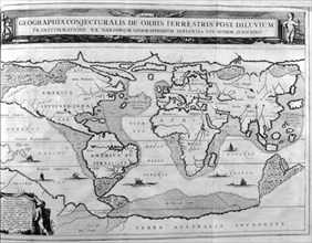
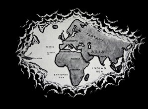
The world as known at the end of the 15th century
ARP18A27_204
Venetia and Venice (detail) from a map of Italy 16...
ARP18A28_325
Map of Nagasaki. Published: Japan 1801 of Kyowa er...
ARP18A27_300
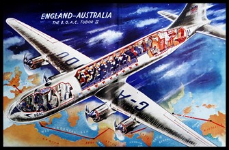
Colour cut-out diagram of a British 1940s commerci...
ARP18A03_259
France depicted in Jacopo Russo Map of the world 1...
ARP18A09_025
Japanese diptych print
ARP18A19_451
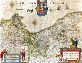
Map of the historical Duchy of Pomerania
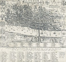
ARP18A19_464
London Map 1593 by john Norden
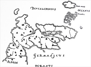
ARP18A27_082
North Britain and Island of Thule.
ARP18A27_101
One of the first maps of the Pacific.
ARP18A27_198
Shield of Mercia, from the Heptarchy; a collective...
ARP18A29_166
Colour Japanese diptych print showing a map of the...
ARP18A01_121
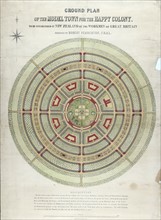
Ground plan of the model town for the happy colony
ARP18A03_262
Palestine with Jerusalem and Damascus
ARP18A07_408
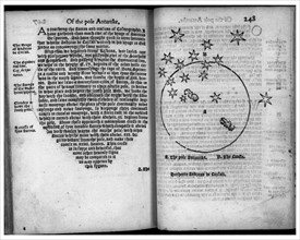
The Pole Antartike and The Crosse
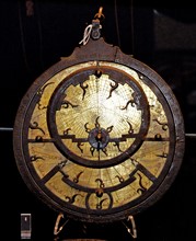
ARP18A19_241
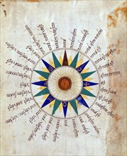
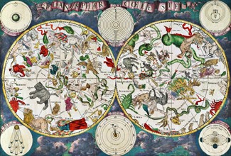
Celestial map of the 17th century
ARP18A27_088
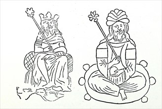
Two Emperors of Tartary.
ARP18A27_093
A portion of Africa from Fra Mauro's map
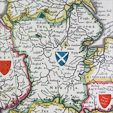
ARP18A27_202
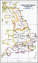
Map showing the Heptarchy of Britain
ARP18A28_324
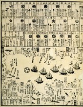
commodore Perry arrives in Uraga, Soshu Province; ...
ARP18A29_229
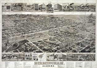
A composite of bird's-eye view of Birmingham, Alab...
ARP18A11_201
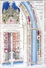
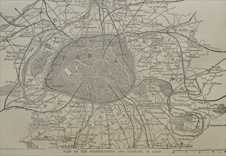
Plan of the Fortifications and Environs of Paris
ARP18A25_026
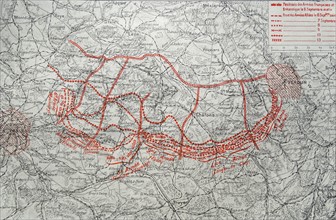
Map depicting the German advance into France after...
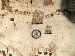
ARP18A03_261
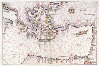
Mediterranean Sea with compass and ship
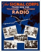
ARP18A08_053
U.S. Army Signal Corps recruiting poster
ARP18A12_474
Instruments for Mecca and for mosques
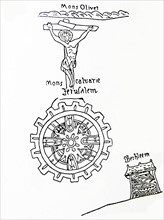
ARP18A27_079
Jerusalem, the centre of the world.
ARP18A15_096
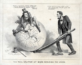
Vice President Andrew Johnson sitting atop a globe
ARP18A16_413
16th Century Map of the World
ARP18A19_448
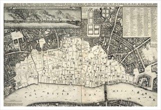
map, of central London after the 'Great Fire of Lo...
ARP18A26_186
Mitchell Map of India, Tibet, China and Southeast ...
ARP18A27_087
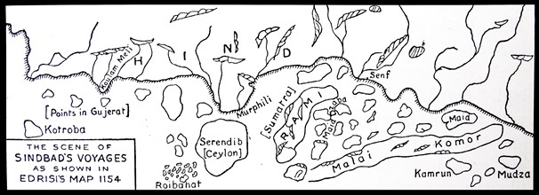
The scene of Sinbad's voyages as shown in Edrisi's...
ARP18A27_114
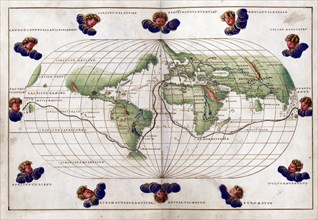
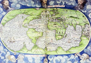
The world as known after the circumnavigation by S...
- Page
-
- of
- 4