Title
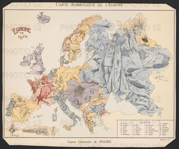
Map of the European states during World War One
Caption
Map of the European states during World War One. Monarchs are shown for Spain, Portugal, Britain, Germany etc. 1915
Date
1915
Credit line
Photo12/Ann Ronan Picture Library
Reference
ARP24A01_409
Model release
No
Property release
NA
License type
Rights managed
Available size
85.9Mb (4.3Mb) / 20.0in x 16.7in / 6000 x 5003 (300dpi)
Keywords
Map European states World War One Monarchs Spain Portugal Britain Germany Europe 20th century war conflict
Restrictions
Editorial use only.