188 résultats pour : cartography
- Page
-
- sur
- 2
Connectez-vous pour plus de résultats
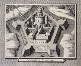
ARP23A18_403
Fortified city at Hormuz, Persia, Iran, 17th centu...
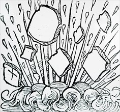
ARP23A13_423
Engraving depicting a fire seen in the night sky o...
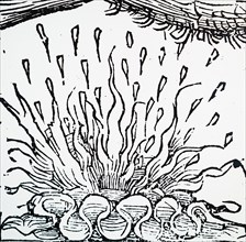
ARP23A13_422
Engraving depicting an aurora during the 7th Centu...

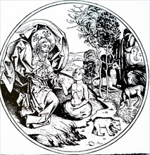
ARP23A13_394
Engraving depicting the fifth day of creation - Go...
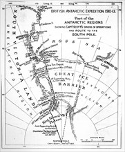
ARP23A12_252
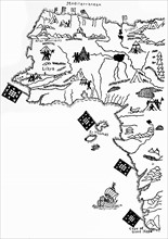
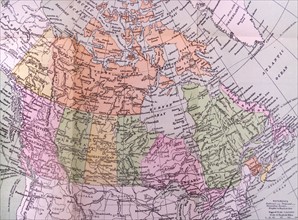
Map illustrating an Expedition of Captain Robert F...
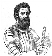
ARP23A12_432
Portrait of Amerigo Vespucci
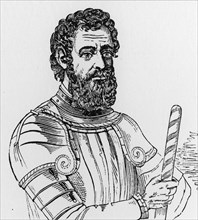
ARP23A12_440
Portrait of Amerigo Vespucci
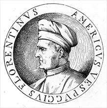
ARP23A12_439
Portrait of Amerigo Vespucci
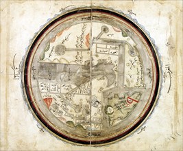
ARP23A15_110
Medieval 10th century World map by Abu Ishaq Ibrah...
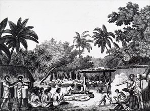
ARP23A16_330
Captain James Cook witnessing a human sacrifice in...
ARP23A13_396
Engraving depicting the sixth day of creation - Go...
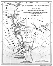
ARP23A12_251
Map illustrating an Expedition of Captain Robert F...
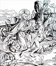
ARP23A13_395
Engraving depicting the creation of Adam and Eve f...
ARP18A03_258
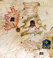
England and Ireland depicted in Jacopo Russo Map o...
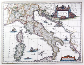
ARP18A03_269
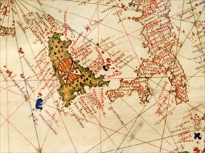
Italy and Sicily depicted in Jacopo Russo Map of t...
ARP18A05_093
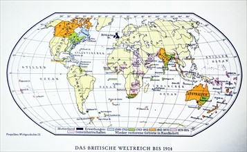
British world map 1914. WWI.
ARP18A27_193
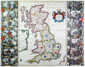
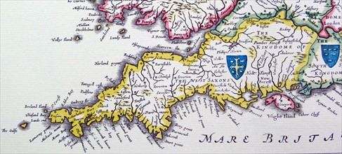
Antique map of Britain. Published 1635
ARP18A07_375
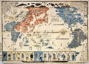
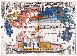
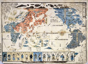
Bankoku jinbutsu no zu (People of many nations)
ARP18A27_305
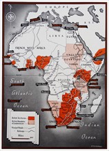
Map of Africa with a colour key identifying the Br...
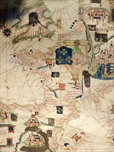
ARP18A03_270
Spain and Portugal depicted in Jacopo Russo Map of...
ARP18A27_106
Part of North America, showing Sebastian Cabot's v...
ARP18A27_199
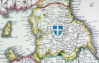
Shield of Northumberland, from the Heptarchy; a co...
ARP18A27_078
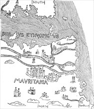
The Pillars of Hercules, as shown in a mediaeval m...
ARP18A27_204
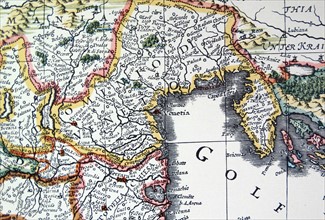
Venetia and Venice (detail) from a map of Italy 16...
ARP18A28_325
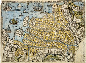
Map of Nagasaki. Published: Japan 1801 of Kyowa er...
ARP18A03_259
France depicted in Jacopo Russo Map of the world 1...
ARP18A09_025
Japanese diptych print
ARP18A27_082
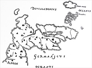
North Britain and Island of Thule.
ARP18A27_101
One of the first maps of the Pacific.
ARP18A27_198
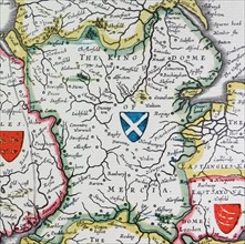
Shield of Mercia, from the Heptarchy; a collective...
ARP18A29_166
Colour Japanese diptych print showing a map of the...
ARP18A03_262
Palestine with Jerusalem and Damascus
ARP18A07_408
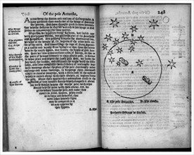
The Pole Antartike and The Crosse
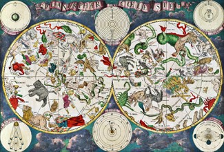
ARP18A19_241
Celestial map of the 17th century
ARP18A27_088
Two Emperors of Tartary.
ARP18A27_093
A portion of Africa from Fra Mauro's map
ARP18A27_202
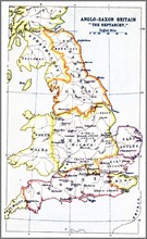
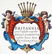
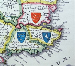
Map showing the Heptarchy (from the Greek hepta, s...
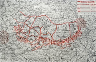
ARP18A25_026
Map depicting the German advance into France after...
ARP18A03_261
Mediterranean Sea with compass and ship
ARP18A27_079
Jerusalem, the centre of the world.
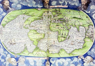
ARP18A16_413
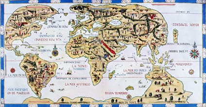
16th Century Map of the World
ARP18A26_186
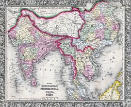
Mitchell Map of India, Tibet, China and Southeast ...
ARP18A27_087
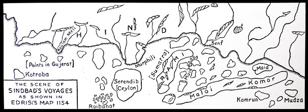
The scene of Sinbad's voyages as shown in Edrisi's...
ARP18A27_114
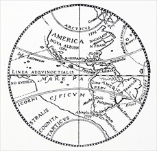
The world as known after the circumnavigation by S...
ARP18A27_195
The Heptarchy is a collective name applied to the ...
ARP18A27_201
Map of Italy, 1631, by Johannes Blaeu based on a m...
ARP18A29_263
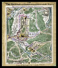
Map of the Battle of Chancellorsville
ARP18A03_263
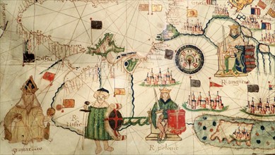
Ottoman Sultan and Turkey depicted in Jacopo Russo
ARP18A26_185
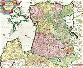
Ducatuum Livoniæ et Curlandiæ Nova Tabula
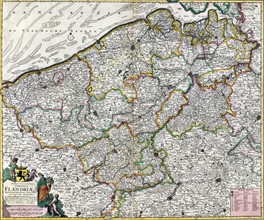
ARP18A26_198
Map titled 'Flandriæ'
ARP18A27_080
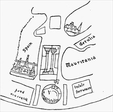
The coast of Africa, after Ptolemy (Mercator's edi...
ARP18A27_196
Shields of Sussex, Kent and Essex from the Heptarc...
ARP18A27_096
Africa as it was known after Vasco Da Gama's exped...
ARP18A27_197
Shields of Wessex and Sussex from the Heptarchy; a...
ARP18A28_005
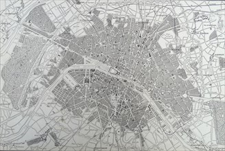
19th Century Map of Paris with the River Seine dep...
ARP18A08_078
Map of Nagasaki
ARP18A27_325
19th Century Map of Paris with the River Seine dep...
ARP18A03_265
King of Hungary depicted in Jacopo Russo Map of th...
ARP18A27_081
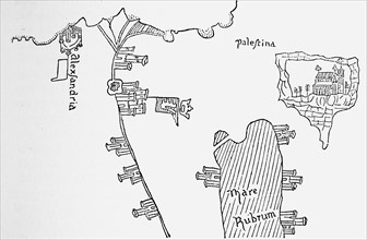
Alexandria in Pizzigani's Map
ARP18A27_092
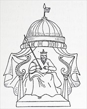
An Emperor of Tartary.
ARP18A27_102
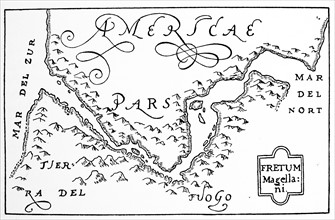
Hondius his map of Magellan strait'.
ARP18A27_107
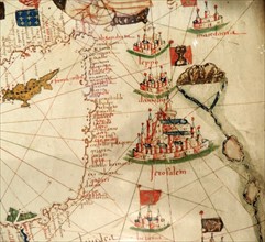
The 'Dauphin' map by Desceliers, 1546,
ARP18A27_111
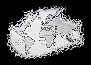
The Silver map of the world.
ARP18A27_203
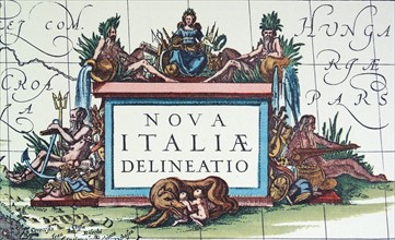
Mythological and allegorical figures including Rom...
ARP18A27_085
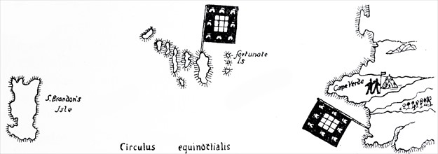
The mysterious Isle of St. Brandon in Martin Behai...
ARP18A27_094
The West Coast of Africa
ARP18A27_112
The Silver map of the world.
ARP18A12_473
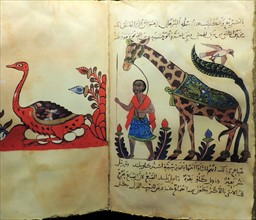
Advances in zoology, botany, astronomy and navigat...
ARP18A29_204
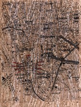
Street map showing the Ground Zero area of Lower M...
ARP18A29_189
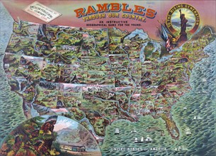
Geographical game called 'Rambles through our Coun...
ARP18A08_400
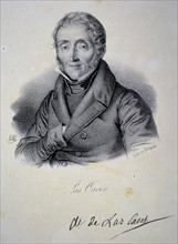
Emmanuel, comte de las Cases
ARP18A12_471
Advances in zoology, botany, astronomy and navigat...
ARP18A23_072
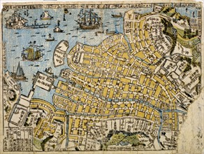
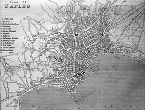
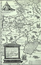
Plan of Naples.
ARP18A27_098
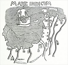
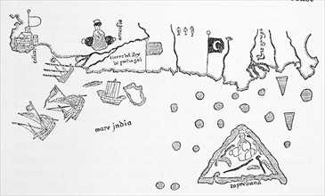
The Malabar Coast.
ARP18A27_108
Anthony Jenkinson's map of Russia
ARP18A27_117
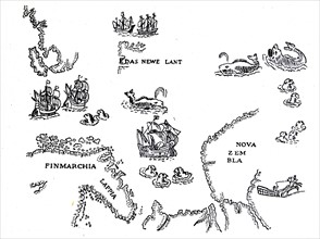
Nova Zambia and the Arctic Regions.
ARP18A27_097
Calicut and the Southern Indian Coast.
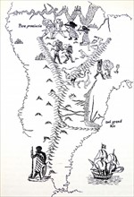
ARP18A27_105
Peru and South America.
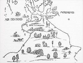
ARP18A27_118
An early map of 'Terra Australis', called 'Java La...
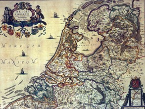
ARP18A00_338
1658 map of the Dutch Republic.
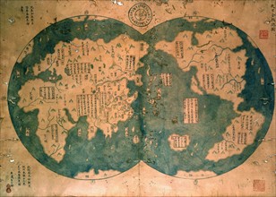
ARP15A01_183
Chinese map of the world dated 1763
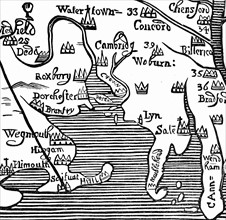
ARP15A00_340
Early map of Massachusetts Bay, America
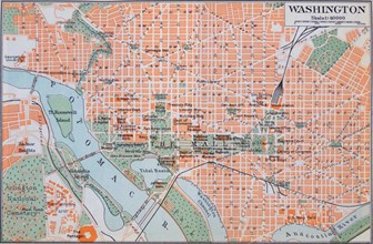
ARP17A37_138
Map of Washington D.C.

ARP17A34_339
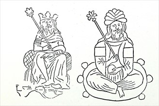
Portrait of Robert Gordon of Straloch
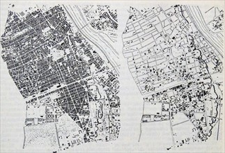
ARP17A37_171
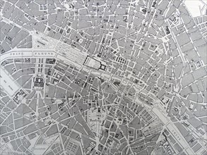
Map showing the central parts of Warsaw
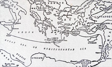
ARP17A22_289
Sketch map to illustrate Saint Paul's Journeys
ARP17A22_280
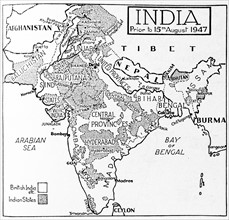
Map depicting India prior to August 1947
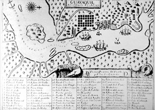
ARP17A23_364
Map of the city of Guayaquil by Dionisio de Alcedo...
ARP17A24_360
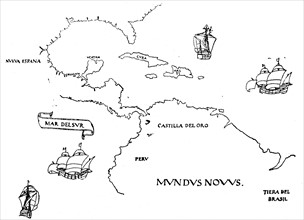
16th century Spanish map showing the Americas
ARP17A25_127
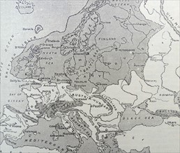
Map of Europe during the Ice Age
ARP17A25_202
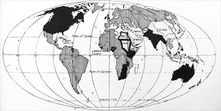
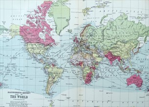
Map depicting the Europeanisation of the World
ARP17A28_002
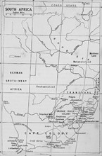
Map of South Africa during the 19th Century
ARP17A24_336
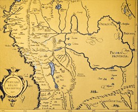
1572 map of the Spanish The Viceroyalty of Peru
ARP17A24_472
Map depicting Coatepec
ARP17A22_314
Section of a globe
ARP17A24_392
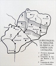
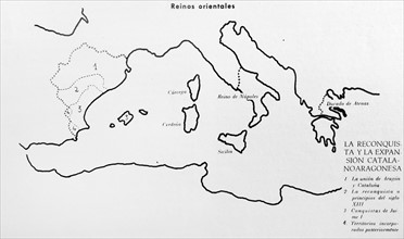
Map depicting 'The Reconquista' of the Kingdom of ...
ARP17A25_072
Illustration from Harmsworth History of the World
ARP17A25_095
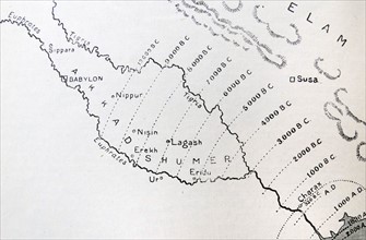
Map of Babylonia
ARP17A25_214
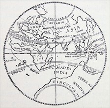
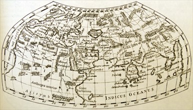
Early Geographers' idea of the world
ARP17A24_397
Map depicting 'The Reconquista' of the Catalan
- Page
-
- sur
- 2