3257 results for: geographical
- Page
-
- of
- 33
Please sign in for more results

BRK26C90_125
Global travel media world globe concept, picture s...
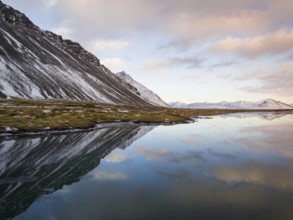
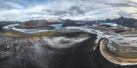
BRK26C98_431
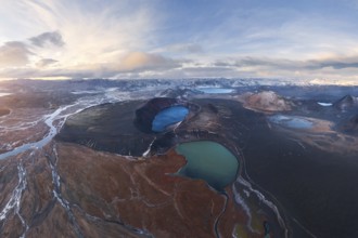
Breathtaking winter landscape of Iceland featuring...
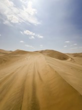
BRK26C99_001
Sweeping views of Ica's vast sand dunes stretch un...
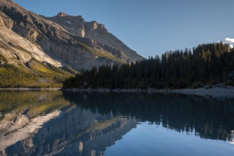
BRK26D04_320
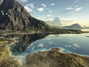
Tranquil lake Oachinensee in Switzerland reflects ...
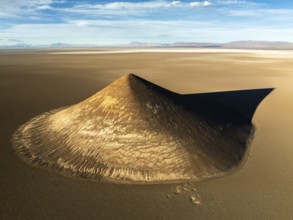
BRK26C78_030
From above, this aerial shot captures the stunning...
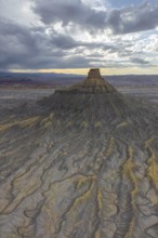
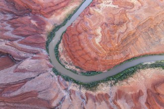
BRK26C80_207
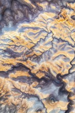
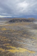
Aerial capture of Utah's stunning golden bentonite...
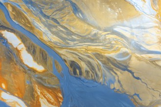
BRK26C87_068
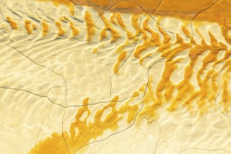
Aerial photo capturing a vibrant, abstract landsca...
BRK26D01_440
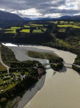
Aerial view captures the diverse landscape of Cant...
BRK26C74_410
From above, this striking aerial shot captures vib...
BRK26C85_191
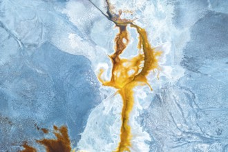
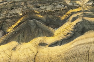
Aerial view of textured golden mud patterns, creat...
BRK26C82_380
Aerial view of Utah's golden sandstone desert disp...
BRK26D02_399
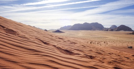
Captivating view over the red sand dunes in Wadi R...
BRK26D01_276
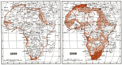
Map of Africa according to the state of research a...
BRK26C87_082
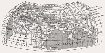
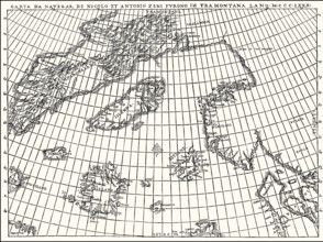
World map by Claudius Ptolemy, c.?100 – c.?170, a ...
BRK26C98_244
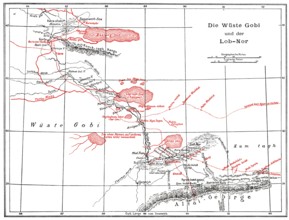
The Gobi Desert with Lop Nur or Lop Nor, East Asia...
BRK26C95_424
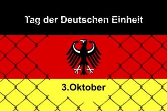
3 October, Day of German Unity, Studio
BRK26C57_049
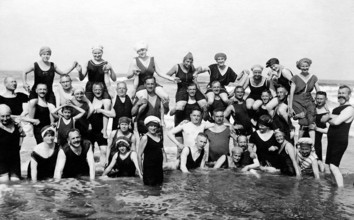
Bathing group on the beach, in the water, piggybac...
BRK26C84_266
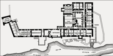
Plan of Chetham's College, Manchester, England, UK...
BRK26C85_283
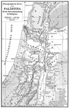
Ethnic map of Palestine, 1000 BCE
BRK26D05_247
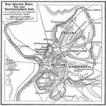
Map of ancient Rome, Italy
BRK26D05_073
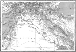
Map of ancient Middle-East
BRK26C88_158
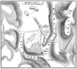
Facsimlile of the Zeno map by the Zeno brothers, N...
BRK26D03_248
Jebus, pre-Israelite Jerusalem
BRK26C85_186
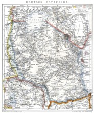
Map of the former German colony of East Africa, 18...
BRK26C80_487
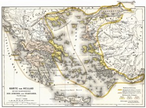
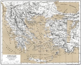
Territory of ancient Hellas, Sparta and Athens
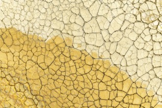
BRK26C16_045
Close-up view of a dry, cracked surface shimmering...
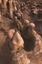
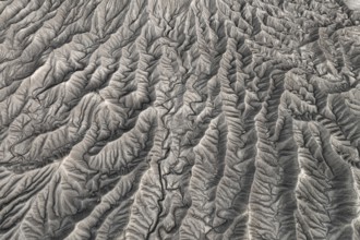
BRK26C14_195
Bizarre and intricate rock formations dominate the...
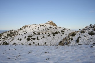
BRK26C13_328
A serene winter scene at Montcabrer in Spain, show...
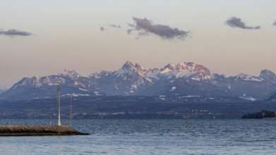
BRK26C11_420
A breathtaking view of the snow-capped Swiss and F...
BRK26C12_448
Aerial view of a rugged desert landscape featuring...

BRK26C12_463
A stunning view of Hanksville Bentonites in Utah s...
BRK26C15_491
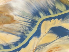
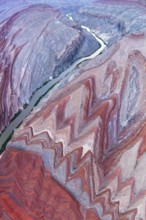
An aerial photograph captures the stunning Rio San...
BRK26C16_370
A breathtaking coastal view of Sherwink, Trinity, ...
BRK26C15_276
Captivating aerial view of Iceland's Highlands sho...
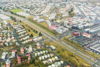
BRK26C23_009
Aerial image of Reykjavik, Iceland, displaying a d...
BRK26C12_138
This image captures the stunning multicolour abstr...
BRK26C23_012
Stunning view of Icelandic mountains blanketed in ...
BRK26C12_446
Aerial view of a rugged desert landscape, with int...
BRK26C14_216
Aerial photograph of Rio San Juan meandering throu...
BRK26C22_485
This stunning panoramic view captures the vast, dr...
BRK26C21_339
Stunning aerial photograph capturing the intricate...
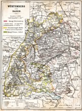
BRK26B81_480
Colored topographic map of the Kingdom of Würtembe...
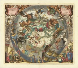
BRK26B12_039
Historical sky map Haemisphaerium Scenographicum A...
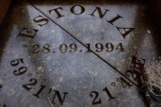
BRK26A62_462
Memorial stone with date and coordinates engraved ...
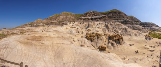
BRK25M21_005
Breathtaking panorama of the drumheller badlands s...
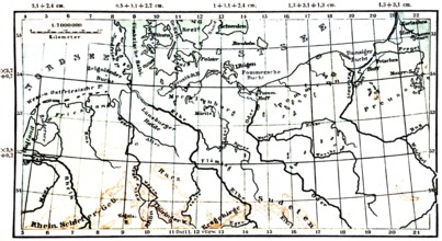
BRK25M48_034
North German Plain, historical geographical map, t...
BRK25M48_035
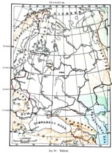
Russia, historical geographical map, topography, A...
BRK25M48_033
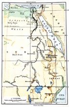
The Nile, historical geographical map, topography,...
BRK25K53_186
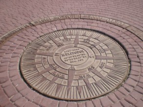
The geographic azimuth at Victory Square is locate...
BRK25J82_474
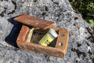
Geocaching, very obvious hiding place in the area ...
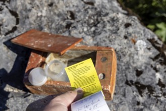
BRK25J82_472
Geocaching, very obvious hiding place in the area ...
BRK25I56_437
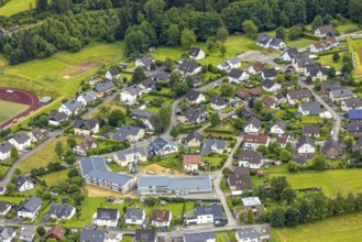
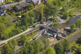
Aerial view, construction site and new constructio...
BRK25I56_237
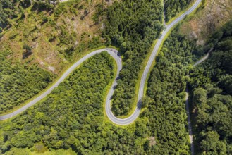
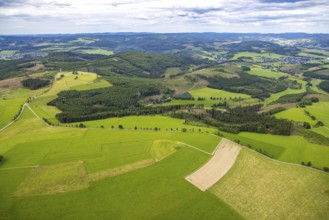
Aerial view, serpentines at the Ochsenkopf between...
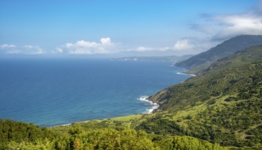
BRK25I65_400
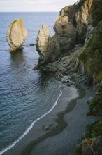
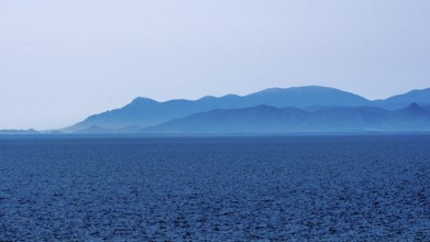
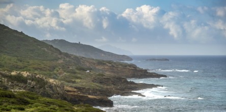
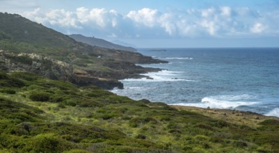
Sardinia, sea and mountains dipped in blue colour,...
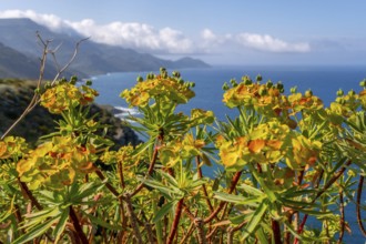
BRK25I65_480
Sardinia, spurge (Euphorbia) bushes on the coastal...
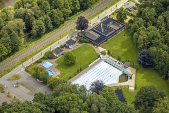
BRK25I56_099
Aerial view, outdoor swimming pool Neheim, swimmin...
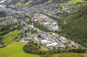
BRK25I56_222
Aerial view, commercial area Unterm Limburg with s...
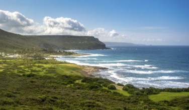
BRK25I65_451
Sardinia, mountains and wooded coast and sea, Bosa...
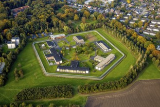
BRK25I57_035
Aerial view, Forensic Psychiatry - LVR Clinic, Hou...
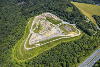
BRK25I56_132
Aerial view, Feldhaus landfill in the forest area ...
BRK25I65_483
Sardinia, mountainous coastal landscape by the sea...
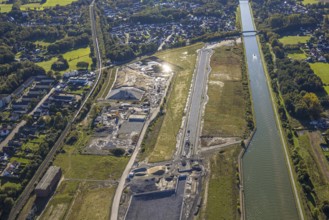
BRK25I56_313
Aerial view, Wasserstadt Aden on the Datteln-Hamm ...
BRK25I65_466
Sardinia, rugged coastal landscape by the sea, mou...
BRK25I56_278
Aerial view, construction site, construction work,...
BRK25I65_459
Sardinia, rugged coastal landscape by the sea, mou...
BRK25I56_226
Aerial view, forest area with forest damage, dista...
BRK25I67_270
Sardinia, Azienda Vitivinicola, Winery and vineyar...
BRK25I56_280
Aerial view, residential area Mühlenstraße corner ...
BRK25I56_449
Aerial view, commercial area in the Aue, roundabou...
BRK25I56_290
Aerial view, Teutoburg Forest, Bodelschwinghstraße...
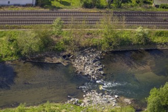
BRK25I56_281
Aerial view, boulders in the river Ruhr, Velmede, ...
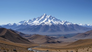
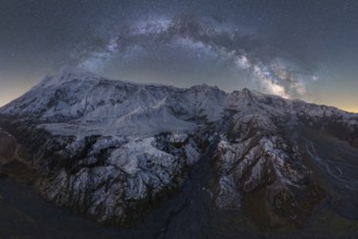
BRK25I46_039
A stunning landscape featuring towering snow-cappe...

BRK25H52_286
Female teacher with medical mask teaching geograph...
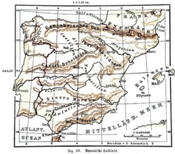
BRK25H88_174
Pyrenean Peninsula, historical geographical map, t...

BRK25H51_378
A depiction of the Earth engulfed in flames agains...
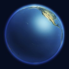
BRK25H52_062
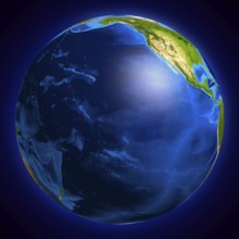
View of the Earth globe from space showing the Pac...
BRK25H52_078
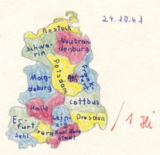
Homework for school, historical map of East German...
BRK25H51_137
Conceptual 3D Illustration of the Earth globe cove...
BRK25H51_395
High resolution Earth globe showing the surface of...
BRK25H80_406
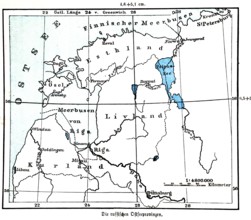
Russian Baltic Sea provinces, historical geographi...

BRK25H04_448
Image relative to politic situation between great ...

BRK25H04_262
Abstract colorful globe circle geometric pattern d...

BRK25H05_344
Image relative to politic situation in Egypt. Nati...
BRK25H13_359
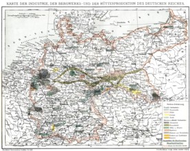
Map of industry, German Empire, 1894, Karte der In...
BRK25G84_131
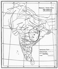
Map of medieval Hindu India, 750, 1200 AD
BRK25G51_045
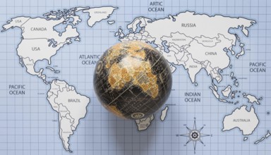
Top view globe world map. Resolution and high qual...

BRK25G96_315
An image of a nice fantasy landscape
BRK25G98_217
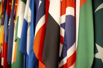
Some world national flags shot from an angle
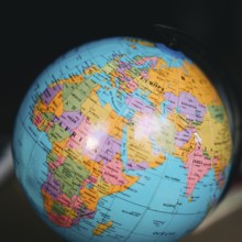
BRK25G51_080
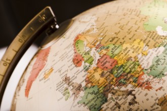
Close up world globe

BRK25G51_395
Globe on a shooping cart

BRK25G57_402
Words cloud relative to politic situation between ...
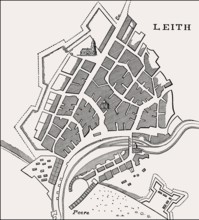
BRK25G95_059
Plan of Leith, Edinburgh, Scotland, 1693
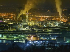
BRK25G05_115
Austria, Linz, industrial estate. Vöst and Chemica...
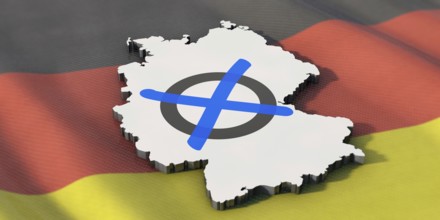
BRK25G04_175
Germany votes - parliamentary election. Germany vo...
BRK25G35_208
An image of a nice fantasy landscape
BRK25G06_489
close up old globe
BRK25G31_388
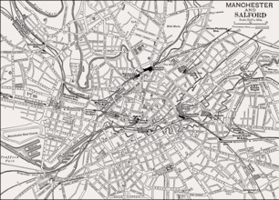
Map of Manchester and Salford, England, UK, 19th c...
BRK25G38_386
Historical map of ancient Greece with Asian and Th...
BRK25G03_482
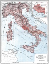
Map of old Italy
BRK25G01_335
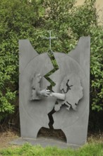
Sculpture for international reconciliation, metal ...
- Page
-
- of
- 33