Caption
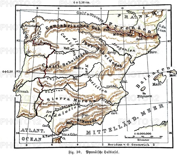
Pyrenean Peninsula, historical geographical map, topography, Madrid, Lisbon, Ebro, Tagus, Pyrenees, Cantabrian Mountains, Sierra Nevada, Balearic Islands, Mediterranean Sea, latitude and longitude, zero meridian, scale, distance in kilometres, Seydlitz Geography 1885
Date
Jul 12, 2025
Credit line
Photo12/imageBROKER/Wolfgang Diederich
Reference
BRK25H88_174
Model release
No
Property release
No
License type
Rights managed
Available size
90.1Mb (4.8Mb) / 20.0in x 17.5in / 5990 x 5260 (300dpi)