Caption
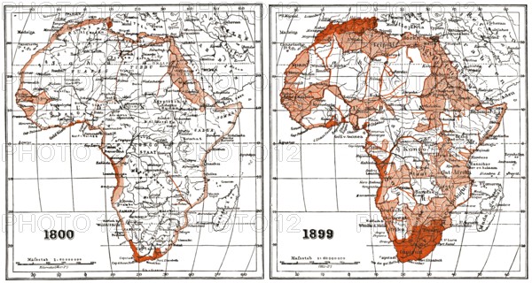
Map of Africa according to the state of research at the beginning and end of the 19th century
Credit line
Photo12/imageBROKER/Heinz-Dieter Falkenstein
Reference
BRK26D01_276
Model release
No
Property release
No
License type
Rights managed
Available size
94.9Mb (7.1Mb) / 26.3in x 14.0in / 7880 x 4210 (300dpi)