70 résultats pour : usgs
- Page
-
- sur
- 1
Connectez-vous pour plus de résultats
UMG22A39_368
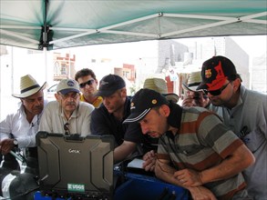
USGS NYWSC_Geophysical_training_in Iraq
UMG22A39_354
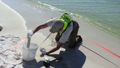
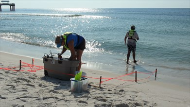
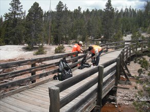
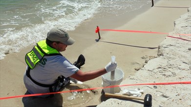
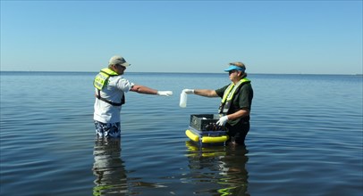
USGS Sediment Sampling at Henderson Beach State Pa...
UMG22A39_372
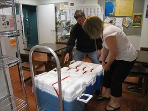
Oil Spill Samples Arrive from Louisiana ca. May 20...
UMG22A39_346
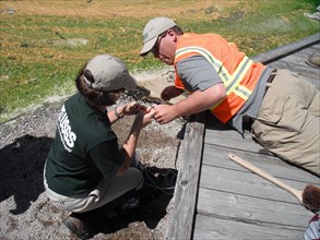
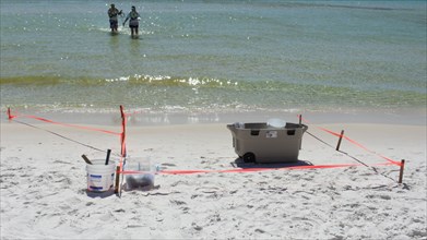
USGS Collects Sediments Samples at Pascagoula Beac...
UMG22A39_366
USGS scientists installing a temperature sensor un...
UMG22A39_373
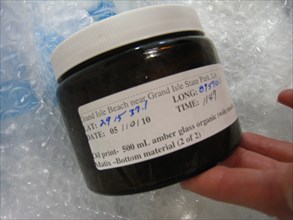
Deepwater Horizon Oil Spill Samples ca. 2010
UMG22A39_347
USGS Setting up at Sampling at Orange Beach, Alaba...
UMG22A39_374
Deepwater Horizon Oil Spill - Evaporated Samples A...
UMG22A33_111
USGS worker collects a Hurricane Irene sample at t...
UMG22A39_358
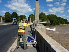
USGS employee conducts measurement at USGS gage 03...
UMG22A39_364
USGS scientists installing a temperature sensor un...
UMG22A39_375
Deepwater Horizon Oil Spill - Samples Undergo Liqu...
UMG22A39_350
USGS Sediment Sampling at St. George Island State ...
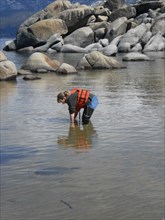
UMG22A39_363
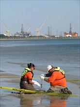
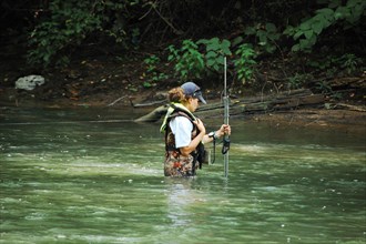
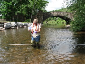
USGS hydrologist collecting a water quality sample...
UMG22A39_376
Deepwater Horizon Oil Spill - Samples Undergo Nitr...
UMG22A39_353
USGS Sampling Site at Henderson Beach State Park c...
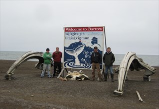
UMG22A39_356
The USGS Golden Geomagnetic crew in Barrow, Alaska...

UMG22A39_377
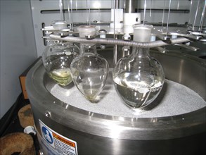
Deepwater Horizon Oil Spill - Samples Are Dissolve...
UMG22A39_247
1981 - Gas Sampling around the Mount St. Helens Do...
UMG22A39_378
USGS worker collecting water samples at Sand Harbo...
UMG22A39_348
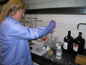
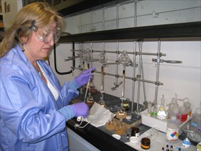
USGS Scientist Lisa Carper testing groundwater sam...
UMG22A39_349
USGS Water-Quality Sampling at St. Marks National ...
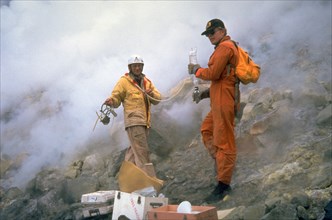
UMG22A33_110
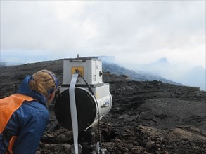
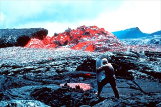
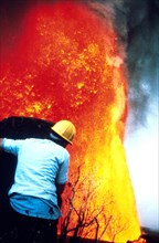
Monitoring Gas Emissions from Kilauea Volcano ca. ...
UMG22A39_072
1994 - Northridge, CA Earthquake Damage
UMG22A28_285
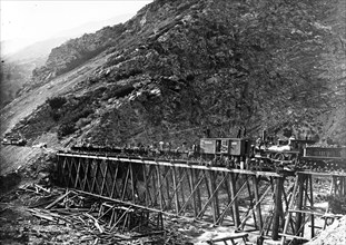
Devil's Gate Bridge, Weber County, Utah 1869.
UMG22A28_377
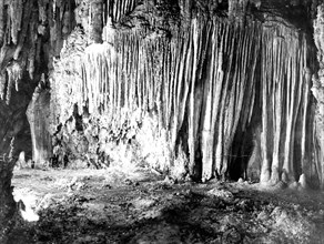
This photo was taken in 1923 inside Carlsbad Caver...
UMG22A32_222
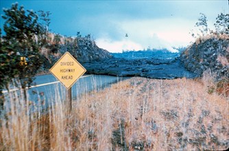
Taken on March 31, 1984, in Hawaii Volcanoes Natio...
UMG22A33_077
1984 Mauna Loa Eruption - Hawaii Volcano
UMG22A23_341
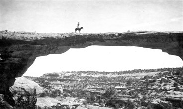
Natural Bridges National Monument in Utah. In this...
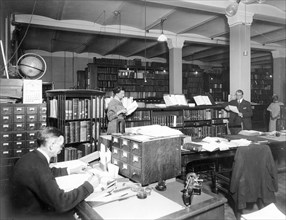
UMG22A23_340
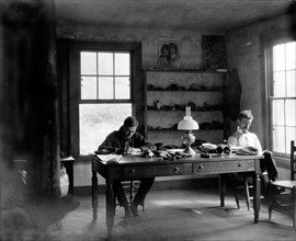
USGS Library in Hooe Building, Washington, DC, 191...
UMG22A24_409
1890 at Arkansas River near Canyon City, Colorado
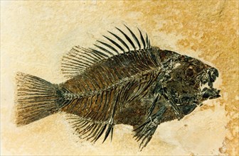
UMG22A32_244
A prepared Priscacara fossil, of a late early Eoce...
UMG22A25_136
Mauna Ulu eruption of Kilauea Volcano December 30 ...
UMG22A29_484
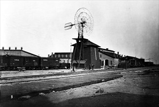
1869 Windmill at North Platte Station - North Plat...
UMG22A29_483
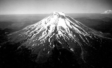
Mount St. Helens north flank at timberline, Skaman...
UMG22A29_482
This is a photo from June 1969 during the Mauna Ul...
UMG22A30_036
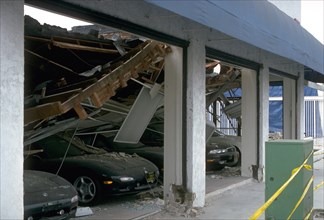
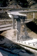
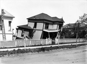
Northridge, CA Earthquake 1994
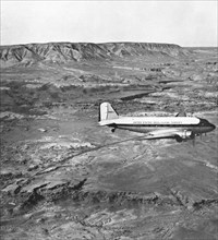
UMG22A33_044
This Douglas C–53D (N19924), crewed and operated b...
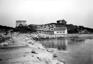
UMG22A29_481
Cape Cod National Seashore, Massachusetts from Aug...
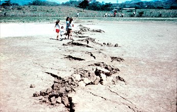
UMG22A30_037
1976 - Guatemala Earthquake 1976. 'Mole tracks' tr...
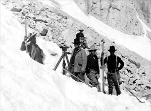
UMG22A33_045
In this photo, taken in August 1905, we see a USGS...
UMG22A30_152
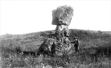
photo from 1916 of Pulpit rock near Alum Creek sou...
UMG22A24_334
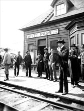
Klondike Gold Rush 1900

UMG22A29_480
John Wesley Powell
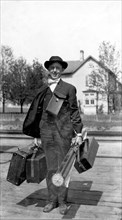
UMG22A30_151
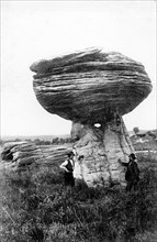
August 28th, 1901 photo of a gentleman with his ha...
UMG22A24_344
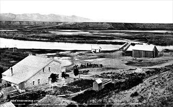
1872 - Bear River Hotel and Bear River Bridge at t...
UMG22A29_281
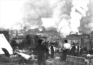
1906 San Francisco Earthquake

UMG22A29_397
St. Francis Dam Flood on March 12-13, 1928. The fl...
UMG22A29_479
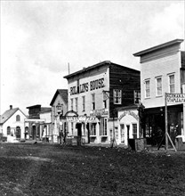
This is a stereoscopic view of Main St in Cheyenne...
UMG22A30_150
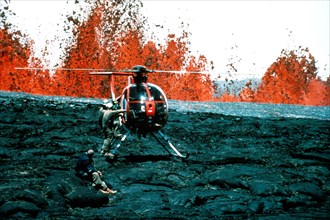
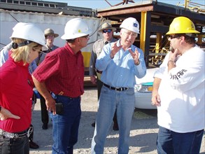
2010 USGS Deepwater Horizon Response - Secretary S...
UMG22A26_022
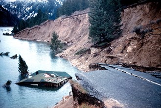
March 27, 1964 Alaska earthquake. The landslide oc...
UMG22A29_273
These gentleman geologists are hard at work in the...
UMG22A29_398
St. Francis Dam flood happened on March 12-13, 192...
UMG22A30_102
This photo was taken on July 15, 1980 which shows ...
UMG22A29_267
In this photo, taken on Sept 11, 1911, we see a pr...
UMG22A30_042
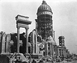
San Francisco City Hall after 1906 Earthquake
UMG22A33_082
1983 - Hawaii Volcano - In the year of '83 amongst...
UMG22A30_041
1906 San Francisco Earthquake
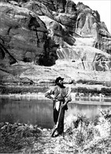
UMG22A30_100
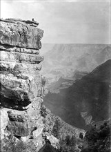
Ca. early 1900s - Man relaxing on edge of Grand Ca...
UMG22A30_040
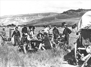
1870 Survey Crew - Group photo of all the members ...
UMG22A30_154
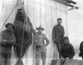
300-pound Halibut captured near Homer wharf in Ala...
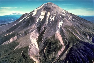
UMG22A33_103
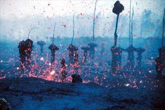
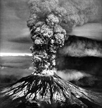
An iconic aerial view of the eruption of Mount St....
UMG22A30_101
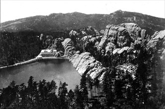
This historical photo of Sylvan Lake in Custer Cou...
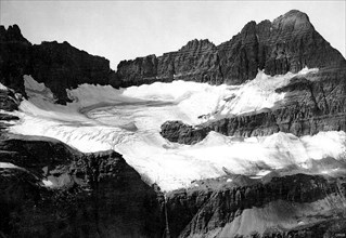
UMG22A30_039
1913 - Shepard Glacier — Well-defined boundaries a...
UMG22A30_153
John F. Steward, a member of the Powell Survey, in...
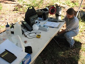
UMG22A30_045
Hydrologic Engineer Loaded with Field Equipment ca...
UMG22A30_044
Pre-1980 Eruption of Mount St. Helens
UMG22A30_043
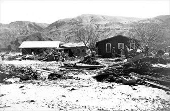
Montana 1959, M7.3 Earthquake — On August 17, 1959...
UMG21A23_101
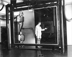
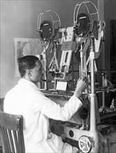
Jay Prendergast adjusts the lens on a Robertson 48...
UMG20A12_341