208 résultats pour : british cartography
- Page
-
- sur
- 3
Connectez-vous pour plus de résultats
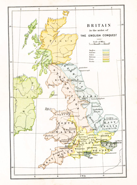
UMG25A05_103
This map shows Britain at the time when it was in ...
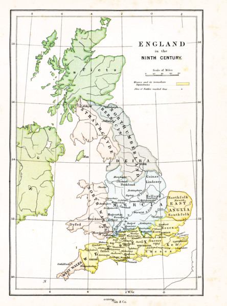
UMG25A05_104
This map shows Britain in the 9th century A.D. The...
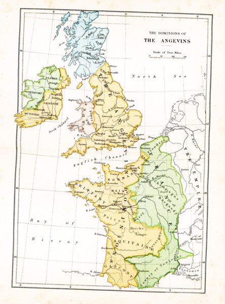
UMG25A05_102
This map shows the dominions of the Angevins in Br...
UMG24A07_010
This illustration dates to 1912 and is part of a s...
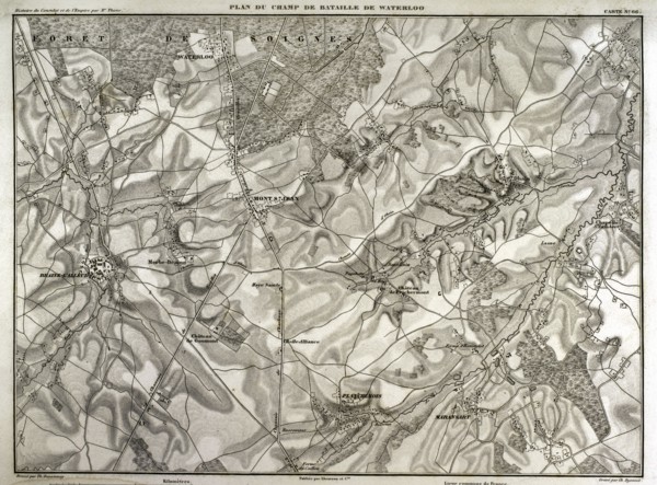
UMG21A15_058
Battlefield of Waterloo.
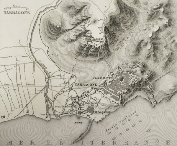
UMG21A15_031
Siege of Tarragona.
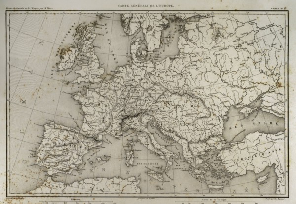
UMG21A15_009
Napoleonic map of Europe.
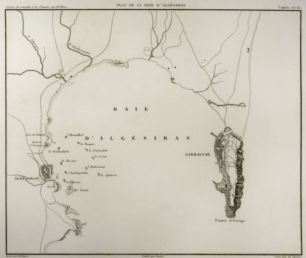
UMG21A15_004
Algeciras Bay.
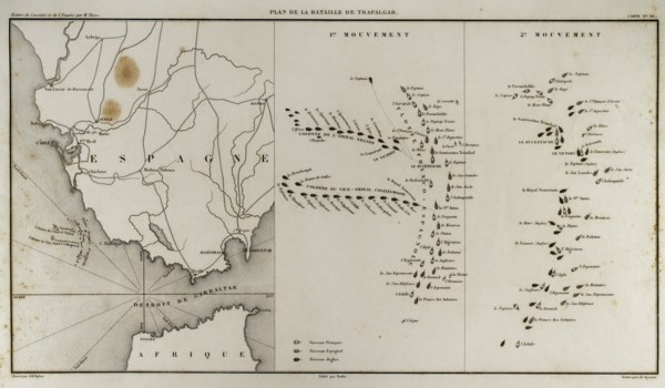
UMG21A15_012
Battle of Trafalgar.
UMG20B36_196
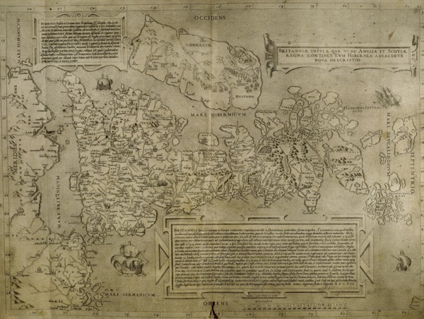
Map of the British Isles. 16th century. 1543
UMG20B36_186
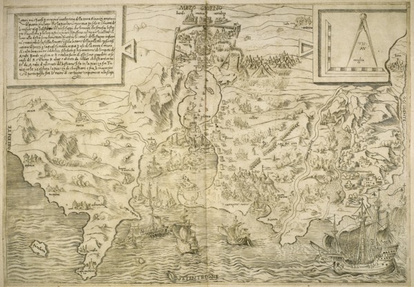
Map of the cities of North Africa. 16th century.

UMG20A45_301
Boy & Girl Have Breakfast
UMG20A01_324
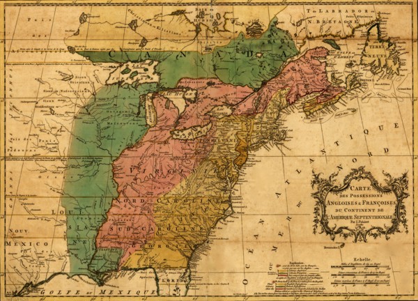
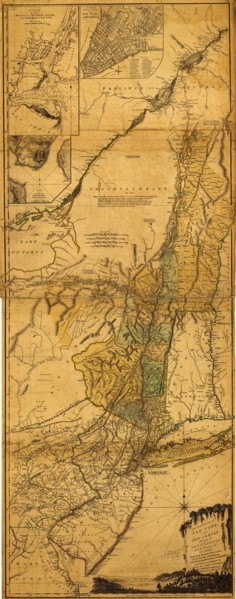
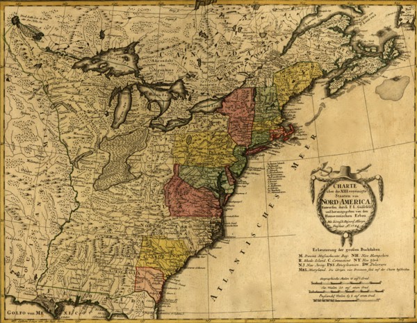
British & French Claims to North America - 1756 17...
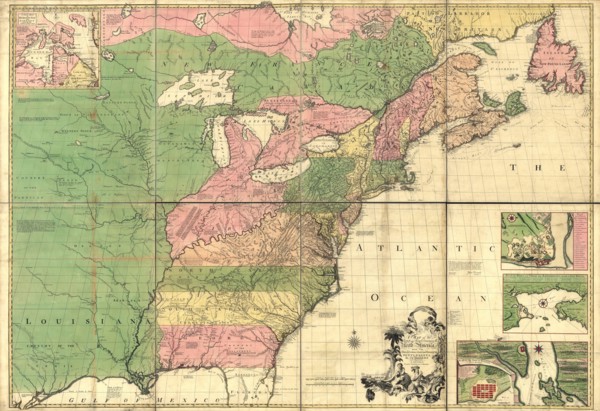
UMG20A01_335
British and French dominions in North America -175...
UMG20A03_214
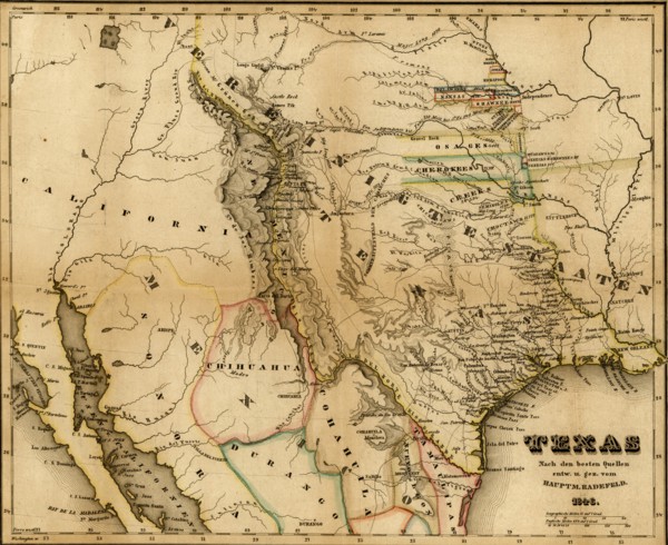
Texas - 1846 1846
UMG20A03_413
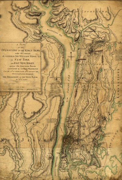
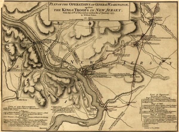
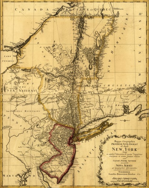
War of Independence New Jersey 1776
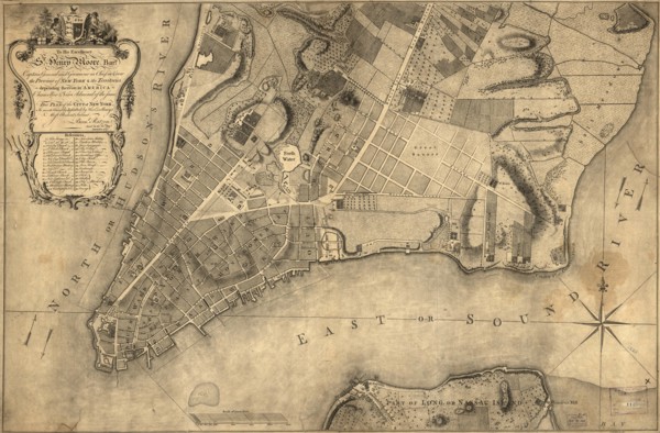
UMG20A03_422
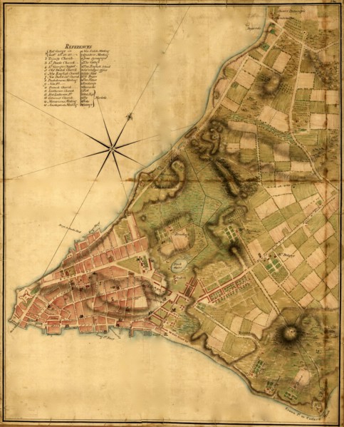
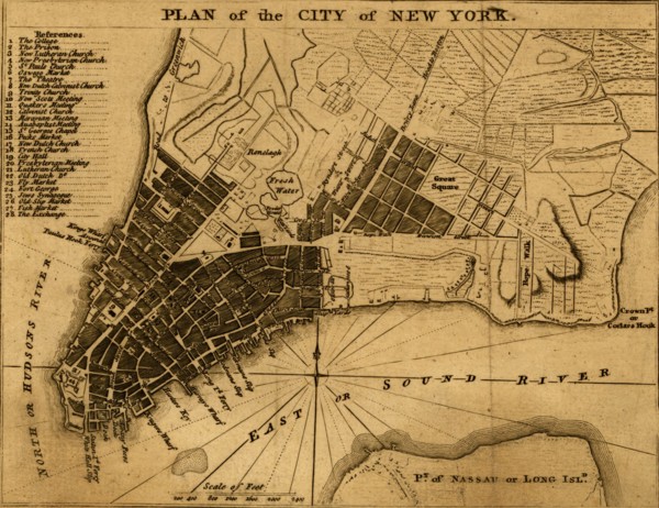
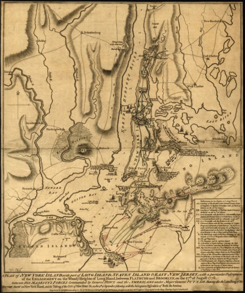
New York City Plan - 1776
UMG20A03_431
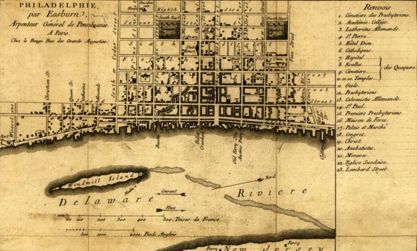
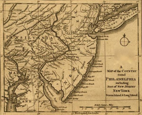
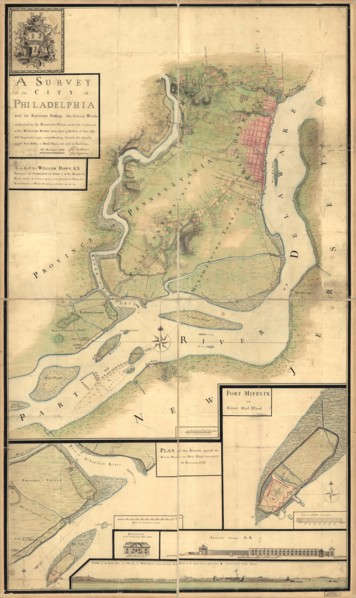
Philadelphia - 1776
UMG20A03_446
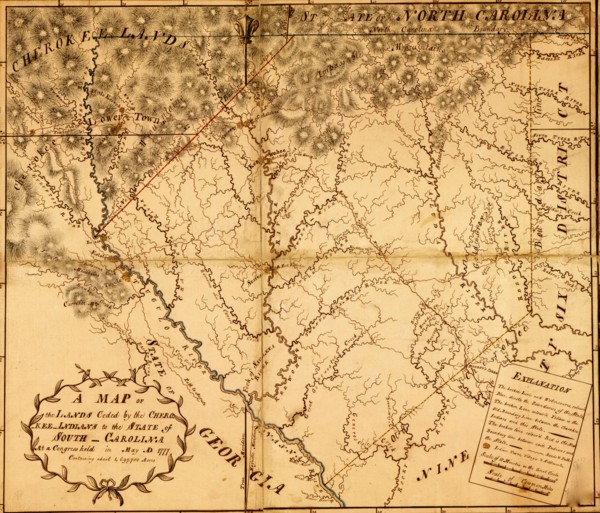
Carolina provide Indian Lands - 1777
UMG20A03_472
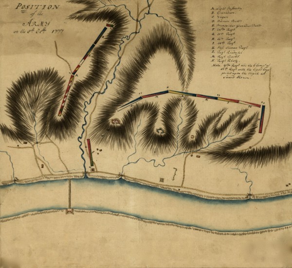
General Burgoyne at Swords House on Hudson's River...
UMG20A03_481
Ticonderoga & Lafayette along Lake Champlain 1777
UMG20A01_325
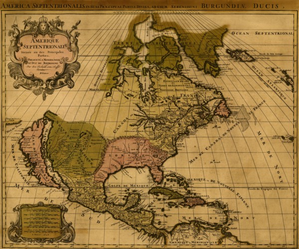
America in 1754 1754
UMG20A03_407
New England during the War of Independence 1776
UMG20A03_423
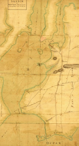
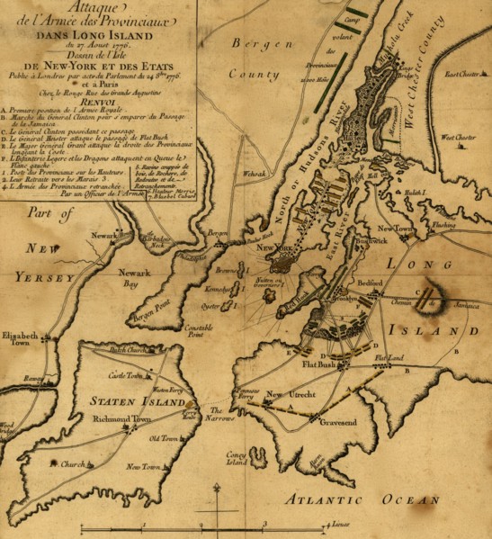
Sketch of New York, narrows & part of Long Island ...
UMG20A03_430
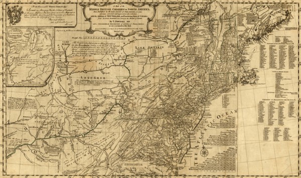
Middle Atlantic Colonies - 1776
UMG20A03_440
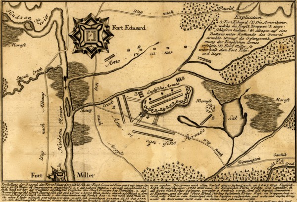
Battle of Fort Eduard - 1777
UMG20A03_471
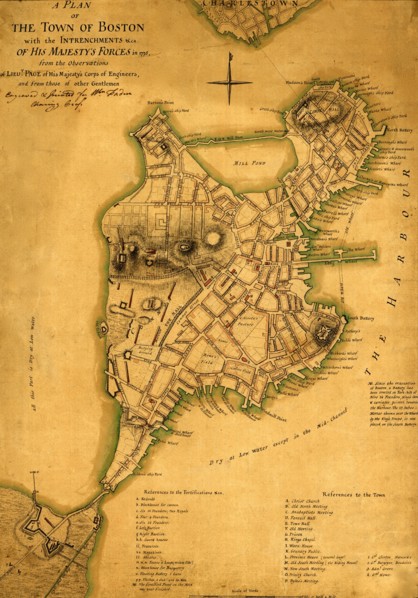
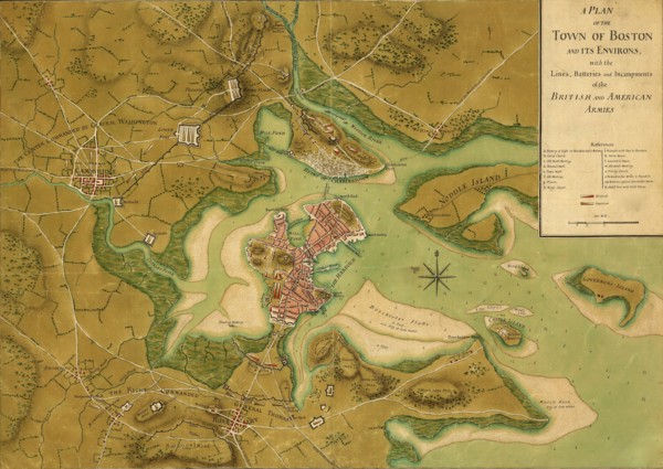
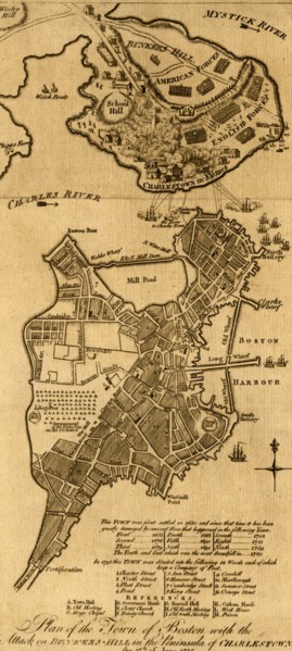
Plan of the town of Boston with British entrenchme...
UMG20A03_482
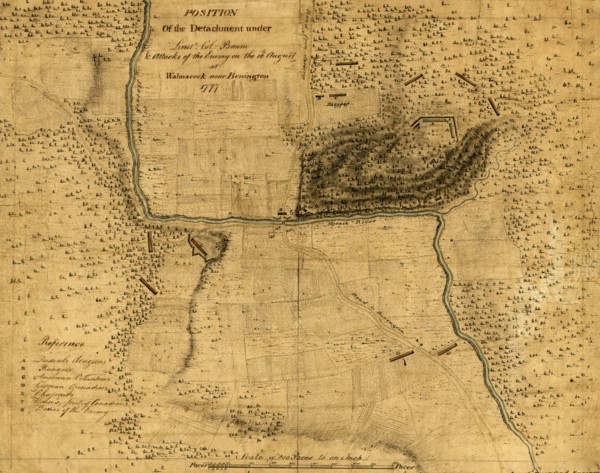
Walmscock near Bennington showing the attacks of t...
UMG20A04_113
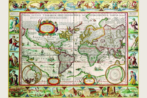
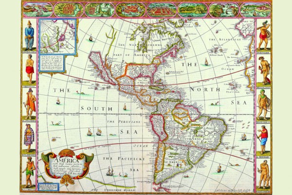
Map of the Americas 1628
UMG20A01_298
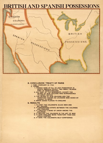
British & Spanish Possessions 1898
UMG20A03_393
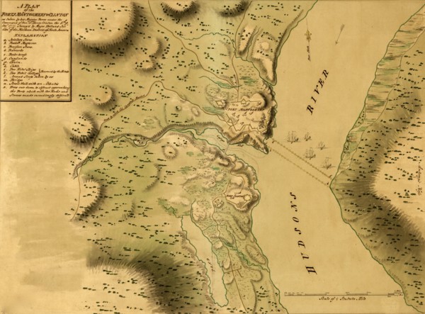
Forts Clinton & Montgomery - 1777
UMG20A03_402
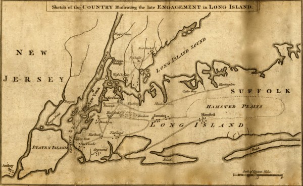
Battle of Long Island - 1776
UMG20A03_429
British Colonies - 1776
UMG20A03_437
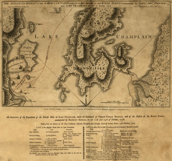
Battle of Valcour Island 1776
UMG20A03_457
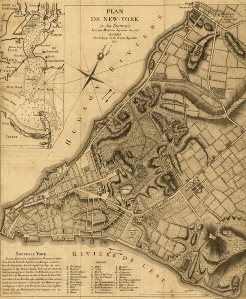
Plan of New York & Environs - 1777
UMG20A03_465
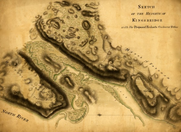
Sketch of the Heights of Kingsbridge, with the pro...
UMG20A03_474
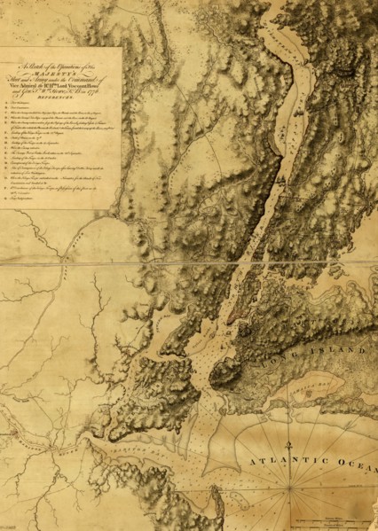
British fleet and army under Howe's Command 1777
UMG20A03_483
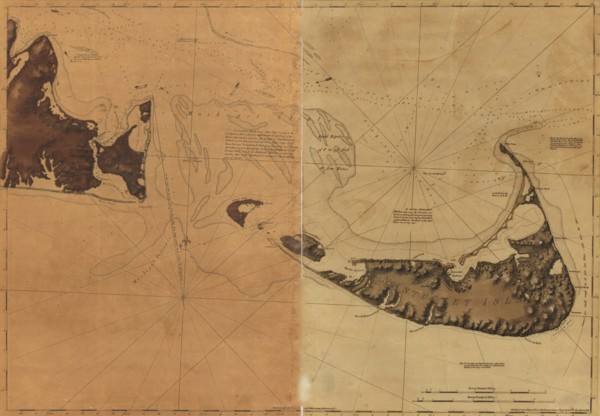
Nantucket Island and the eastern half of Martha's ...
UMG20A01_027
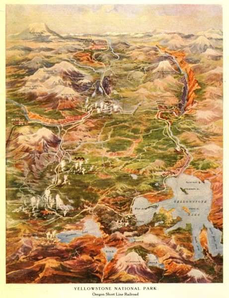
Yellowstone National Park
UMG20A03_392
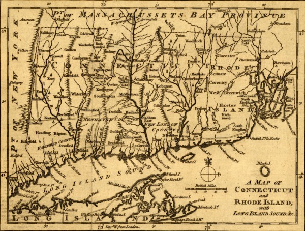
Connecticut and Rhode Island with Long Island Soun...
UMG20A03_403
Battle of Long Island - 1776
UMG20A03_428
New York & New Jersey - 1776
UMG20A03_438
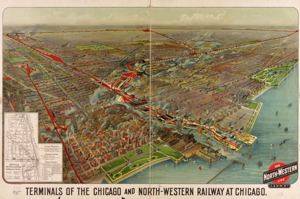
Terminals of the Chicago and North-Western Railway...
UMG20A03_456
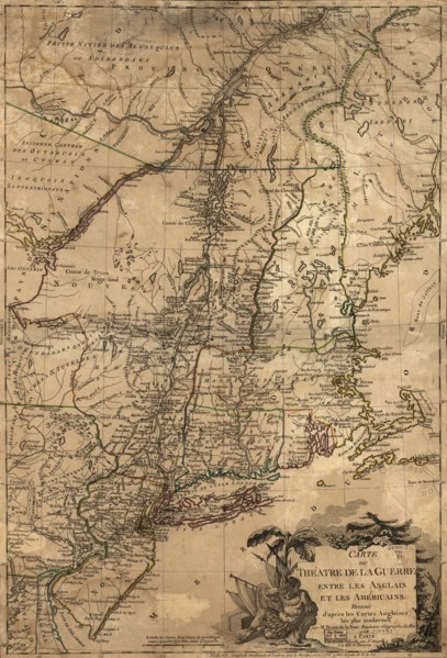
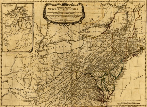
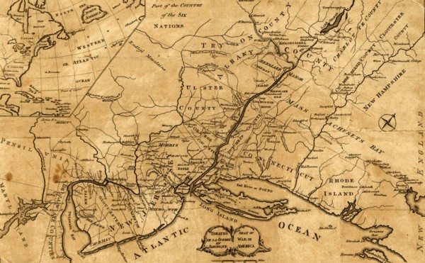
Theatre of War in the Thirteen Colonies - 1777 177...
UMG20A03_466
Plan of the Forts Montgomery & Clinton - 1777
UMG20A03_473
Fort Mifflin - 1777
UMG20A03_484
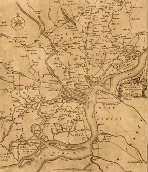
Philadelphia - 1777

UMG20A04_105
New & Accurate Map of the World; a Stereographic P...
UMG20A03_146
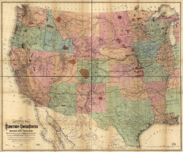
National Map of the Territories of the United Stat...
UMG20A03_155
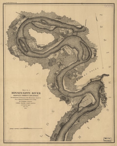
Mississippi River Reconnaissance for the use of th...
UMG20A03_382
Boston under Siege from the British - 1776
UMG20A03_427
French & English Settlements in North America - 17...
UMG20A03_435
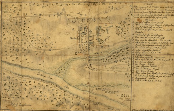
Battle of Trenton - 1776
UMG20A03_468
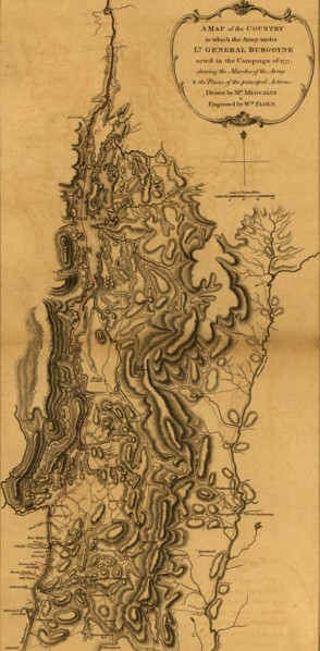
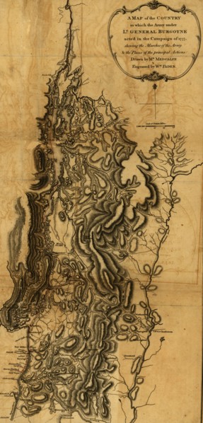
Expedition of General Burgoyne - 1778 1777
UMG20A03_477
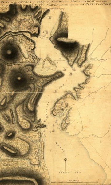
Plan of the attack of Fort Clinton and Montgomery ...
UMG20A04_004
Attack on Bunker Hill, Boston 1775

UMG20A04_087
Stereographic Projection of the World with Latitud...
UMG20A04_123
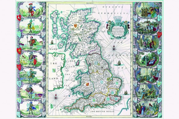
Britannia 1676
UMG20A01_296
Miscellaneous Explorations 1898
UMG20A01_365
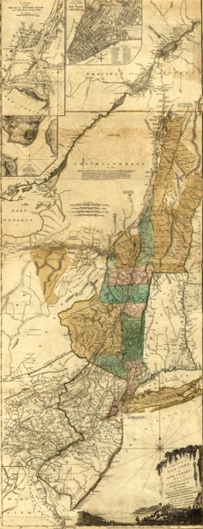
New York & New Jersey during the Revolution - 1778
UMG20A03_145
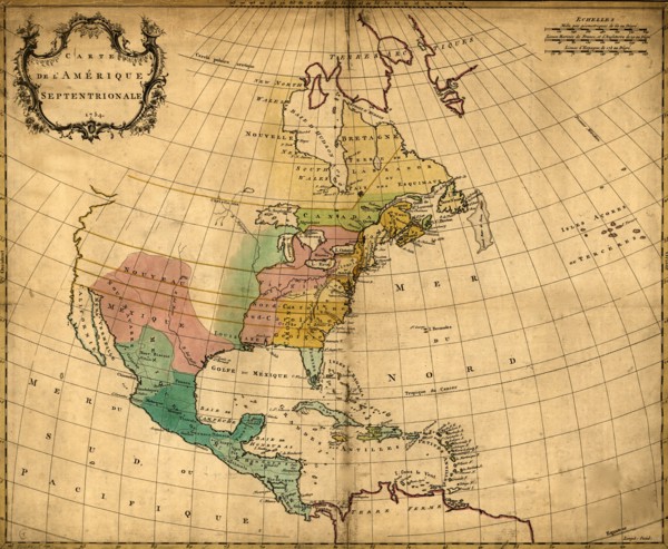
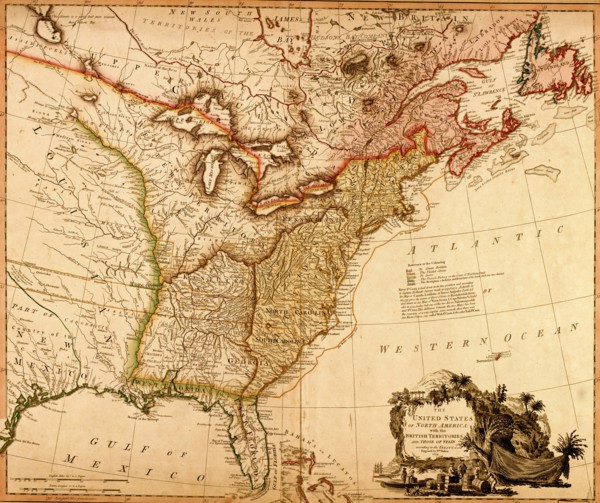
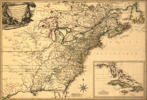
British Territories in North America - 1784 1784
UMG20A03_383
Rough draught of Boston and harbor - 1776
UMG20A03_436
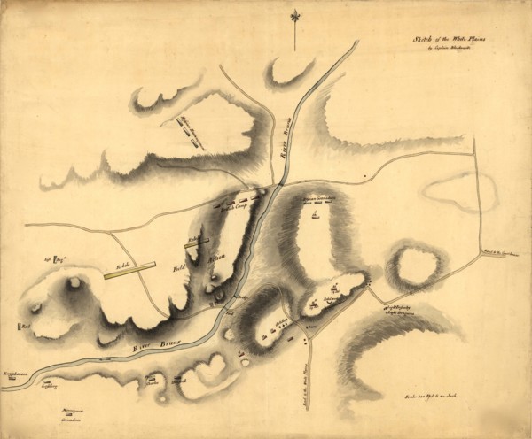
White Plains - 1776
UMG20A03_467
Expedition of General Burgoyne - 1777
UMG20A03_478
British Possessions at the Time of the War of Inde...
UMG20A04_003
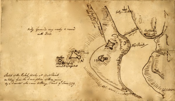
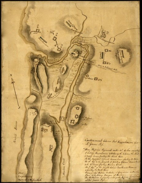
Colonial Defenses of West Poimt from Deserter's Ma...

UMG20A04_124
Africa 1640
UMG20A03_425
New York City map shows streets, wharves, ferries,...
UMG20A03_434
Battle of Trenton - 1776
UMG20A03_470
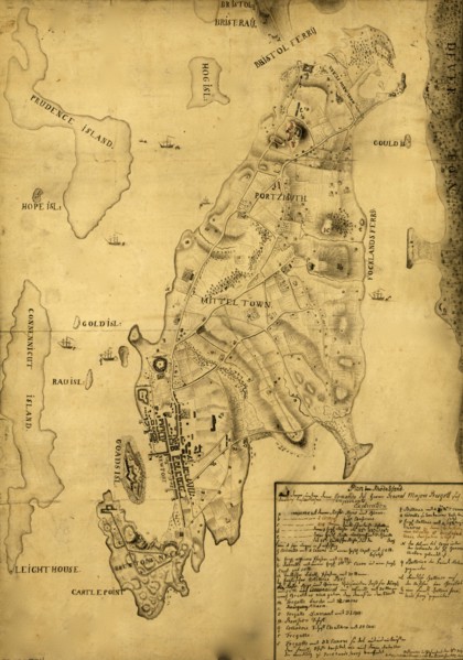
Rhode Island - 1777
UMG20A03_479
Fort Washington or Knypehausen - 1777
UMG20A04_013
American Positions after retreat to Long Island - ...
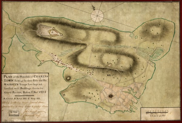
UMG20A04_024
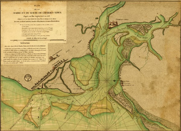
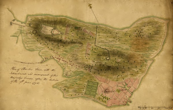
Charles Town Peninsula, posts of His Majesty's For...
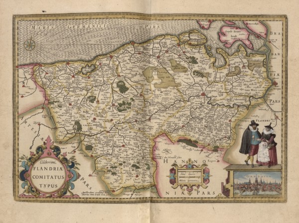
UMG20A01_047
Flanders, Belgium Map 1622
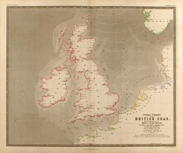
UMG20A02_104
British Isles, Waves, High Water & Tides 1848
UMG20A03_424
Plan of New York 1776
UMG20A03_469
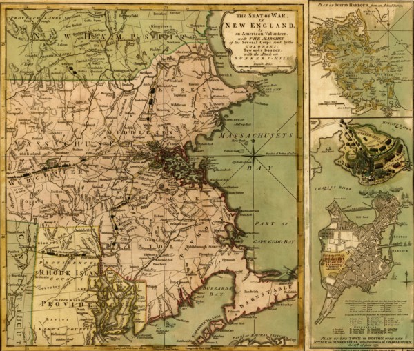
Seat of War in America - 1777
UMG20A03_480
British & German Troops in Saratoga - 1777
UMG20A04_014
British Troops on Fort Washington, Manhattan Islan...
UMG20A04_023
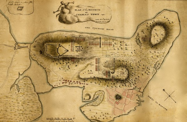
Plan of the heights of Charles Town 1775
UMG20A00_358
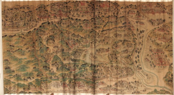
Map of Empire Palace in Rehol. 1750
UMG20A01_338
America Divided amongst Claimants - 1694 1694
UMG20A01_360
Theatre of War - 1779 1779
UMG20A01_439
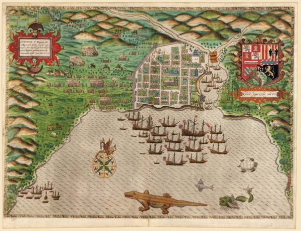
Sir Francis Drakes West Voyage to the West Indies;...
UMG20A03_151
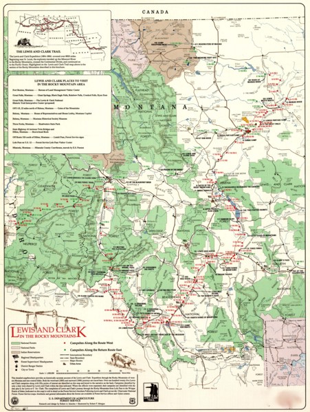
Lewis and Clark in the Rocky Mountains
UMG20A03_195
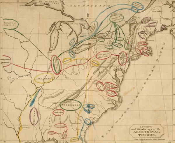
United States - Aboriginal Tribes
UMG20A03_387
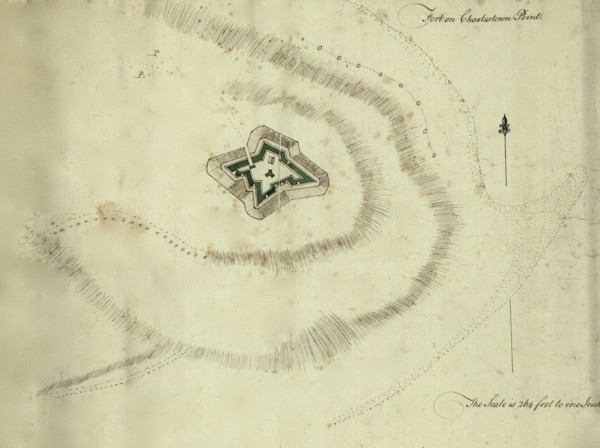
Fort on Charleston Point, Boston - 1776
UMG20A03_396
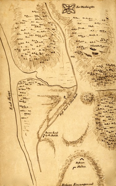
Fort Washington with the position of Hessian encam...
UMG20A03_405
Battle of Long Island - 1776

UMG20A03_414
War of Independence New Jersey 1776
UMG20A03_451
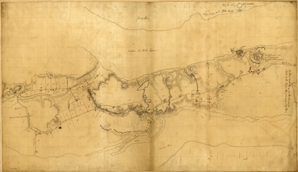
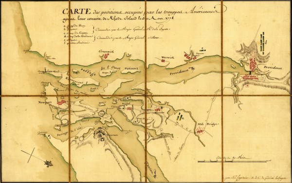
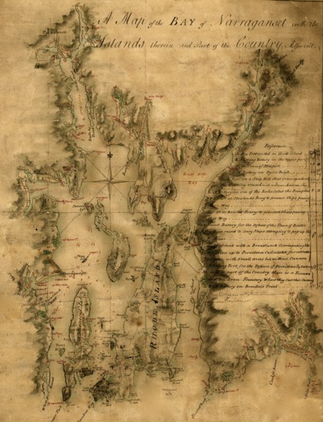
Narragansett Bay - 1777
UMG20A03_460
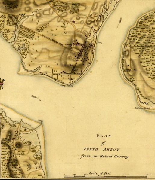
Perth Amboy - 1777
UMG20A04_011
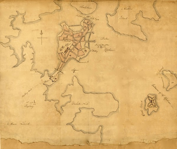
Charlestown Harbor after capture by the British 17...
UMG20A04_022
Bunker Hill - 1775 1775
UMG20A04_025
Seat of War with the attack on Bunker Hill 1775
UMG20A04_109
America 1676
UMG20A01_067
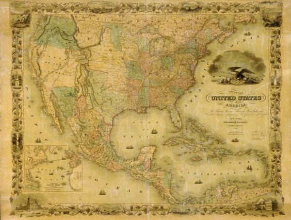
United States 1849
UMG20A01_339
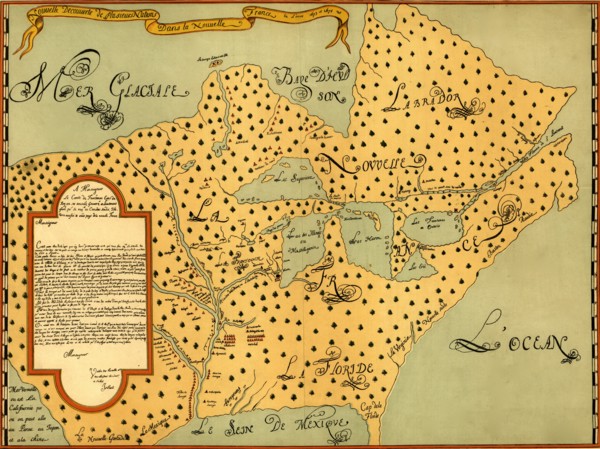
New France - 1673 1673
UMG20A01_361
Eighteenth Century Map of the United States - 1784...
UMG20A01_392
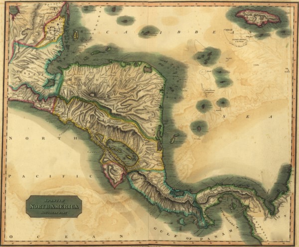
Spanish Central America 1816
- Page
-
- sur
- 3