Sujet
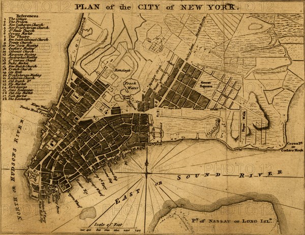
New York City map shows streets, wharves, ferries, principal buildings, and built-up area. 1776
Légende
New York City map shows streets, wharves, ferries, principal buildings, and built-up area.
Date
1776
Crédit
Photo12/Universal Images Group
Notre référence
UMG20A03_425
Model release
NA
Property release
NA
Licence
Droits gérés
Format disponible
11.5Mo (1.2Mo) / 19.3cm x 14.9cm / 2282 x 1758 (300dpi)