Période

10 résultats pour : pierre mortier

  • Page
  • sur
  • 1
Connectez-vous pour plus de résultats
The Venetian Doge's State Galley, 1693. The splendid galley, used by the ruler of Venice, is
HRM25A15_424

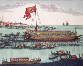
The Venetian Doge's State Galley, 1693. The splend...

The English man-of-war Royal, 1693. A warship pictured in full sail.
HRM25A15_423

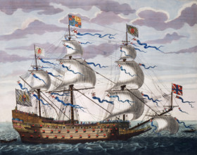
The English man-of-war Royal, 1693. A warship pict...

Map showing the Gulf of Mexico and surrounding area, 1705. New Mexico, Louisiana, Florida, Mexico,
HRM25A16_258

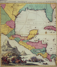
Map showing the Gulf of Mexico and surrounding are...

Map of the World, c1701. Nautical table showing magnetic variations. The phenomenon of magnetic
HRM25A14_177

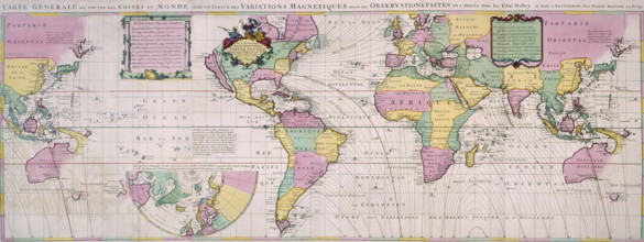
Map of the World, c1701. Nautical table showing ma...
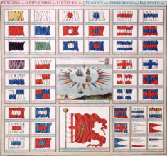
Naval ensigns and pennants, c1693. 'Pavillons avec l'Explication des Couleurs &c' (Flags with
HRM25A15_433

Naval ensigns and pennants, c1693. 'Pavillons avec...
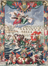
Frontispiece of Mortier's "Neptune François", 1693. Pieter Mortier was a Dutch publisher of French
HRM25A15_428

Frontispiece of Mortier's "Neptune François", 1693...
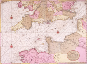
Map of the English Channel, 1693. 'Carte de la Manche'. During the reign of Louis XIV, the French
HRM25A15_430

Map of the English Channel, 1693. 'Carte de la Man...
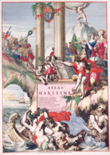
Title page of a maritime atlas, c1693-c1694. This is from volume II of the "Atlas Maritime",
HRM25A15_429

Title page of a maritime atlas, c1693-c1694. This ...
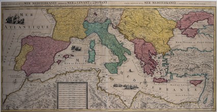
Marine chart of the eastern part of the Mediterranean Sea with the entire African coast..., 17th cen Creator: Sanson, Nicolás (1600-1667) .
HRM23A21_203

Marine chart of the eastern part of the Mediterran...

'The Zimbabwe Ruins near Fort Victoria, Rhodesia, South Africa', c1930s. Creator: Unknown.
HRM19F29_032

'The Zimbabwe Ruins near Fort Victoria, Rhodesia, ...