7333 résultats pour : island
- Page
-
- sur
- 74
Connectez-vous pour plus de résultats
HRM26A22_147
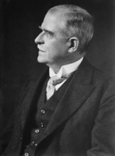
Sir Gerald Strickland, between c1915 and c1920. Cr...
HRM26A27_375
The Slaughter of the Suitors of Penelope, (1810?)....
![Temple of Aphaena [sic], Aegina, Greece, c1955. Creator: Arthur Charles Kirby Ware.](https://lres.photo12.com/th/t-hrm26a28_290.jpg)
HRM26A28_290
Temple of Aphaena [sic], Aegina, Greece, c1955. C...
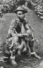
HRM26A25_247
Siova-Biahome, chieftain of Musola (Boloko, South ...
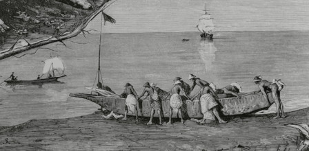
HRM26A25_303
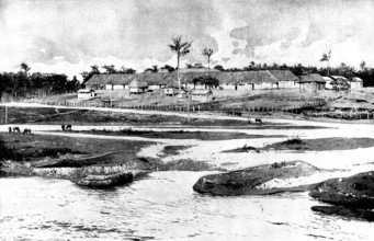
Bubis launching a canoe into the water, Concepcion...
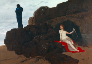
HRM26A27_269
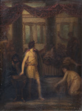
Prospero and Miranda, 1803. Creator: Henry Thomson...
HRM26A24_097
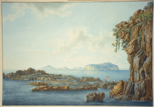
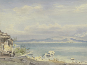
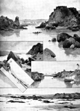
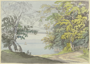
Coastal landscape of Bonne Nuit Bay, 1881. Creator...
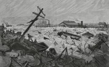
HRM26A25_297
Invasion of Herr's Island, (Pittsburgh) by water a...
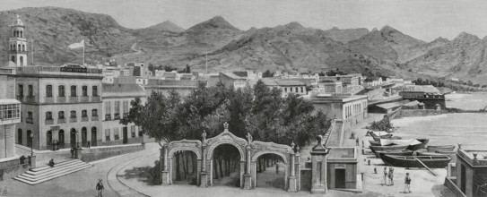
HRM26A25_308
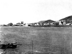
Calle de la Marina, (La Marina Street) and Alameda...
HRM26A27_245
Study of a Dutch girl leaning against a fence, (Ma...
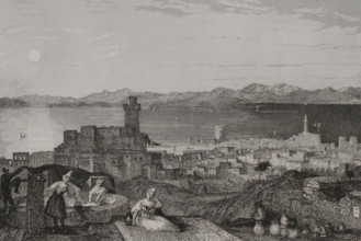
HRM26A23_489
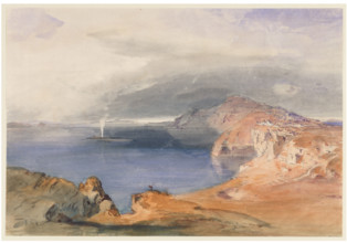
Santorini (Thira), c1843. Creator: Carl Rottmann.
HRM26A24_402
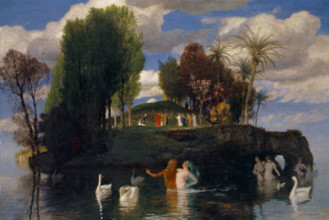
The island of life, 1888. Creator: Arnold Bocklin.

HRM26A27_446
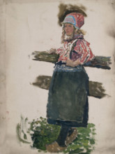
Study of a young girl carrying a pole, (Marken), m...
HRM26A24_446
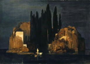
Isle of the Dead, 1880. Creator: Arnold Bocklin.
HRM26A23_191
Sicily, rocky shore by the sea, three fishermen in...
HRM26A23_372
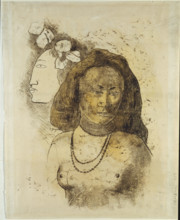
Tahitian Woman with Evil Spirit, c1899-1900. Creat...
HRM26A22_214
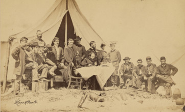
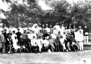
General Gillmore & Staff, 1863. Creator: Haas & Pe...
HRM26A23_371
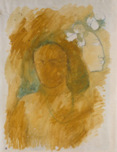
Tahitian Woman with Evil Spirit, c1899-1900. Creat...
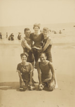
HRM26A22_186
Group portrait on the beach, Block Island, 1912. C...
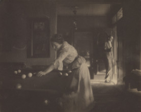
HRM26A22_213
Gertrude Käsebier O'Malley at Billiards (Self-port...
HRM26A24_468
Odysseus and Calypso, 1882. Creator: Arnold Bockli...
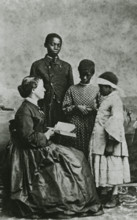
HRM26A22_075
Portrait of teacher Laura M. Towne, a founder of t...

HRM26A26_060
Canal Houtgracht with drawbridge, Amsterdam, Nethe...
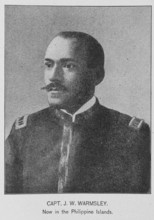
HRM26A22_082
Capt. J.W. Warmsley; Now in the Philippine Islands...
HRM26A26_030
Rhodes, 1840. Creator: Leonce Lhuillier.
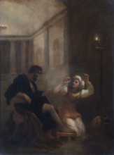
HRM26A27_374
Ulysses discovered by his Nurse, (1810?). Creator:...
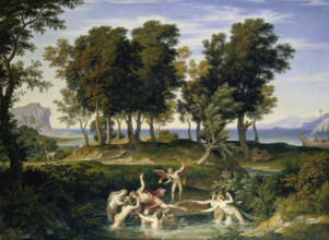
HRM26A12_202
Landscape with the Rape of Hylas, 1832. Creator: J...
HRM26A14_457
The Trial of M. Zola in Paris: scenes at the Assiz...
HRM26A15_242
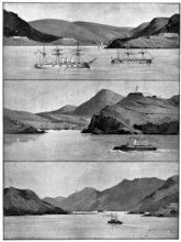
The Spanish-American Crisis: views of the Islands ...
HRM26A15_260
The Barrage of the Nile, 1898. Creator: Unknown.
HRM26A15_427
The Spanish-American War:...Grand Canary Island......
HRM26A15_020
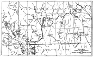
Gold in British Columbia: plan of the associated g...
HRM26A15_440
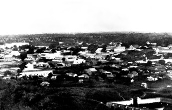
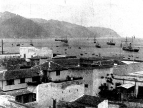
The Spanish-American War: general view of Ponce, P...
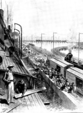
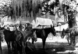
HRM26A16_074
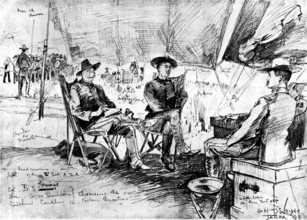
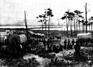
The Spanish-American War - in camp at Tampa: Ameri...
HRM26A16_081
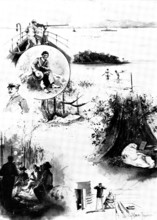
The Spanish-American War: our special artist in Cu...
HRM26A16_092
The Chinese Question: British, American, German, a...
HRM26A16_265
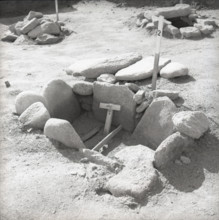
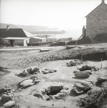
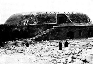
Bronze Age burial site, St Mary's, Scilly Isles, c...
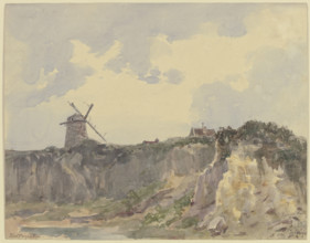
HRM26A17_021
Isles of Scilly, c1960s. Creator: Arthur Charles K...
HRM26A14_458
The Trial of M. Zola in Paris: scenes at the Assiz...
HRM26A14_274
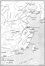
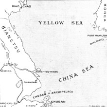
The Chinese Crisis: positions of Port Arthur and K...
HRM26A15_241
The Spanish-American Crisis: views of the Islands ...
HRM26A12_053
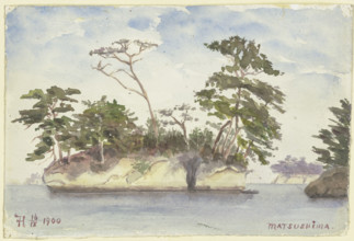
Group of islands off Matsushima, 1900. Creator: Fr...
HRM26A15_439
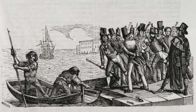
The Spanish-American War: landing-place in the har...

HRM26A16_027
Advertisement for "Montserrat" Lime-Fruit Juice, 1...
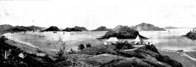
HRM26A16_091
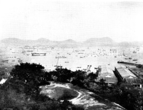
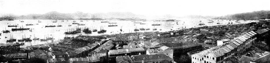
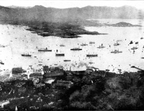
The Chinese Question: the harbour of Hong Kong...,...
HRM26A16_266
Bronze Age burial site, St Mary's, Scilly Isles, c...
HRM26A15_205
The Chinese Question: views of the stations acquir...
HRM26A12_006
Frauenchiemsee, 1876. Creator: Ernst Morgenstern.
HRM26A12_028
Herreninsel Island with its monastery in Lake Chie...
HRM26A15_315
The Spanish-American War: views in the Philippine ...
HRM26A15_359
Rear-Admiral W. T. Sampson, Commander-In-Chief of ...
HRM26A16_101
Lord Charles Beresford's party at Portsmouth: M.P....
HRM26A16_373
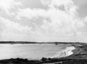
Causeway from Gugh to St Agnes, Scilly Isles, c195...
HRM26A14_279
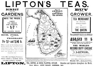
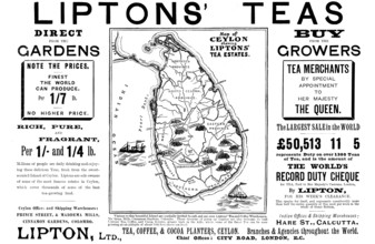
Advertisement for Lipton's Teas, 1898. Creator: Un...
HRM26A15_215
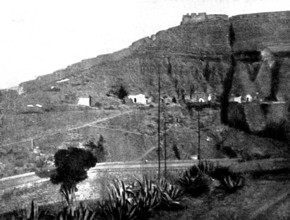
The Chinese Question: Wei-Hai-Wei, the naval fort ...
HRM26A15_272
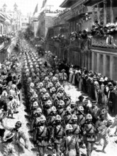
The Spanish-American War: Spanish troops marching ...
HRM26A12_005
Frauenchiemsee, 1876. Creator: Ernst Morgenstern.
HRM26A13_242
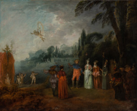
The Embarkation for Cythera, c1709-1710. Creator: ...
HRM26A15_441
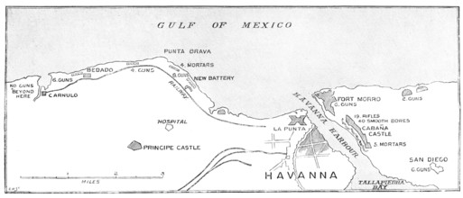
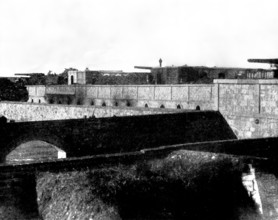
The Spanish-American War: the defences of Havana.....
HRM26A17_146
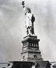
Statue of Liberty, New York City, c1955. Creator: ...
HRM26A12_252
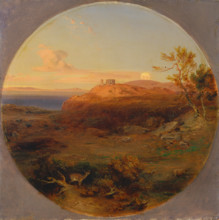
Greek Landscape on the Island of Aegina, 1842-1845...
HRM26A15_246
The Spanish-American Crisis: views of the Islands ...
HRM26A11_280
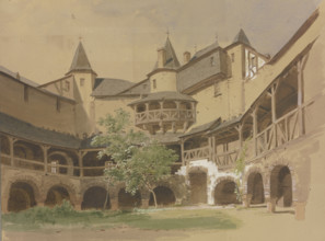
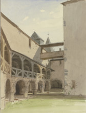
Pfalzgrafenstein Castle near Kaub, 1849. Creator: ...
HRM26A15_489
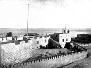
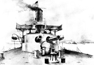
The Spanish-American War: the United States monito...
HRM26A16_114
The Spanish-American War: loading the United State...
HRM26A15_182
The Chinese Question: battery on the Island of Liu...
HRM26A15_245
The Spanish-American Crisis: views of the Islands ...
HRM26A15_256
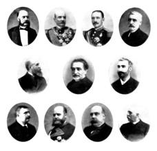
The Spanish-American Crisis: the leaders of Spanis...
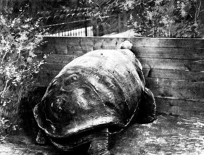
HRM26A15_263
The last surviving Galapagan Tortoise, 1898. Creat...
HRM26A16_113
The Spanish-American War:...United States Mobilisa...
HRM26A14_306
The Chinese Crisis: the Chusan Islands, commanding...
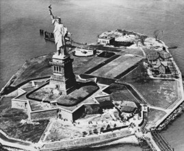
HRM26A17_144
Statue of Liberty, New York City, c1955. Creator: ...
HRM26A17_243
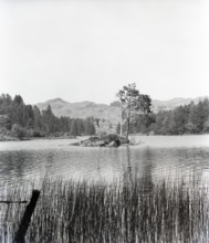
Tarn Hows, Lake District, c1955. Creator: Arthur C...
HRM26A15_244
The Spanish-American Crisis: views of the Islands ...
HRM26A13_256
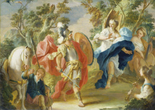
Rinaldo and Armida in the Magic Forest, 1730-1738....
HRM26A16_116
The Spanish-American War: the "Sandoval" encampmen...
HRM26A14_384
The Cretan Question: officers of the international...
HRM26A15_243
The Spanish-American Crisis: views of the Islands ...
HRM26A11_281
Pfalzgrafenstein Castle near Kaub, 1849. Creator: ...
HRM26A14_305
The Chinese Crisis: relative positions of the isla...
HRM26A15_036
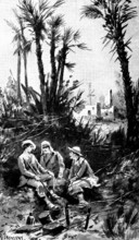
The Soudan Advance: scenes on the Nile, 1898. Crea...
HRM26A15_279
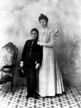
Christina, Queen-Regent of Spain, and her son, Alf...
HRM26A16_093
The Chinese Question: British Kowloon, from Hong-K...
HRM26A16_115
The Spanish-American War: the United States camp a...
HRM26A21_103
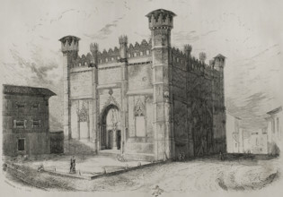
La Lonja or Sa Llotja, (Palma Market), Palma, Majo...
HRM26A19_311
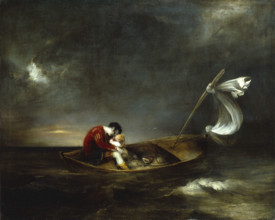
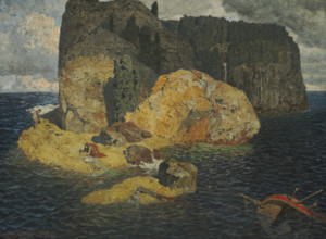
Island Shipwreck. Creator: Rothaug, Alexander (187...
HRM26A15_277
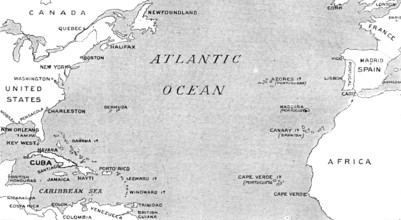
The Spanish-American War: map illustrating the rel...
HRM26A15_322
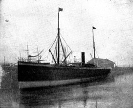
The Spanish-American War: steam-ship "Buenaventura...
HRM26A16_118
The Spanish-American War: Spanish schooner running...
HRM26A20_172
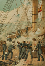
Casto Méndez Núñez wounded during the Battle of Ca...
HRM26A15_321
The Spanish-American War: Spanish outposts in Cuba...
HRM26A13_015
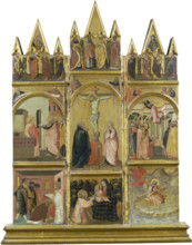
Crucifixion, Virgin and Child, Deacon and Scenes f...
HRM26A15_278
The Spanish-American War: the steam-ship "New York...
HRM26A16_117
Spanish-American War: U.S. Mobilisation at Tampa: ...
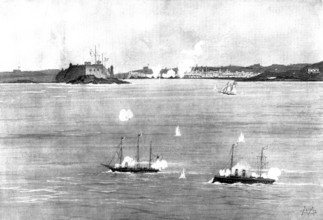
HRM26A15_320
The Spanish-American War: the Spanish Flotilla at ...
HRM26A20_415
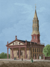
St Paul's Chapel in Manhattan, New York, 1837, (18...
HRM26A11_447
View from the shore of Mainau Island towards Lake ...
HRM26A15_220
The Chinese Question:...Fort on Itan Island, after...
HRM26A20_185
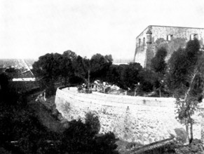
First Carlist War, (1833-1840), Barcelona, Catalon...
HRM26A15_229
Advertisement for Liptons' Teas, 1898. Creator: Un...
- Page
-
- sur
- 74