84 résultats pour : model map
- Page
-
- sur
- 1
Connectez-vous pour plus de résultats
BRK26C32_412
Silver figure explorer traveling by Ekaterina Kova...
BRK26C32_414
Silver figure explorer traveling by Ekaterina Kova...
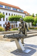
BRK26B77_136
Weinsberg is a town in the district of Heilbronn, ...
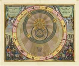
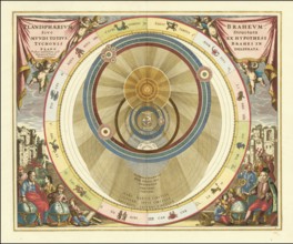
BRK26B12_023
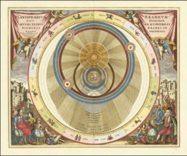
Planisphaerium Braheum, a famous historical celest...
BRK26B12_034
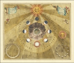
Historical copper engraving entitled Phases of the...

BRK26B12_036
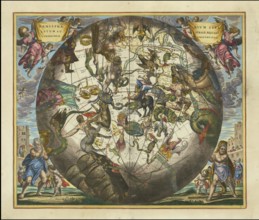
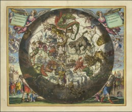
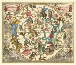
Sky map of the northern sky, known as Hemisphaeriu...
BRK26B12_044
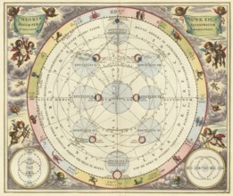
Historical astronomical map Theoria Lunae, Eius Mo...
BRK26B12_035
Planisphaerium of Aratos from the famous celestial...
BRK26B12_025
Sky map Hemisphaerii Borealis Coeli et Terrae Spha...
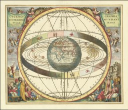
BRK26B12_029
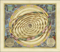
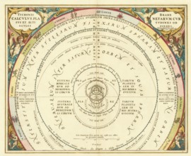
Orbium Planetarum Terram Complectentium Scenograph...
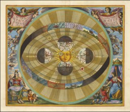
BRK26B07_429
Historical presentation of the tychonic world view...
BRK26B12_027
Ancient star map, specifically a depiction of the ...
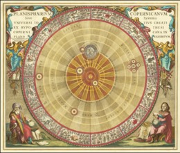
BRK26B12_041
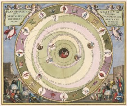
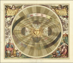
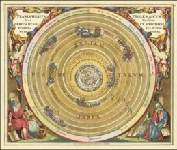
Scenographia Systematis Copernicani, scenography o...
BRK26B12_030
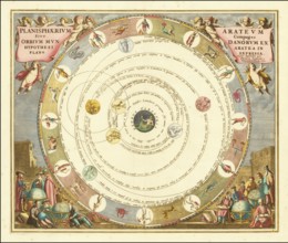
Planisphaerium Arateum, part of the famous celesti...
BRK26B12_031
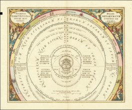
A 17th century illustration of Tycho Brahe's geo-h...

BRK26B12_024
Historical celestial map depicting the Ptolemaic, ...
BRK26B12_032
Historical astronomical map titled Planisphaerium ...
BRK26B12_021
Historical sky map with Ptolemy's geocentric world...
BRK26B12_026
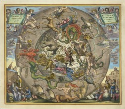
Haemisphaerium Stellatum Boreale cum Subiecto Hæmi...
BRK26B12_033
Presentation of the geocentric world view based on...
BRK26B12_017
Historical presentation of the Tychonic world syst...
BRK26B12_038
Historical sky map Corporum Coelestium Magnitudine...
BRK26B12_047
Historical sky map titled Haemisphaerium Stellatum...
BRK26B12_048
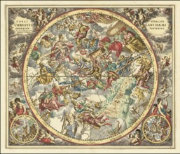
Historical sky map titled Coeli Stellati Christian...
BRK25H78_367
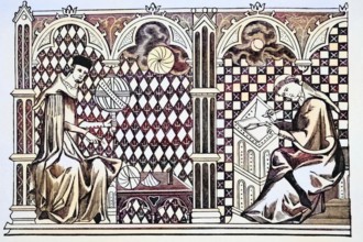
Mathematician monks, one teaching the globe, the o...
BRK25H79_216
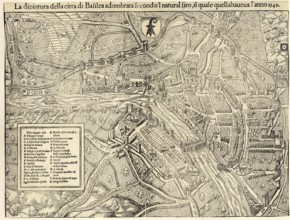
City map of Basel around 1549, Switzerland, reprod...
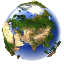
BRK25G18_478
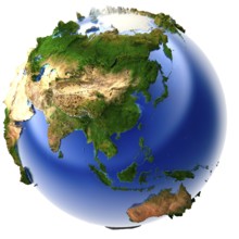
3D model of the globe with an exaggerated vertical...
BRK25G19_088
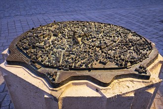
Munich, GERMANY - 9 MARCH 2018: Munich bronze mini...
BRK25F87_411
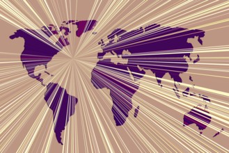
World map design. Earth with continents. Map of eu...
BRK25F51_133
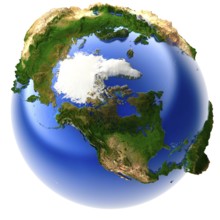
3D model of the globe with an exaggerated vertical...
BRK25E86_408
3D model of the globe with an exaggerated vertical...
BRK25E37_155
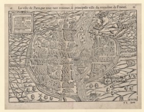
City map of Paris in 1568, France, reproduction fr...
BRK25E48_390
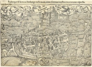
Town map of Rouffach, Rufach, in 1548, today Depar...
BRK25E16_048
Copernicus' heliocentric model of the universe, 16...

BRK25D57_472
Child holding a small model globe in hand on white...
BRK25D13_249
World map design. Earth with continents. Map of eu...
BRK25D22_071
World map design. Earth with continents. Map of eu...

BRK25D14_199
Little model globe on white background in view
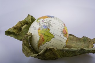
BRK25D25_376
Little model globe placed on dry Autumn leaf

BRK25C79_440
Claudius Ptolemy's geocentric model of the Univers...
BRK25C78_195
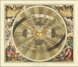
Heliocentric model of the universe, as proposed by...
BRK25C75_196
Danish astronomer Tycho Brahe's model of the unive...
BRK25B78_181
Museum of German Inland Navigation, in the former ...

BRK24I31_122
Old frigate pirate ship adventure with rustic glob...
BRK24H23_042
Model released young man hiker map reading

BRK24C51_089
An Earth globe placed on a wooden dock overlooking...
BRK24B59_273
Child pointing at location on three dimensional mo...
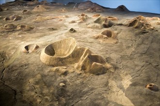
BRK24A92_355
Model map of volcanoes at Timanfaya Volcano Interp...
BRK23G64_292
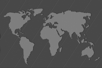
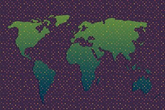
World map design. Earth with continents. Map of eu...
BRK23G64_318
World map design. Earth with continents. Map of eu...
BRK23G64_036
World map design. Earth with continents. Map of eu...
BRK23G64_035
World map design. Earth with continents. Map of eu...
BRK23G64_073
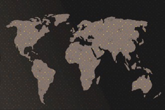
World map design with heart pattern. Earth with co...
BRK23G64_011
World map design. Earth with continents. Map of eu...

BRK23G63_457
World map design with heart pattern. Earth with co...
BRK23G63_471
World map design with heart pattern. Earth with co...
BRK23G63_476
World map design. Earth with continents. Map of eu...

BRK23F03_263
Frame tools vacation

BRK23E32_138
Top view hands holding plasticine globe people

BRK23E22_183
Stacked books with globe
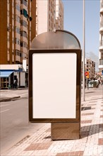
BRK23E28_123
Blank advertising stand near street city

BRK23E62_008
Person with magnifying glass looking globe

BRK23E31_276
Wallet top coins with copy space
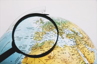
BRK23E27_476
Magnifying glass near globe
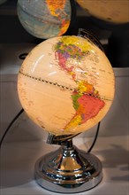
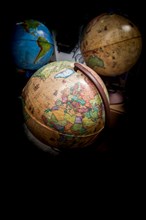
BRK23D43_474
Little colorful model globe with maps on it
BRK23B37_073
Little colorful model globe with maps on it
BRK23B04_131
Little colorful model globe with maps on it
BRK23A82_180
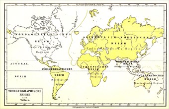
Animal geography world map
BRK23A63_102
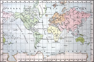
Earth map in Mercator projection from the year 188...
BRK23A67_304
Earth map in Mercator projection
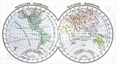
BRK22H05_499
Little colorful model globe with maps on it

BRK22G99_105
Flat lay jar with coins
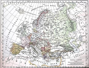
BRK22E67_129
Map of Europe from 1880
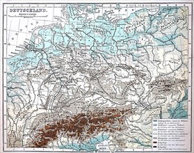
BRK22E67_131
Map with elevation data from Germany
BRK22E67_123
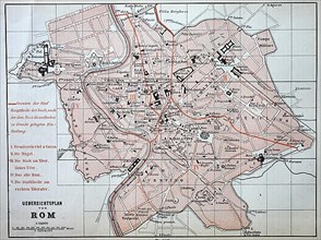
City map of Rome from 1880
BRK22C35_077
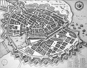
Hamburg im Mittelalter
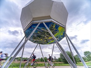
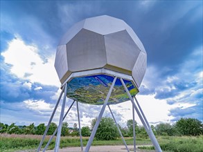
BRK21C62_216
Model of a weather radar with radome
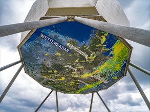
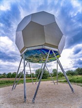
BRK21C61_314
Model of a weather radar with radome
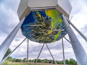
BRK21C64_015
Model of a weather radar with radome
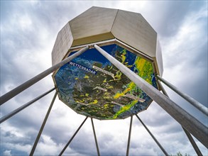
BRK21C60_006
Model of a weather radar with radome
BRK21C60_007
Model of a weather radar with radome

BRK21C61_313
Model of a weather radar with radome
BRK21C62_422
Model of a weather radar with radome
BRK19D11_117