71 results for: new map
- Page
-
- of
- 1
Please sign in for more results
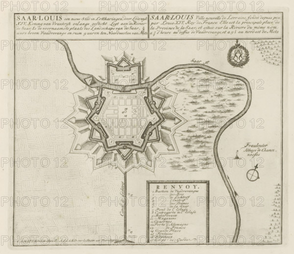
LZT26B29_151
Map of Saarlouis, Saar-Louis a new city in Lorrain...
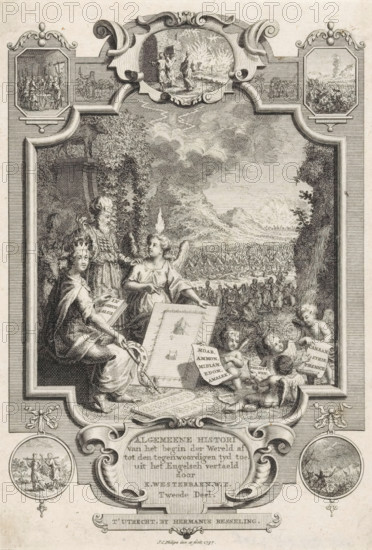
LZT26A90_004
Title page for: Kornelis Westerbaen, Algemeene his...
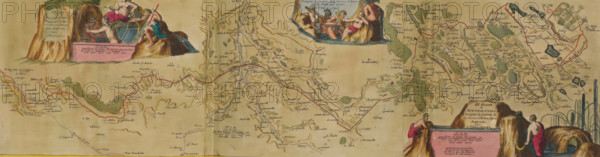
LZT26B23_446
Map of the new canal from Pontgouin to Versailles,...
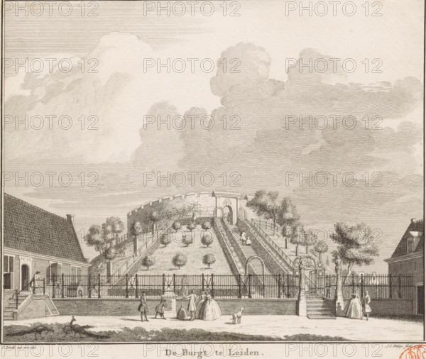
LZT26B34_057
The castle at Leiden, View of the castle of Leiden...
LZT26B34_228
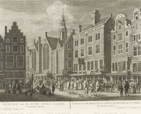
View of the St. Olof's Chapel (Oudezijds Chapel) i...
LZT26B34_257
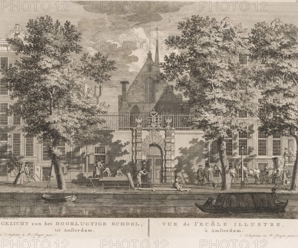
View of the Illustrious School, in Amsterdam, View...
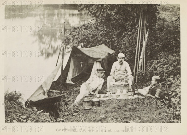
LZT26B07_171
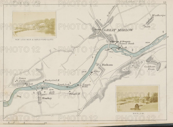
View of a weir in the Thames near Hurley, New Lock...
LZT26B34_267
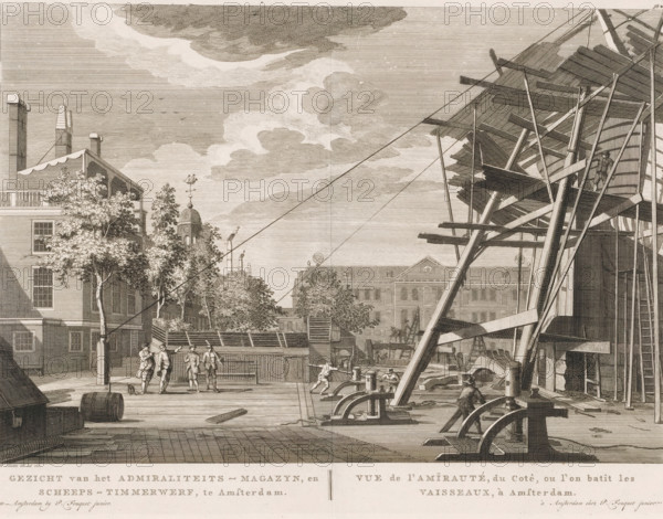
View of the Admiralty Magazine, and Shipyard, in A...
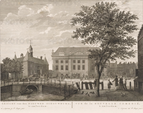
LZT26B34_288
View of the theatre on Leidseplein in Amsterdam, V...
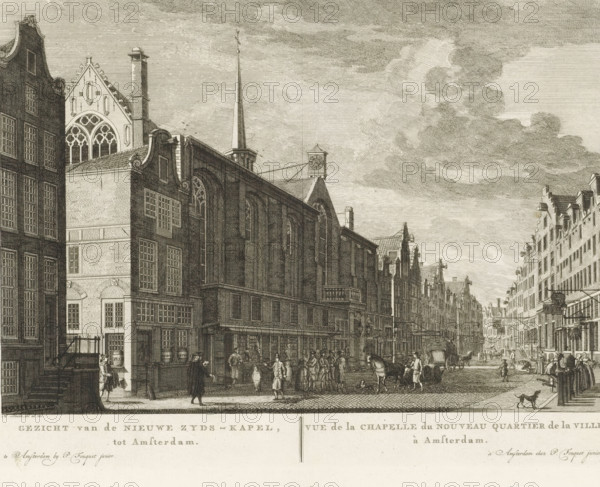
LZT26B34_229
View of the Nieuwe Zyds-Kapel, in Amsterdam, Vue d...
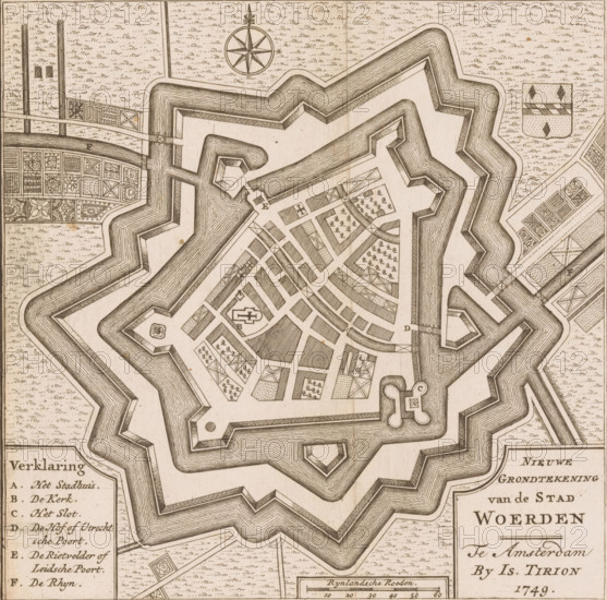
LZT26B32_328
New Ground Plan of the City of Woerden, Map of Woe...
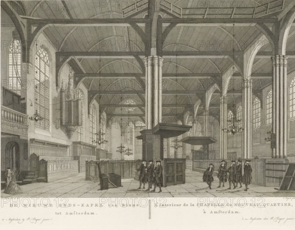
LZT26B34_230
Interior of the Nieuwezijds Chapel in Amsterdam, T...
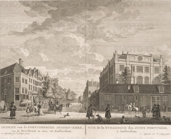
LZT26B34_241
View of the Portuguese Synagogue in Amsterdam, Vie...
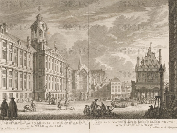
LZT26B34_221
View of the City Hall, the New Church and the Weig...
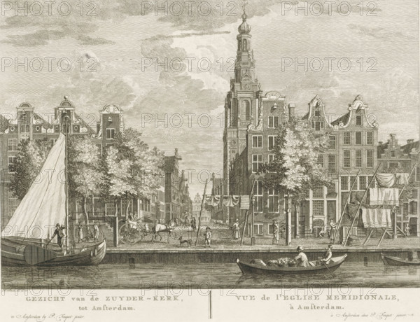
LZT26B34_232
View of the Zuyder-Kerk, in Amsterdam, Vue de l'Eg...
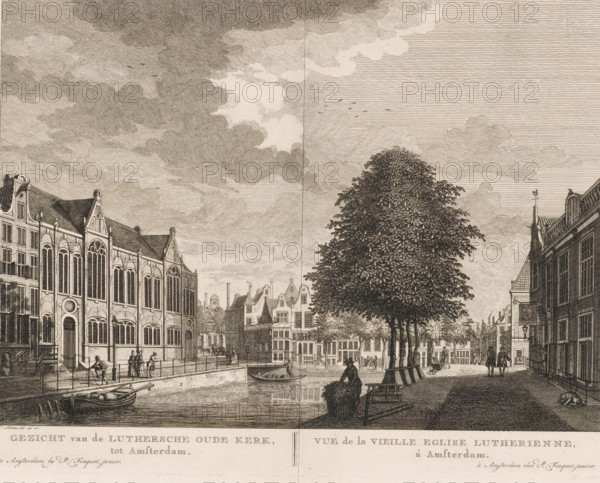
LZT26B34_239
View of the Old Lutheran Church in Amsterdam, View...
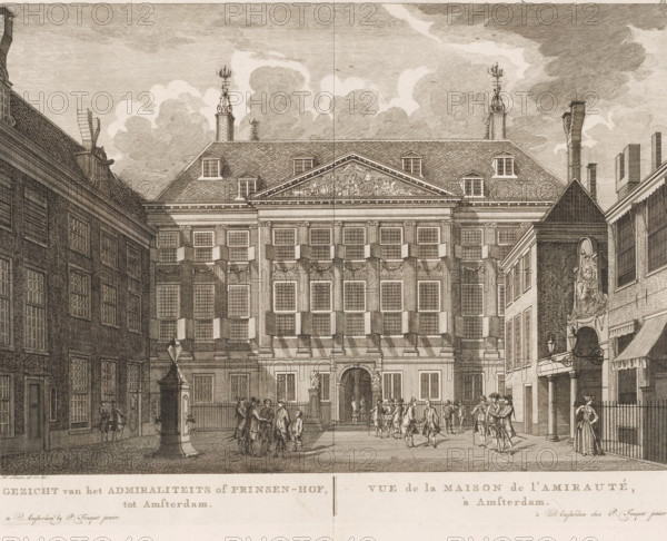
LZT26B34_265
View of the Admiralty or Prince's Court, in Amster...
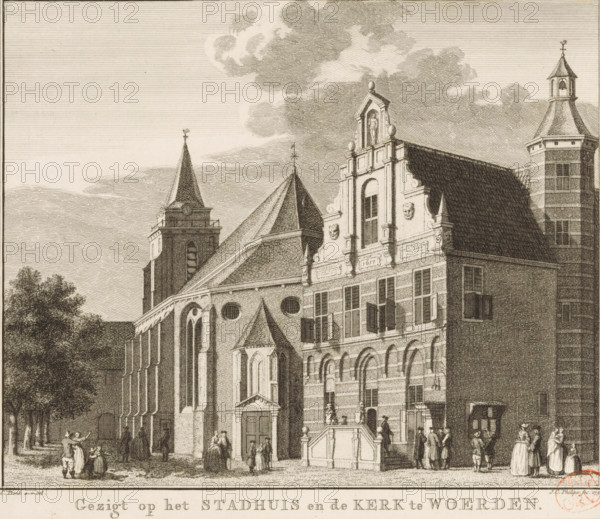
LZT26B34_071
View of the church and town hall in Woerden, View ...
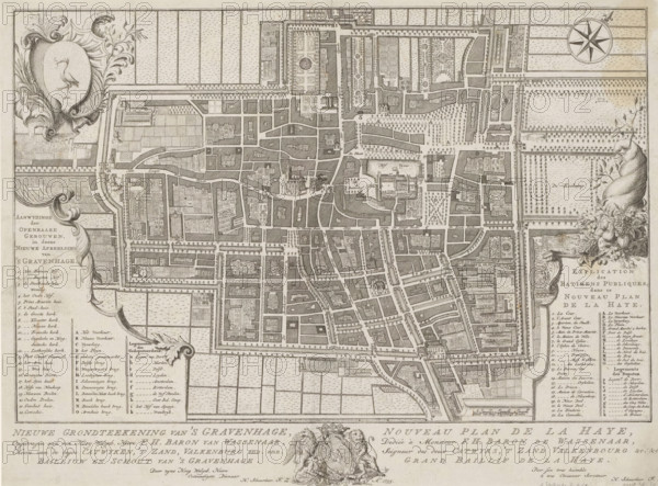
LZT26B34_126
New ground plan of The Hague, Nouveau plan de La H...
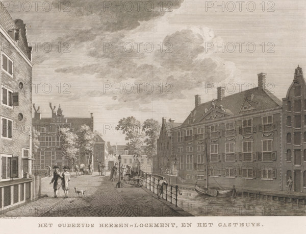
LZT26B34_259
The Oudezijds Heeren-Logement, and the Gasthuys, V...
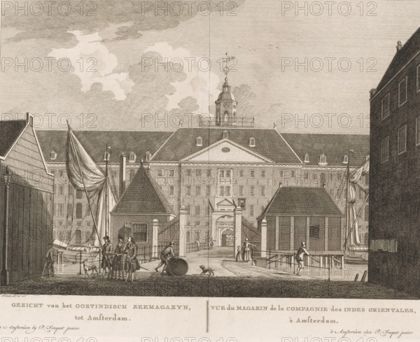
LZT26B34_270
View of the East India Company's Maritime Magazine...
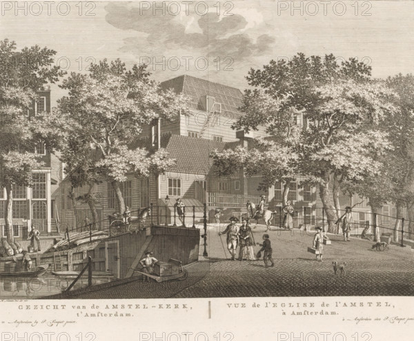
LZT26B34_235
View of the Amstel Church, in Amsterdam, View of t...
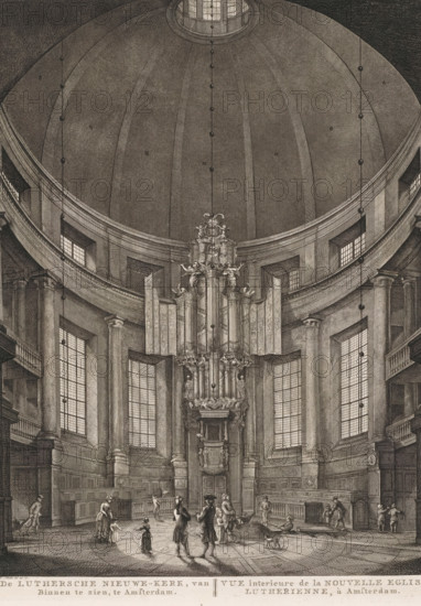
LZT26B34_244
The Lutheran New Church, Viewed from the Inside, i...
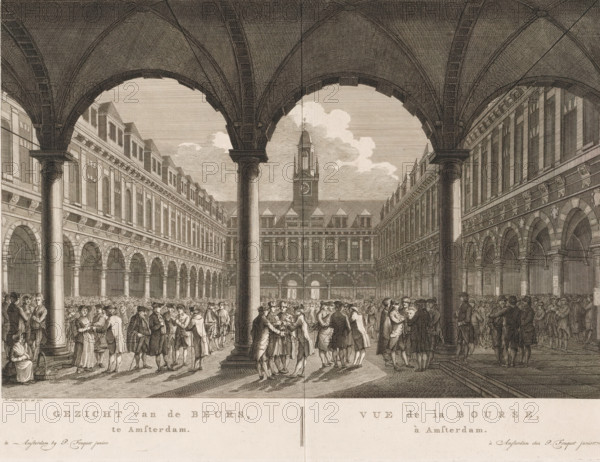
LZT26B34_253
View of the Stock Exchange, in Amsterdam, Vue de l...
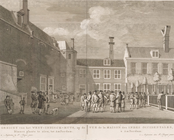
LZT26B34_271
View of the West Indies House, seen in the courtya...
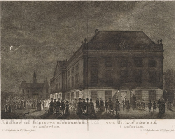
LZT26B34_289
View of the New Theatre, in Amsterdam, Vue de la C...
LZT26B04_266
A new map of the river Thames from Thames Head to ...
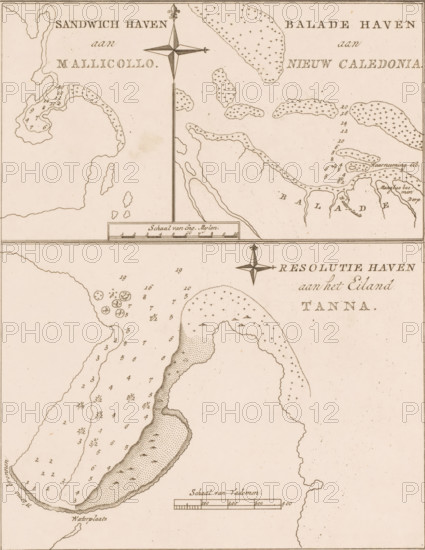
LZT26B39_261
Map of the coasts of the islands of Malakula, New ...
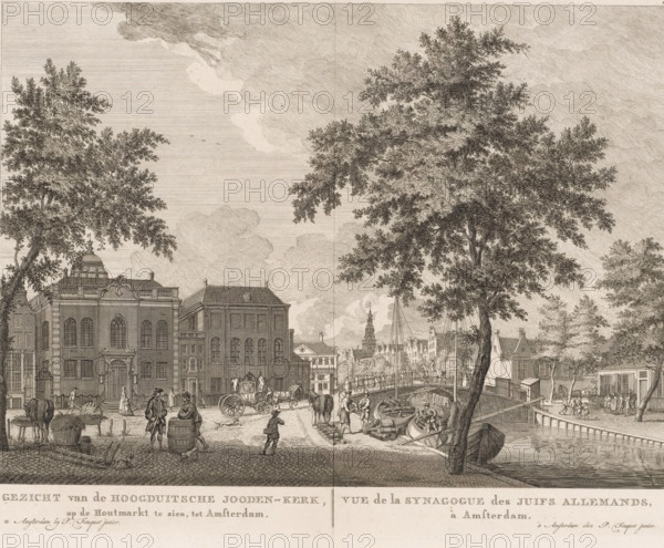
LZT26B34_243
View of the High German Jewish Church, visible on ...
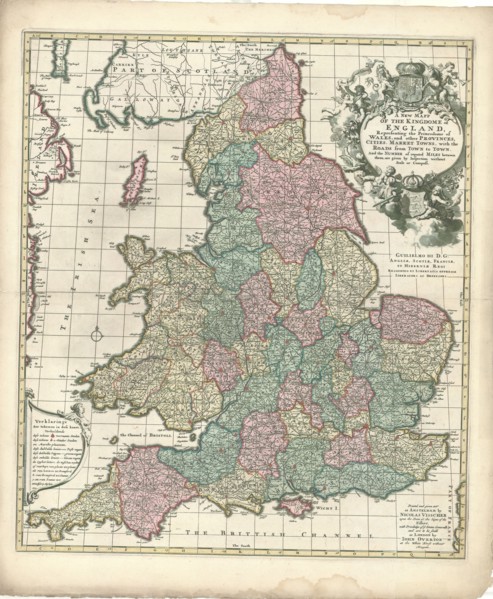
LZT20A46_071
Map, A new mapp of the kingdome of England, Copper...
LZT20A47_130
Map, A new map of Libya or old Africk shewing its ...
LZT19B45_290
Bohn, François, KAMPEN, N.G. FROM. State and geogr...

LZT19B49_166
Geography puzzle in coffin: map with the Netherlan...
LZT19B36_249
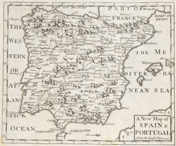
A new map of Spain and Portugal, from the latest o...
LZT19A96_326
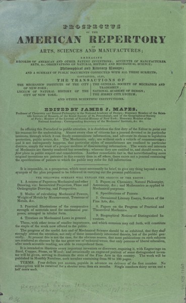
A Full description of the Daguerreotype Process: A...
LZT16A32_101
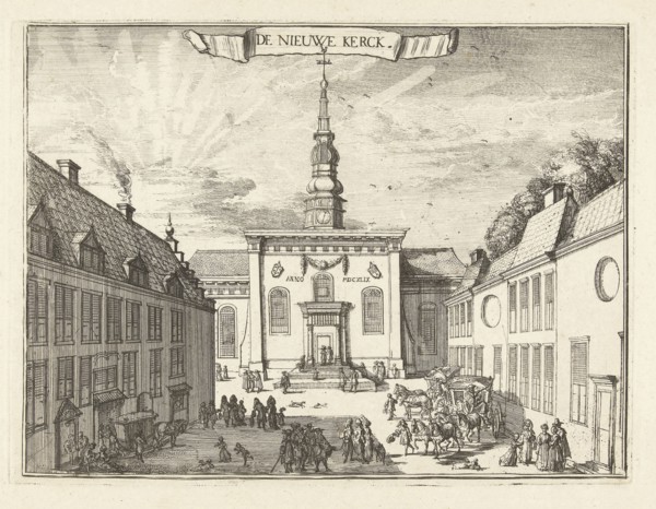
View of the New Church in Haarlem, The Netherlands...
LZT16A00_222
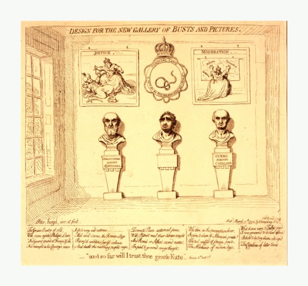
Design for the new gallery of busts and pictures, ...
LZT16A63_030
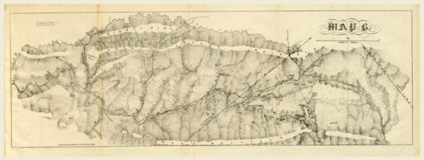
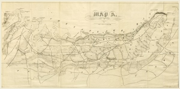
Report on the new map of Maryland, 1836, 19th cent...
LZT16A63_096
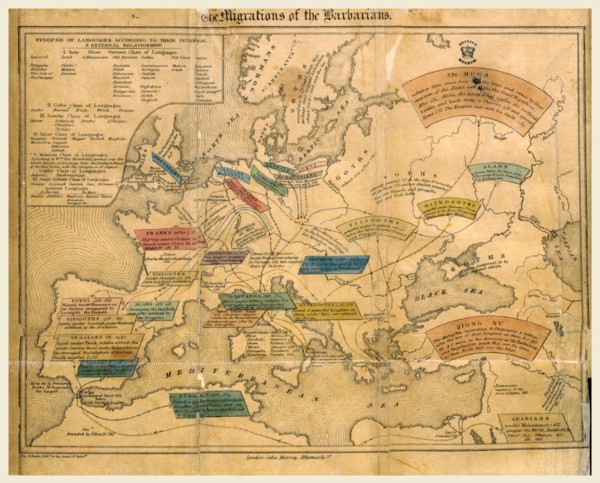
The History of the Decline and Fall of the Roman E...
LZT16A61_448
Ancient History of the Egyptians A new edition, r...
LZT16A62_228
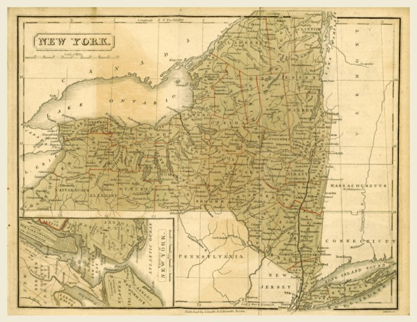
Map New York, The Boston School Atlas, US, America...
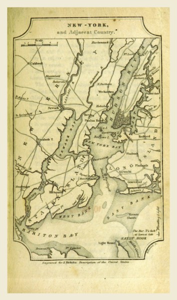
LZT16A62_145
New York, A Geographical Description of the United...
LZT16A62_154
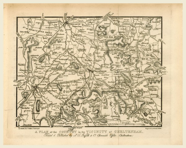
Map, Griffith's new historical description of Chel...
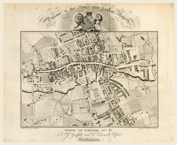
LZT16A62_137
Map, Griffith's new historical description of Chel...
LZT16A63_033
Report on the new map of Maryland, 1836, 19th cent...
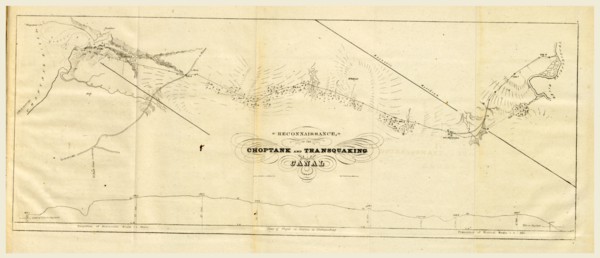
LZT16A63_035
Choptank and transquaking canal, Report on the new...
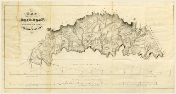
LZT16A63_045
Map Rail Road from Frederick Town to Pennsylvania ...
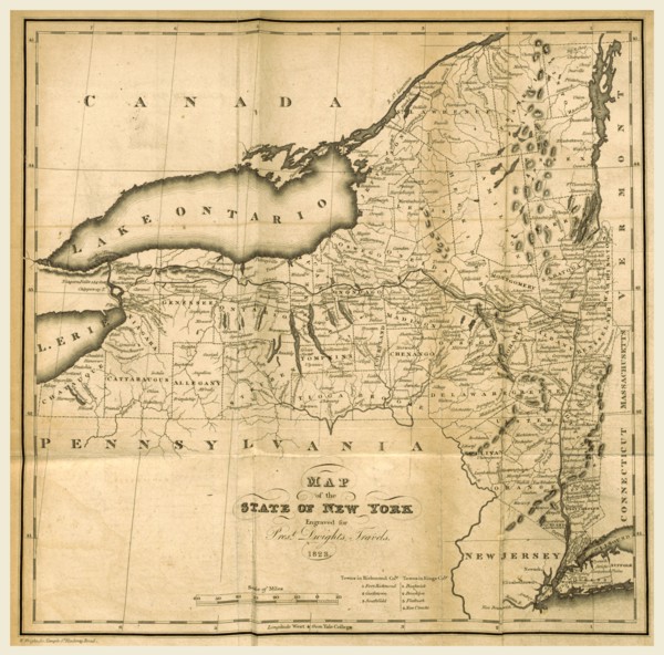
LZT16A62_088
Map of the State of New York, 1823, 19th century e...
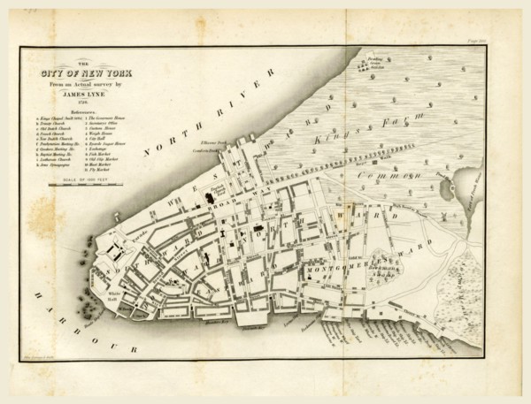
LZT16A63_147
Map of New York, 1728, History of the New Netherla...
LZT16A62_076
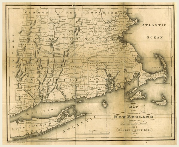
Map of the southern part of New England, 1823, 19t...
LZT16A63_047
Report on the new map of Maryland, 1836, 19th cent...
LZT13A39_222
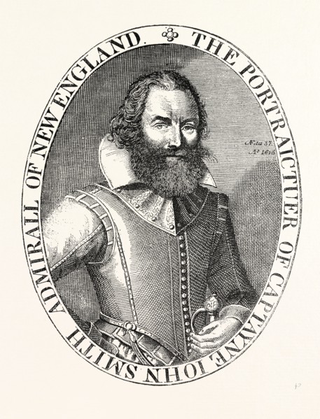
CAPTAIN SMITH, FROM THE PORTRAIT IN HIS VIRGINIA, ...

LZT13A39_032
MAP OF NEW YORK ABOUT THE MIDDLE OF THE EIGHTEENTH...
LZT13A39_348
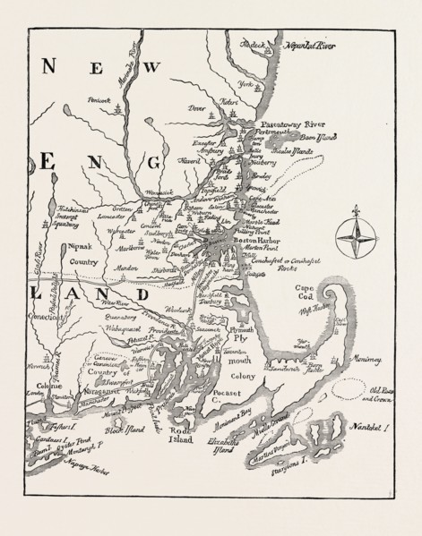
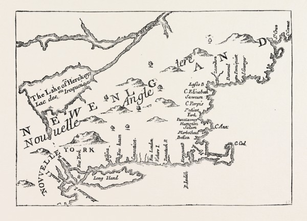
MAP OF NEW ENGLAND AT THE BEGINNING OF THE EIGHTEE...
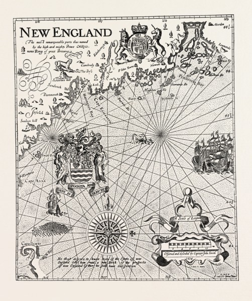
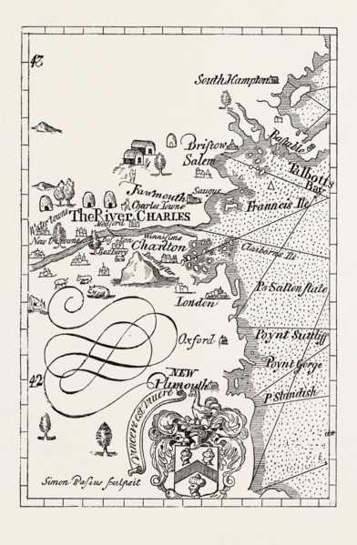
LZT13A39_238
PART OF CAPTAIN J. SMITH'S MAP OF NEW ENGLAND, UNI...
LZT13A39_282
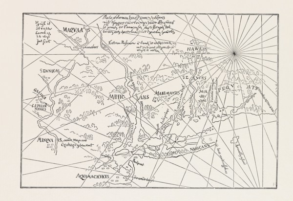
THE EARLIEST MAP OF THE NEW NETHERLANDS, US, USA, ...
LZT13A39_237
PART OF CAPTAIN J. SMITH'S MAP OF NEW ENGLAND. FRO...
LZT13A39_355
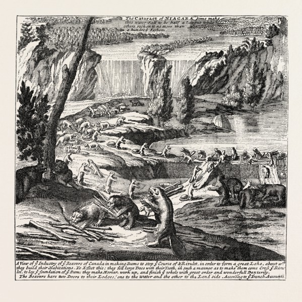
NIAGARA AND THE BEAVER DAMS. From Moll's New and E...
LZT13A39_302
NEW ENGLAND IN 1684, UNITED STATES OF AMERICA, fro...
LZT13A36_348
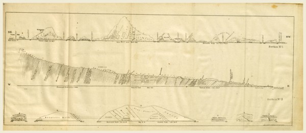
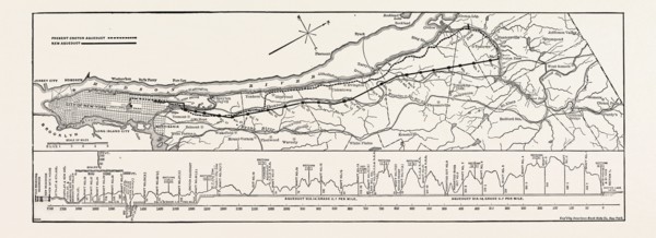
MAP AND PROFILE OF THE NEW AQUEDUCT, NEW YORK CITY...
LZT13A39_098
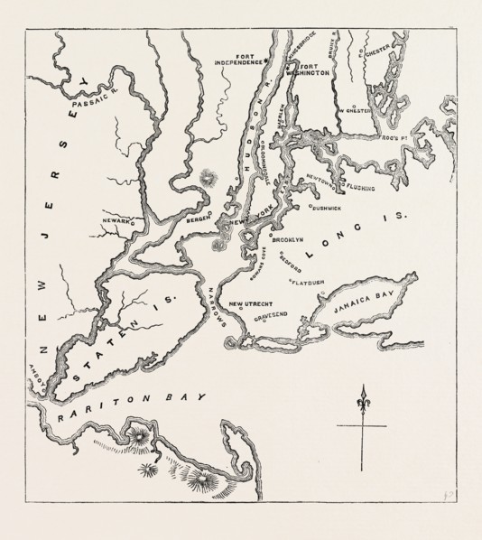
MAP OF NEW YORK AND VICINITY, 1776, UNITED STATES ...
LZT13A39_291
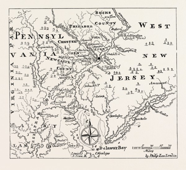
MAP OF PENNSYLVANIA AND WEST NEW JERSEY, From Thom...
LZT13A25_475
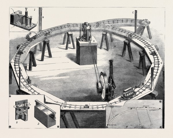
PROFESSORS AYRTON AND PERRY'S NEW ELECTRIC RAILWAY...
LZT13A17_335
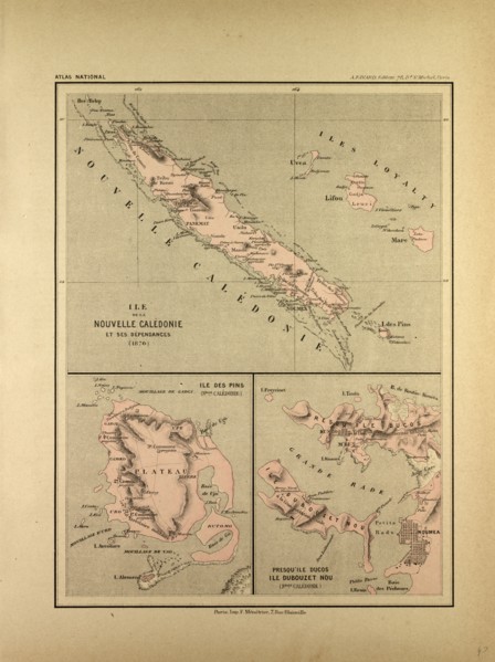
MAP OF NEW CALEDONIA
LZT13A20_233
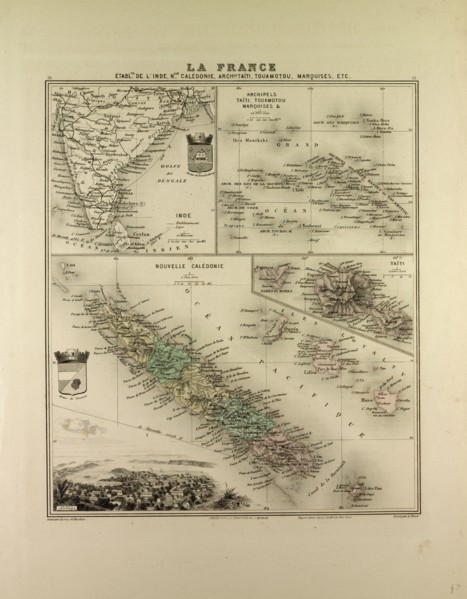
MAP OF INDIA, NEW CALEDONIA, TAHITI, TUAMOTU ARCHI...
LZT13A00_051
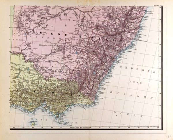
New South Wales Gotha, Justus Perthes, 1872, Atlas...
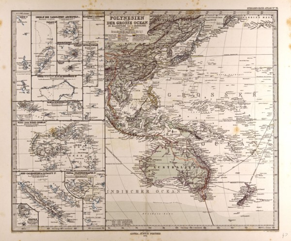
LZT13A00_049
Polynesia Oceania Gotha, Justus Perthes, 1872, Atl...
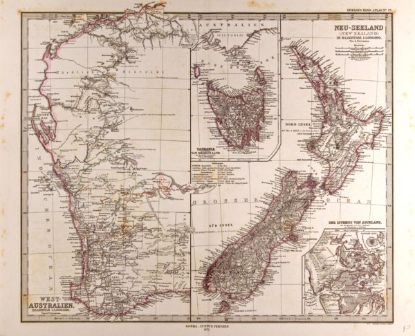
LZT13A00_050
New Zealand Australia Gotha, Justus Perthes, 1872...
LZT13A17_086
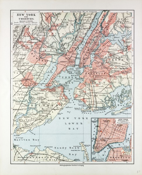
MAP OF NEW YORK, UNITED STATES OF AMERICA, 1899
LZT13A16_498
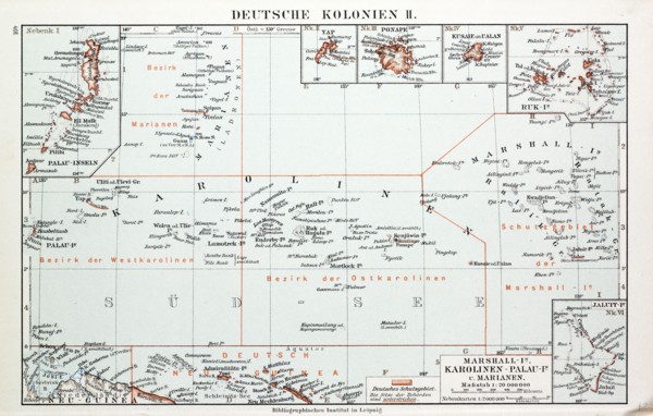
MAP OF GERMAN COLONIES, GERMAN NEW GUINEA, 1899
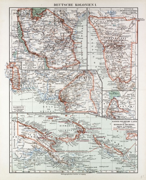
LZT13A16_497