783 results for: city maps
- Page
-
- of
- 8
Please sign in for more results
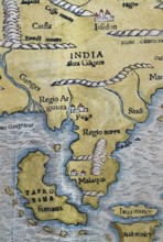
BRK26C62_346
North India, Sumatra, Malaysia, detail, hand-colou...
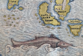
BRK26C56_190
South India, Sumatra, Malaysia, sea monster, detai...

BRK26C77_206
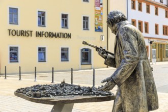
A female tourist stands in front of an ornate wood...
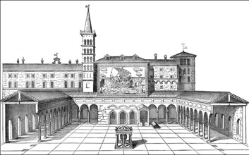
BRK26D02_391
Old St. Peter's Basilica, Vatican, Rome, Italy, 13...
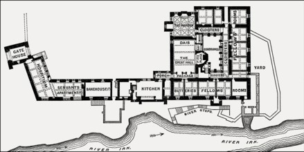
BRK26C84_266
Plan of Chetham's College, Manchester, England, UK...
BRK26C85_283
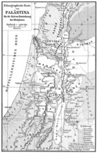
Ethnic map of Palestine, 1000 BCE
BRK26D05_061
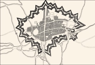
Plan der Befestigungsanlagen von Oxford während de...
BRK26D05_247
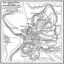
Map of ancient Rome, Italy
BRK26D03_248
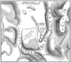
Jebus, pre-Israelite Jerusalem
BRK26C85_186
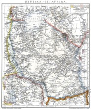
Map of the former German colony of East Africa, 18...
BRK26C80_487
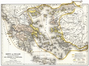
Territory of ancient Hellas, Sparta and Athens

BRK26C16_137
A Hispanic LGBTQIA+ man with vibrant style sits at...

BRK26C15_384
A Latino transgender man in a hat and sunglasses e...

BRK26C11_102
A Latino transgender man, wearing casual denim and...
BRK26C18_149
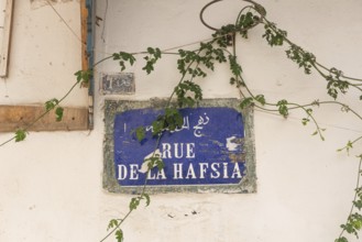
A Tunisian street sign for Rue de la Hafsia writte...
BRK26C19_091
London, United Kingdom. June 28th 2022 Street sign...
BRK26C24_030
Sofia, Bulgaria. April 1st 2019 Sofia City Metro S...
BRK26C29_041
Sofia, Bulgaria. November 22nd 2025. Sofia city me...
BRK26C33_289
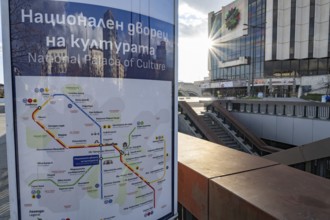
An informative sign on the platform with city and ...
BRK26C34_405
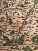
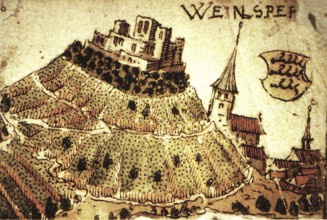
Hand-painted historical map from 1579, Peter Weinh...
BRK26B68_051
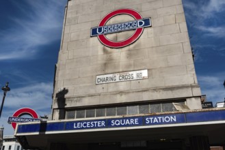
London, United Kingdom, June 28th 2022 Leicester S...
BRK26C19_086
London, United Kingdom. July 9th 2022 Sign for the...
BRK26C19_089
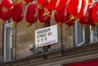
London, United Kingdom, June 28th 2022 9 Wardour S...
BRK26C19_106
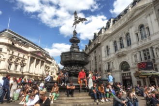
London, United Kingdom, June 28th 2022 Tourists si...
BRK26C19_261
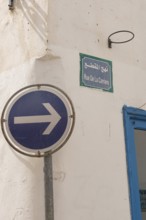
A one-way blue street sign on Rue de la Carriere, ...
BRK26C32_412
Silver figure explorer traveling by Ekaterina Kova...
BRK26C18_152
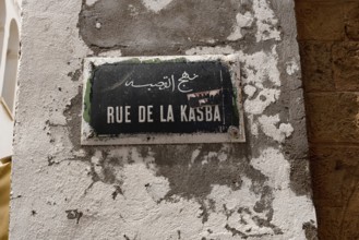
Tunis, Tunisia. 13th May 2024 A Tunisian street si...
BRK26C19_109
London, United Kingdom, June 28th 2022 Dott Electr...
BRK26C32_414
Silver figure explorer traveling by Ekaterina Kova...
BRK26C22_216
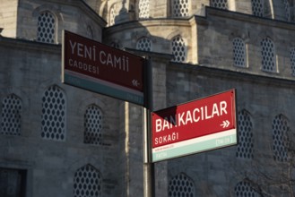
Street sign for Yeni Cami Caddesi and Bankacilar S...
BRK26C28_444
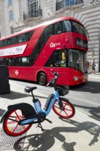
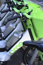
London, UK. January 30th 2025. Lime Electric E bik...
BRK26C23_373
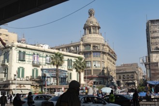
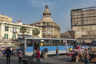
Cairo, Egypt. December 7th 2022 Busy Traffic cross...
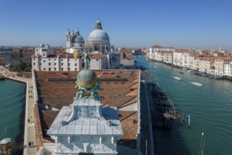
BRK26C35_425
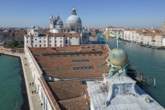
Drone footage of the Dogana da Mar, moving wind va...
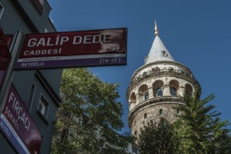
BRK26C22_239
Istanbul, Turkey. October 5th 2021 The Galata Towe...

BRK26C49_496
Concept of global international trade and commerce...
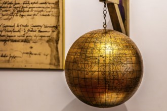
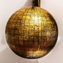
BRK26B81_394
Jagiellonian globe, first globe, with the newly di...

BRK26C01_209
Dhaka, Bangladesh- 28 Oct 2025: An iPad displaying...
BRK26B77_136
Weinsberg is a town in the district of Heilbronn, ...
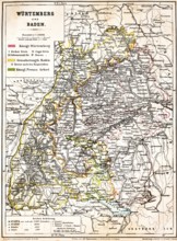
BRK26B81_480
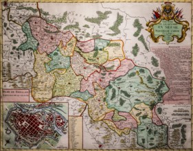
Colored topographic map of the Kingdom of Würtembe...

BRK26C01_213
Dhaka, Bangladesh- 24 Oct 2025: A iPad screen disp...

BRK26C01_215
Dhaka, Bangladesh- 30 Oct 2025: Apple Maps app on ...

BRK26C01_214
Dhaka, Bangladesh- 30 Oct 2025: Apple Maps app dis...
BRK26B55_020
Cairo, Egypt. December 7th 2022 Busy Traffic cross...
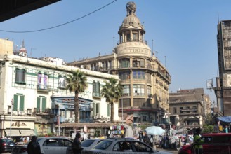
BRK26B55_050
Cairo, Egypt. December 7th 2022 Busy Traffic cross...
BRK26B12_483
Jagiellonian globe, first globe, with the newly di...
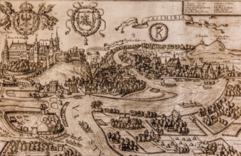
BRK26B12_349
Map of Kazimierz, copper engraving, 1608, Kazimier...
BRK26B12_264
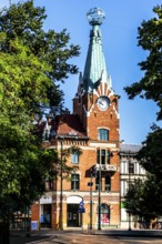
House under the globe, 1904, headquarters of the K...
BRK26B12_042
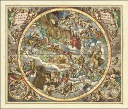
Sky map titled Coeli Stellati Christiani Haemispha...
BRK26B12_232
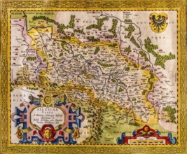
Map of Silesia as described by Martin Helwig from ...
BRK26B12_246
Map of Silesian theater of war and city map of Wro...
BRK26B06_100
Drone footage of the Dogana da Mar, moving wind va...

BRK26B41_457
Concept of global international trade and commerce...

BRK26A72_428
Diverse group of engineers and architects collabor...

BRK26A89_480
Concept of global international trade and commerce...
BRK26A59_253
Site plan, public city map, sign for the building,...
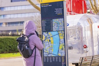
BRK26A51_449
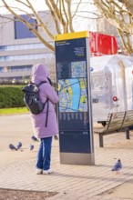
Woman in warm clothes looking at a map at a city m...
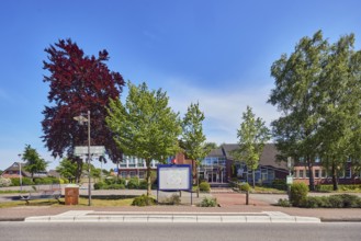
BRK26A73_055
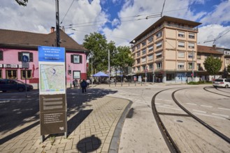
Neuenkirchen Rathaus bus stop, town hall of the mu...
BRK26A51_450
Woman wearing warm clothes looking at a map at a c...

BRK26A35_217
Three cheerful young women using smartphone and ri...

BRK26A31_327
Concept of global international trade and commerce...

BRK26A17_210
Close up of hands holding smartphone with multiple...

BRK26A17_208
Tourist using a smartphone while surrounded by the...
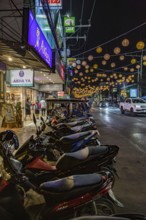
BRK26A45_387
Motor scooters line the side of the downtown stree...

BRK25M35_011
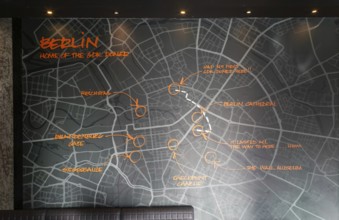
Map of Berlin inside GDK German Doner Kebab takeaw...
BRK25M99_288
Takeaway Korean restaurant picture menu, Newport C...

BRK25M35_007
Inside GDK German Doner Kebab takeaway restaurant,...

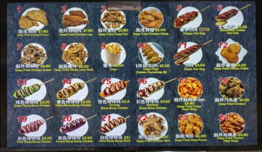
BRK25M99_258
Takeaway Korean restaurant picture menu, Newport C...

BRK25M10_190
Information board about the Badturm with historica...

BRK25M23_123
Young man using a smartphone and wearing headphone...

BRK25M85_235
Concept of global international trade and commerce...

BRK25M44_285
A woman with curly hair is focused on driving a ca...

BRK25L52_406
Inside GDK German Doner Kebab takeaway restaurant,...
BRK25L52_405
Map of Berlin inside GDK German Doner Kebab takeaw...

BRK25L99_020
Concept of global international trade and commerce...

BRK25L58_440
Smiling woman with headphones validating a contact...

BRK25L58_337
Young smiling woman using a payment validator for ...
BRK25L82_374
Central station with Atlas carrying the globe on h...
BRK25L82_375
Side front of the main railway station with Atlas ...
BRK25L82_373
Side front of the main railway station with Atlas ...
BRK25L26_432
Hanover, historical city map from 1907
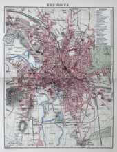
BRK25L26_429
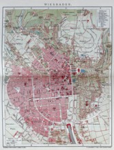
Wiesbaden, historical city map from 1907
BRK25L26_413
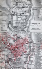
Jerusalem, historical city map from 1907, the old ...
BRK25L26_428
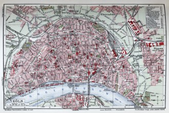
Cologne, historical city map from 1906
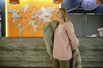
BRK25L00_067
A woman stands at a reception area, wearing a pink...
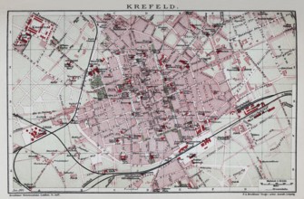
BRK25L26_435
Krefeld, historical city map from 1907
BRK25L26_426
Kiel and Kiel harbour, historical city map from 19...
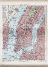
BRK25L26_416
New York City, Neuyork, historical city map from 1...
BRK25L26_427
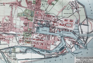
Wilhelmshaven, historical city map from the year19...
BRK25L26_433
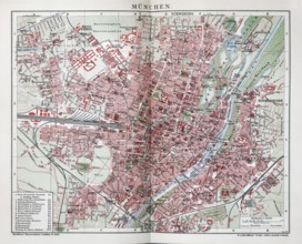
Munich, historical city map from 1907
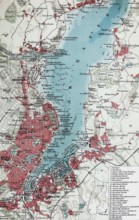
BRK25L26_439
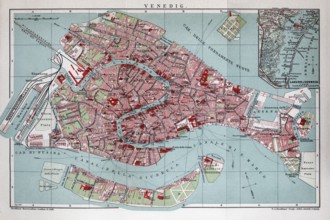
Venice, historical city map from 1906
BRK25L02_450
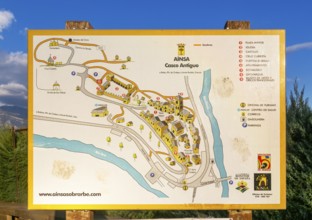
Map of historic buildings medieval village of Ains...
BRK25L26_424
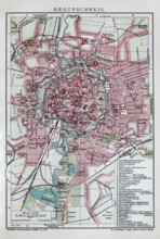
Brunswick, historical city map from 1907
BRK25L26_425
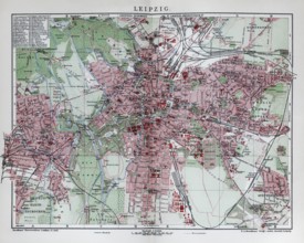
Leipzig, historical city map from 1907
BRK25L26_420
Warsaw, historical city map from 1907
BRK25L26_434
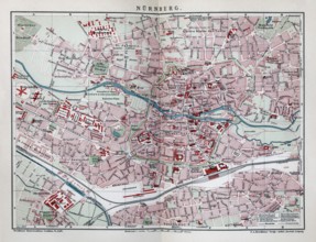
Nuremberg, historical city map from 1906
BRK25L26_438
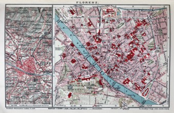
Florence, historical city map from 1907
BRK25L26_294
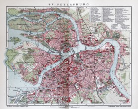
Saint Petersburg, Leningrad, Petrograd, historical...
BRK25L26_418
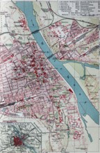
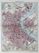
Bordeaux, historical city map from 1906, France
BRK25L26_431
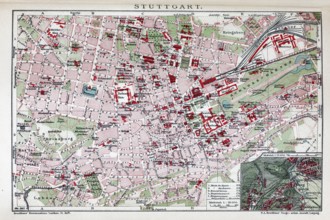
Stuttgat, historical city map from 1907
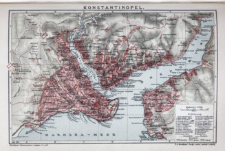
BRK25L26_293
Constantinople, Istanbul, historical city map from...
- Page
-
- of
- 8