Période

11 résultats pour : u.s. geological survey

  • Page
  • sur
  • 1
Connectez-vous pour plus de résultats
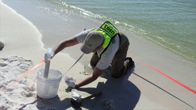
USGS Sediment Sampling at Henderson Beach State Park in Florida ca. 2010
UMG22A39_354

USGS Sediment Sampling at Henderson Beach State Pa...
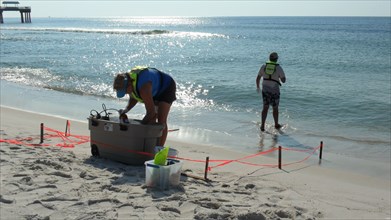
USGS Setting up at Sampling at Orange Beach, Alabama ca. 2010
UMG22A39_347

USGS Setting up at Sampling at Orange Beach, Alaba...
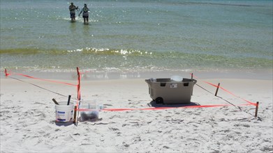
USGS Sampling Site at Henderson Beach State Park ca. October 2010
UMG22A39_353

USGS Sampling Site at Henderson Beach State Park c...
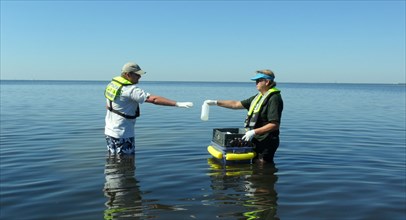
USGS Water-Quality Sampling at St. Marks National Wildlife Refuge ca. 2010
UMG22A39_349

USGS Water-Quality Sampling at St. Marks National ...
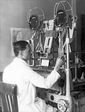
USGS Library in Hooe Building, Washington, DC, 1917
UMG22A23_340

USGS Library in Hooe Building, Washington, DC, 191...
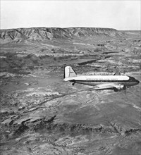
This Douglas C–53D (N19924), crewed and operated by the U.S. Geological Survey (USGS), was photographed while surveying the Painted Desert, southwest of Cameron in northeastern Arizona.
UMG22A33_044

This Douglas C–53D (N19924), crewed and operated b...
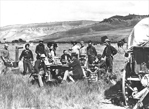
1870 Survey Crew - Group photo of all the members of the Survey, made while in camp at Red Buttes at the junction of the North Platte and Sweetwater Rivers, in Wyoming.
UMG22A30_040

1870 Survey Crew - Group photo of all the members ...
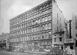
Geological Survey building, F Street ca. between 1909 and 1920
UMG22A12_339

Geological Survey building, F Street ca. between 1...

Geological Survey. Washington, D.C., March 13. Albert Pike using a stereoscope on a pair of photographs to bring out the relief and locate objects for a map circa 1937.
UMG21A21_279

Geological Survey. Washington, D.C., March 13. Alb...

Geological Survey, Dept. Interior. Washington, D.C., Mar. 13. E.A. Shuster working with the erocartograph constructing topographies from airplane pictures circa 1937.
UMG21A21_280

Geological Survey, Dept. Interior. Washington, D.C...

Aerocartograph Mapping
UMG20A12_341

Aerocartograph Mapping