4006 results for: village conservation area
- Page
-
- of
- 41
Please sign in for more results
BRK26C63_099
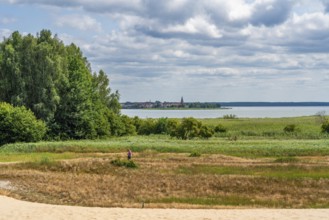
View from a sand dune in the nature reserve Altwar...
BRK26C72_291
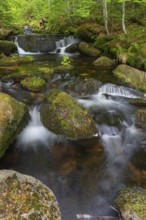
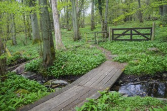
Kleine Ohe creek below Waldhaeuser village in the ...
BRK26C59_024
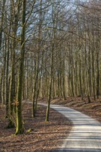
Narrow winding road through forest in spring-winte...
BRK26C56_065
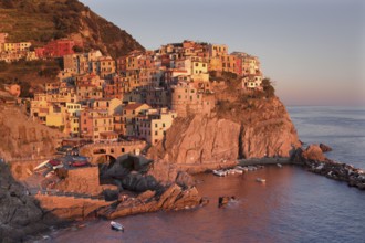
Townscape, Manarola, Cinque Terre, Rivera di Levan...
BRK26C61_223
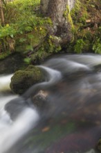
Bridge over stream on hiking trail in Stenshuvud N...
BRK26C68_267
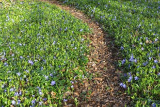
Lesser periwinkle (Vinca minor), Apocynaceae, fore...
BRK26C87_428
Kleine Ohe creek below Waldhaeuser village in the ...
BRK26C77_417
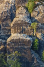
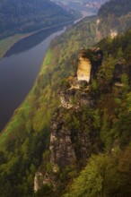
Sandstone formations in late light at the Bastei r...
BRK26C68_396
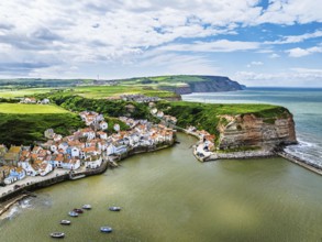
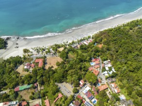
Staithes Village from a drone, North Yorkshire, No...
BRK26C66_386
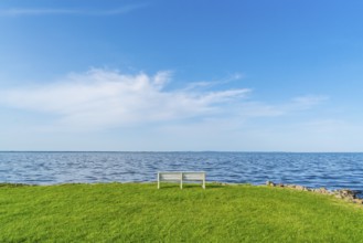
Isolated, white, empty bench in a meadow on the sh...
BRK26C61_278
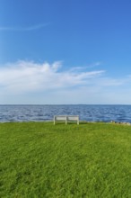
Isolated, white, empty bench in a meadow on the sh...
BRK26C88_110
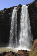
Ahamra region, the Blue Nile waterfall, in the hig...
BRK26C58_074
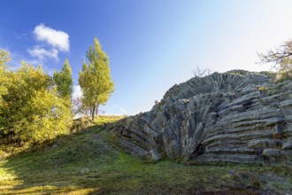
Exposed basalt outcrop from volcanic times, Hirtst...
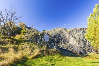
BRK26C59_344
Exposed basalt outcrop from volcanic times, Hirtst...
BRK26C64_278
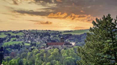
Green hills and a village on a winding road, surro...
BRK26C59_301
Winter at the quarry lake in Wesenitztal near Elbe...
BRK26C57_062
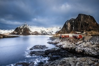
Fishermen's houses, Rorbu, Moskenesoya, Reine, Ham...
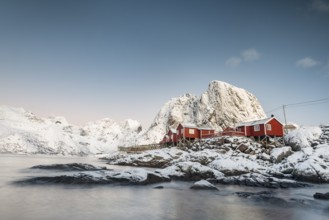
BRK26C57_110
Town and fisherman's cabins or Rorbus in front of ...
BRK26C66_116
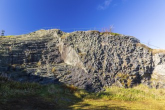
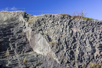
Exposed basalt columns from volcanic times, the so...
BRK26C60_140
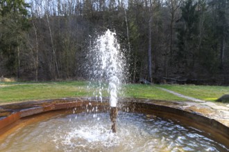
Neumühle thermal spring with a constant water temp...
BRK26C67_234
Aerial view, coast and town, Corrohoe Bay and Play...
BRK26C66_490
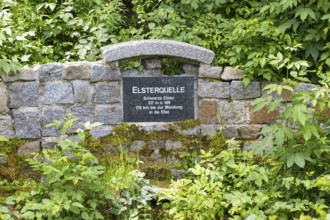
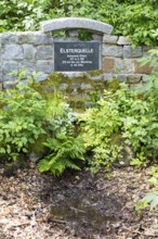
Elster spring, the source of the Black Elster, sou...
BRK26C66_175
Exposed basalt columns from volcanic times, here t...
BRK26C68_078
Elster spring, the source of the Black Elster, sou...
BRK26C63_466
Exposed basalt columns from volcanic times, here t...
BRK26C67_134
Exposed basalt columns from volcanic times, Hirtst...
BRK26C64_148
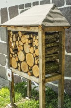
Insect asylum, insect box, insect hotel, bee house...
BRK26C67_326
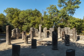
Remains of the baptistery in the archaeological ru...
BRK26C72_169
The bright lit Wartturm above the Elbe river seen ...
BRK26C88_418
San Miguel del Valle, Oaxaca, Mexico, The San Migu...
BRK26C87_017
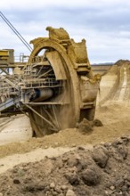
Opencast lignite mine Garzweiler 2, bucket wheel e...
BRK26C97_087
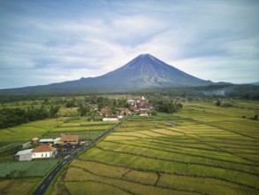
A breathtaking aerial view of Mount Semeru, the hi...
BRK26C64_015
Insect asylum, insect box, insect hotel, bee house...
BRK26C66_225
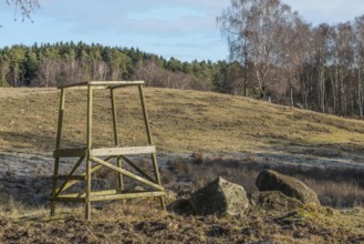
Lookout tower in Snogeholm nature reserve and hiki...
BRK26C55_327
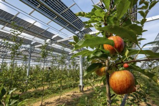
Agri-photovoltaic test plant, an apple tree planta...
BRK26C66_267
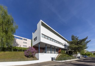
Weissenhof Estate on the Killesberg in Stuttgart. ...
BRK26C61_308
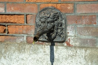
Fountain in the shape of a lion's head. Esteil vil...
BRK26C62_353
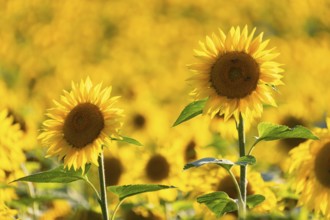
Sunflower (Helianthus annuus), field, agricultural...
BRK26C86_229
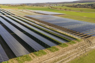
Extensive solar fields in a rural area, villages o...
BRK26C65_469
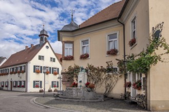
Klingenmünster with the August Becker Monument, on...
BRK26C95_153
Oianleku Natural Park at sunrise, snowy beech fore...
BRK26C97_451
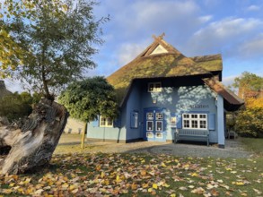
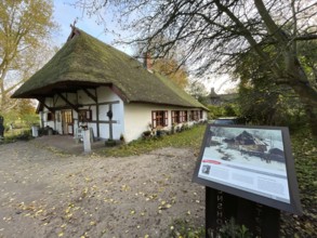
Galerie Kunstkaten, Künstlerdorf und Baltic resort...
BRK26C68_059
View from the observation tower in the Dubringer M...
BRK26C64_342
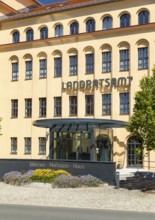
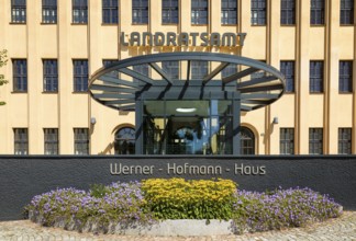
Former porcelain factory, today district administr...
BRK26C66_458
Künstlerdorf and Baltic resort Ahrenshoop, art tra...
BRK26C55_251
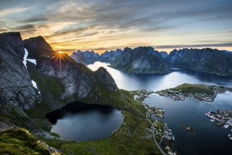
View from Reinebringen, Reinebriggen, 442m, midnig...
BRK26C64_169
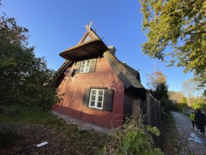
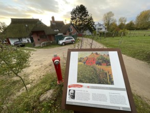
Künstlerdorf and Baltic resort Ahrenshoop, archite...
BRK26C81_420
Traditional wooden houses in the village of Chocho...
BRK26C83_035
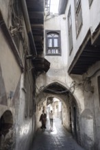
Damascus, Syria. December 10th 2025. The narrow st...
BRK26C61_138
Former porcelain factory, today district administr...
BRK26C61_431
Friedenslinden viewpoint with view of Schmorsdorf ...
BRK26C63_422
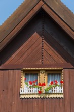
Close-up of a wooden window with red flowers under...
BRK26C19_285
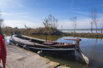
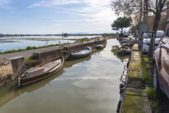
Traditional barca de l'albufera moored at a concre...
BRK26C31_177
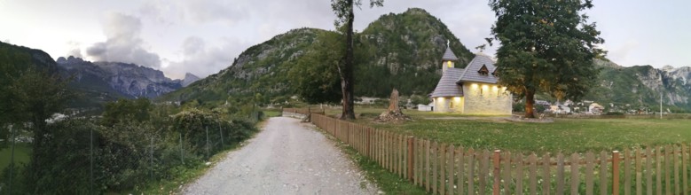
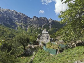
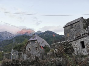
Picturesque church in Theth, a village with mounta...
BRK26C36_436
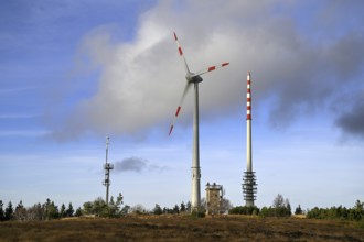
Wind turbine in the high moor on the Hornisgrinde,...
BRK26C31_147
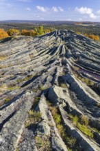
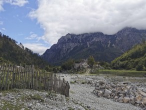
Rocky area and fences lead to a small village in a...
BRK26C31_113
Stone house surrounded by gardens and mountains un...
BRK26C30_337
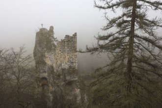
An abandoned castle ruin in fog with a cross on th...
BRK26C23_468
Hilly landscape in the Zicker Mountains, including...
BRK26C33_168
Typical landscape in the Rhön biosphere reserve, w...
BRK26C50_261
Semi-stationary speed camera in Nobelstraße, in th...
BRK26C18_141
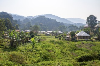
Small village nestled between green hills, on the ...
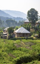
BRK26C18_142
Small village nestled between green hills, on the ...

BRK26C33_169
Typical landscape in the Rhön Biosphere Reserve, w...
BRK26C26_266
View of Rosenberg Fortress in Kronach with a corn ...
BRK26B76_215
Houses in the town of Jackerath, belong to Titz im...
BRK26C19_183
Traditional boats moored along a narrow canal in e...
BRK26C31_176
Traditional village with stone houses and Albanian...
BRK26C18_013
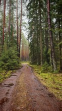
A forest path leading through a pine forest (pinus...
BRK26C19_077
The fortress, Veste Rosenberg in Kronach in the li...
BRK26C30_334
Foggy rock formations and autumn forest in the val...
BRK26C17_143
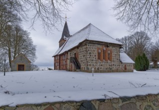
Lassahn village church in the snow in the Schaalse...
BRK26C17_165
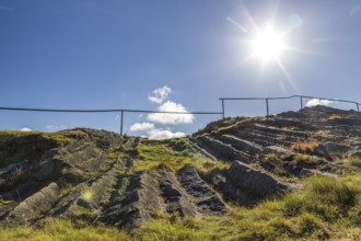
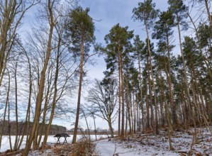
Hiking trail and rest area on the snow-covered and...
BRK26C28_220
Künstlerdorf and Baltic resort Ahrenshoop, Künstle...
BRK26C38_033
Steinernes Meer natural monument, Großer Berg in G...
BRK26C18_139
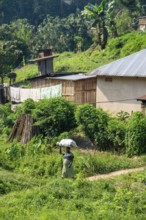
Local woman carrying luggage on her head, small vi...
BRK26C28_217
Künstlerdorf and Baltic resort Ahrenshoop, archite...
BRK26C28_219
Galerie Kunstkaten, Künstlerdorf und Baltic resort...
BRK26C28_223
Künstlerdorf und Baltic resort Ahrenshoop, art tra...
BRK26C39_430
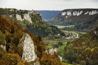
Autumnal forest and Werenwag Castle, Eichfelsen vi...
BRK26C54_195
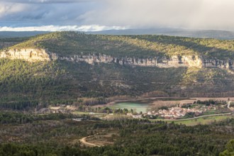
View from viewpoint mirador de Una, village Una, l...
BRK26C28_218
Künstlerdorf and Baltic resort Ahrenshoop, archite...
BRK26C39_432
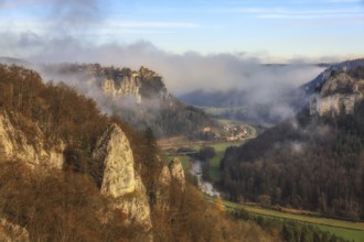
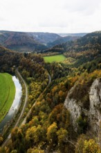
Autumnal forest, Eichfelsen viewpoint, near Irndor...
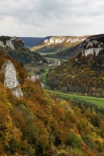
BRK26C39_433
Autumnal forest and Werenwag Castle, Eichfelsen vi...
BRK26C49_025
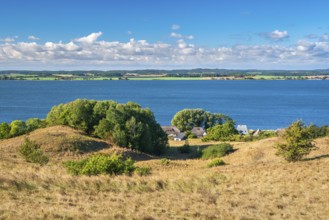
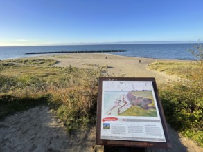
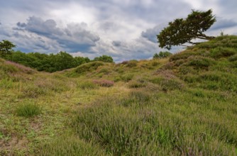
Ripple-crowned dune area in the Schleswig-Holstein...
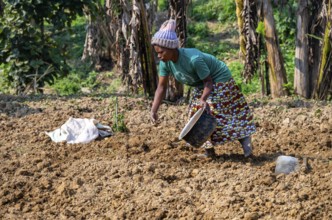
BRK26C18_135
Local woman working in her small potato field, sma...
BRK26C54_230
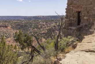
Scenic view from welcome center at Palo Duro Canyo...
BRK26C54_276
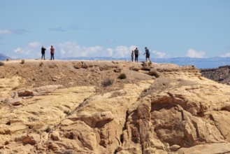
Hikers on the trail to an overlook at the end of F...
BRK26C54_274
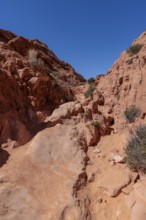
Rock formations along the Fire Canyon Overlook Tra...
BRK26C17_161
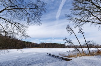
Winter day at the swimming area and jetty on the s...
BRK26C28_221
Künstlerdorf and Baltic resort Ahrenshoop, art tra...
BRK26C17_163
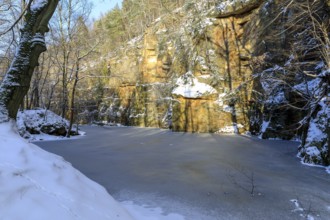
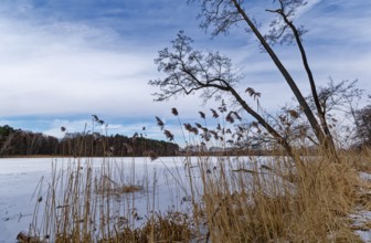
Snow-covered and ice-covered shore of the Heiliger...
BRK26C28_222
Künstlerdorf und Baltic resort Ahrenshoop, art tra...
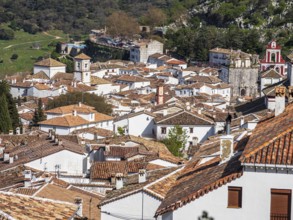
BRK26C54_433
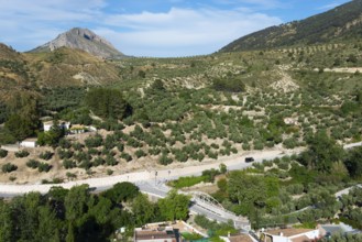
Village Grazalema, Sierra de Grazalema, Andalusia,...
BRK26C28_198
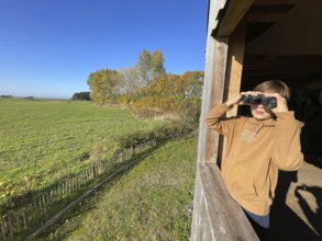
Boy watching cranes with binoculars, Perfect place...
BRK26C28_216
Künstlerdorf and Baltic resort Ahrenshoop, Künstle...
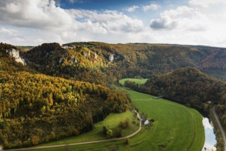
BRK26C39_429
Autumnal forest, Eichfelsen viewpoint, near Irndor...
BRK26C28_197
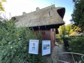
Perfect place to observe cranes, Nabu, Kranorama a...
BRK26C19_192
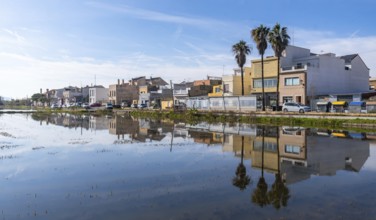
El palmar fishing village and palm trees mirrored ...
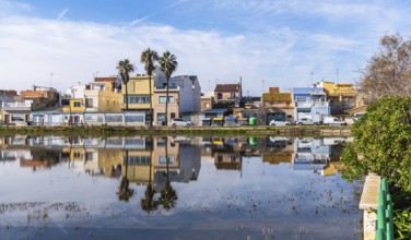
BRK26C19_190
El palmar fishing village houses and palm trees mi...
- Page
-
- of
- 41